Public Tags
Showing images tagged with path:Heart of England Way tag.
|
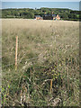
New hedge planting beside Heart of England Way
by Robin Stott geograph for square SP1767 In the foreground is a lightweight electric fence protecting young hedge plants.... (more)
Tags:
ArdenX
top:Boundary, BarrierX
Electric FenceX
path:Heart of England Way
near:Henley-in-ArdenX
top:LowlandsX
New HedgeX
top:PathsX
|
|
Heart of England Way, Curdworth
by E Gammie geograph for square SP2097 Category: Long Distance Footpath The Heart of England Way looking towards Curdworth bottom lock with the... (more)
Tags:
canal:Birmingham and FazeleyX
top:CanalsX
path:Heart of England Way
top:Lakes, Wetland, BogX
top:PathsX
|
|
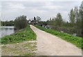
Beacon Park, Lichfield
by Michael Westley geograph for square SK1109 View from Heart of England Way of path into large park to west of Lichfield... (more)
Tags:
place:Beacon ParkX
path:Heart of England Way
LakeX
ParkX
top:Park and Public GardensX
top:PathsX
top:Sport, LeisureX
|
|
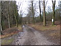
Down Hill Path
by Gordon Griffiths geograph for square SJ9916 The view down the Heart of England Way path on Cannock Chase.
|
|
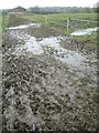
Muddy Heart of England Way nearing Baddesley Clinton
by Robin Stott geograph for square SP1971 Heavy foot traffic has turned frozen ground liquid and slippery. National Trust land.
Tags:
ArdenX
postcode district:B93X
place:Baddesley ClintonX
top:Farm, Fishery, Market GardeningX
path:Heart of England Way
Long Distance FootpathX
top:LowlandsX
path:Midland LinkX
top:PathsX
|
|
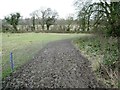
Muddy path between paddocks, Heart of England Way northeast of Kingswood
by Robin Stott geograph for square SP1971 Frozen mud was turning liquid under constant foot traffic. The horses were being... (more)
Tags:
ArdenX
postcode district:CV35X
top:Farm, Fishery, Market GardeningX
path:Heart of England Way
place:KingswoodX
Long Distance FootpathX
top:LowlandsX
path:Midland LinkX
top:PathsX
|
|
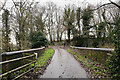
Rowington Hill Bridge
by Robin Stott geograph for square SP2069 The bridge carries a track and the Heart of England Way from Rowington village... (more)
Tags:
top:CanalsX
postcode district:CV35X
type:GeographX
canal:Grand Union CanalX
path:Heart of England Way
top:LowlandsX
bridge:Path Over CanalX
place:RowingtonX
top:Village, Rural SettlementX
|
|
Two styles of notice to dog-owners, Baddesley Clinton
by Robin Stott for square SP2071 At the point where the Heart of England Way crosses the drive for visitors to... (more)
Tags:
postcode district:B93X
place:Baddesley ClintonX
top:CommunicationsX
top:Country EstatesX
top:Farm, Fishery, Market GardeningX
path:Heart of England Way
top:LowlandsX
path:Midland LinkX
NoticesX
ParklandX
|
|
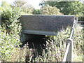
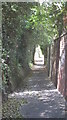
Henley Road bridges Tapster Brook: 1
by Robin Stott geograph for square SP1767 The Heart of England Way leaves the grounds of Holly Bank Farm by the bridge.... (more)
Tags:
ArdenX
Bridge (Road Over Stream)X
BrookX
path:Heart of England Way
near:Henley-in-ArdenX
top:LowlandsX
top:PathsX
top:Rivers, Streams, DrainageX
|
|
Field edge southwest of Holly Bank Farm
by Robin Stott geograph for square SP1667 In the foreground can be made out a lightweight electric fence protecting young... (more)
|
|
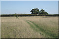
Heart of England Way crossing a pasture
by Robin Stott geograph for square SP1667 An approximate reverse view is Derek Harper's SP1667 : Heart of England Way.
|
|
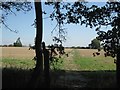
Heart of England Way near Hungerfield Farm
by Robin Stott geograph for square SP1666 The view from Edge Lane, an unclassified county road or green lane.... (more)
Tags:
ArdenX
lane:Edge LaneX
top:Farm, Fishery, Market GardeningX
path:Heart of England Way
near:Henley-in-ArdenX
name:HungerfieldX
top:LowlandsX
top:PathsX
|
|
Shaded pathway, Beacon Park
by Michael Westley geograph for square SK1109 Alongside northern edge of park in Lichfield, the route of Heart of England Way... (more)
|
|
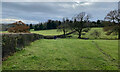
Approaching Rowington
by Robin Stott geograph for square SP2069 The Heart of England Way runs beside dense hedges. The tower of the church of St... (more)
Tags:
top:Boundary, BarrierX
postcode district:CV35X
top:Farm, Fishery, Market GardeningX
type:GeographX
path:Heart of England Way
top:LowlandsX
near:RowingtonX
Winter FieldsX
|
|
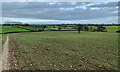
Towards Rowington Green
by Robin Stott for square SP2070 Looking north from the Heart of England Way, left of centre are the tall pines... (more)
Tags:
type:Cross GridX
postcode district:CV35X
top:Farm, Fishery, Market GardeningX
path:Heart of England Way
top:LowlandsX
near:RowingtonX
near:Rowington GreenX
Winter FieldsX
|
|
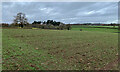
Arden countryside near Rowington
by Robin Stott geograph for square SP2069 The view is northeast from the Heart of England Way towards Wroxall.
Tags:
postcode district:CV35X
top:Farm, Fishery, Market GardeningX
type:GeographX
path:Heart of England Way
top:LowlandsX
near:RowingtonX
near:Rowington GreenX
Winter FieldsX
|
|
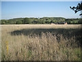
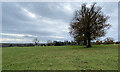
Fields north of Hazelwood Green
by Robin Stott geograph for square SP1666 A house at Hazelwood Green is on the right, just in the square. Hazel Wood is on... (more)
Tags:
ArdenX
top:Farm, Fishery, Market GardeningX
FarmlandX
path:Heart of England Way
near:Henley-in-ArdenX
top:LowlandsX
|
|
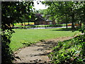
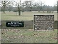
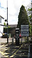
Shaw Lane Car Park, Lichfield
by Michael Westley geograph for square SK1109 Free on Sundays. Signs also for popular Heart of England Way long distance... (more)
Tags:
top:Business, Retail, ServicesX
Car ParkX
path:Heart of England Way
top:Park and Public GardensX
top:Sport, LeisureX
Ticket MachineX
|
|
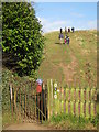
Climb every.... mountain (well, hill)
by Michael Westley geograph for square SP1566 Category: Hill scenery View at junction of Alne Close and Beaudesert Lane, of footpath up to site of... (more)
Tags:
path:Heart of England Way
|
|
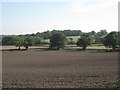
Missing hedge near Rowington
by Robin Stott geograph for square SP2069 The isolated trees, right, mark the line of a hedge shown on the 2015 1:25,000... (more)
Tags:
postcode district:CV35X
top:Farm, Fishery, Market GardeningX
type:GeographX
path:Heart of England Way
top:LowlandsX
near:RowingtonX
Winter FieldsX
|
|
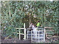
Gated access to bridleway
by Michael Westley geograph for square SP2683 Walking south-west from Ivy House Farm, footpath reaches well-used bridleway... (more)
|
|
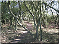
Oak coppice near Hungerfield Farm
by Robin Stott geograph for square SP1667 In the past oak was coppiced both for timber and for its bark. The bark was... (more)
Tags:
ArdenX
Coppiced OakX
path:Heart of England Way
near:Henley-in-ArdenX
top:LowlandsX
top:Woodland, ForestX
|