Public Tags
Showing images tagged with place:Ash tag.
|
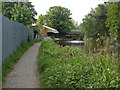
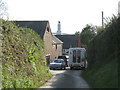
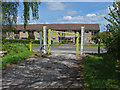
Ash Wharf
by Alan Hunt geograph for square SU8953 The abandoned shed at Ash Wharf on the Basingstoke Canal with the railway bridge... (more)
|
|
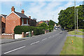
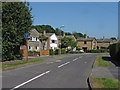
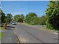
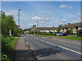
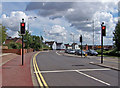
Ash Hill Road
by Alan Hunt geograph for square SU8951 Looking west along Ash Hill Road from the entrance to the Coronation gardens car park.
|
|
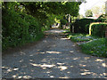
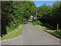
Church Lane, Ash
by Alan Hunt geograph for square SU8950 The unmade access road that runs from Grange Road to Ash Church Road.
|
|
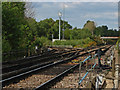
Ash Junction
by Alan Hunt geograph for square SU8953 The railway junction where the line from Frimley meets the main Waterloo to... (more)
|
|
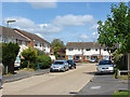
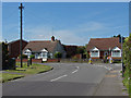
Derwent Road, Ash
by Alan Hunt geograph for square SU8851 1960s housing on this road off Lakeside Road in Ash.
|
|
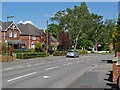
Ash Church Road
by Alan Hunt geograph for square SU8950 Looking east along Ash Church Road with Hartshorn Cottage and the spire of St... (more)
Tags:
place:Ash
top:Housing, DwellingsX
top:Religious SitesX
top:Roads, Road TransportX
top:Village, Rural SettlementX
|
|
Ash Cross
by Robin Stott geograph for square SX8350 The signs announce Ash Tree Farm plant nursery and riding clinic. This view is... (more)
Tags:
place:Ash
near:DartmouthX
Lane CrossroadX
top:LowlandsX
top:Roads, Road TransportX
top:Village, Rural SettlementX
|
|
Rowan Field, Ash
by Alan Hunt geograph for square SU8850 The track from Shawfield Lane with Rowan Field recreation area on the right.
Tags:
place:Ash
top:Roads, Road TransportX
|
|
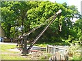
Ash Yard Crane
by Colin Smith geograph for square SU8851 Historic crane beside the Basingstoke Canal near Aldershot.
|
|
Ashurst Road
by Alan Hunt geograph for square SU8851 A residential road off Lakeside Road in Ash.
|
|
Shawfield Lane, Ash
by Alan Hunt geograph for square SU8850 Looking east along Shawfield Lane towards the junction with Shawfield Road.
|
|
Grange Road, Ash
by Alan Hunt geograph for square SU8950 Looking east along Grange Road from the junction with South lane.
|
|
South Lane, Ash
by Alan Hunt geograph for square SU8950 Looking north along South Lane with the junction of The Briars on the right.
|
|
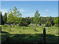
Ash cemetery
by Alan Hunt geograph for square SU8950 Looking across the cemetery at the back of St. Peter's Church.
|
|
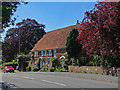
Hartshorn Cottage
by Alan Hunt geograph for square SU8950 The 14th century cottage on Ash Church Road beside St Peter's Church.
|
|
South Lane, Ash
by Alan Hunt geograph for square SU8950 The junction of South Lane with Grange Road on the right.
|
|
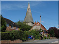
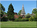
St Peter's Church, Ash
by Alan Hunt geograph for square SU8950 The spire of the church from the Collins Gardens recreation ground.
|
|
Great Bottom Flash
by Alan Hunt geograph for square SU8953 Old barges left over from the Second World War on this large lake. The... (more)
|
|
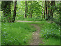
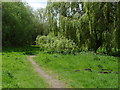
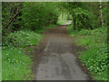
Track in the woods
by Alan Hunt geograph for square SU8953 One of the paths in the woods east of the Basingstoke Canal with the road... (more)
|
|
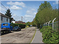
Lakeside Road, Ash
by Alan Hunt geograph for square SU8851 Looking west along Lakeside Road from near the Nature reserve entrance.
|
|
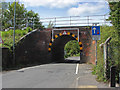
Railway Bridge, Lakeside Road
by Alan Hunt geograph for square SU8951 The Victorian railway arch over Lakeside Road in Ash.
Tags:
place:Ash
Railway Bridge Over RoadX
top:RailwaysX
top:Roads, Road TransportX
Victorian Railway ArchX
|
|
The Quadrant, Ash
by Alan Hunt geograph for square SU8951 This short unmade road dates from the 1890s although many of the houses appear... (more)
|
|
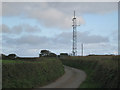
Mast by Ash Reservoir
by Robin Stott geograph for square SX8350 The covered hilltop reservoir can be seen to the right of the mast. The spot... (more)
|
|
Boarding kennels and cattery, Ash Cross
by Robin Stott geograph for square SX8350 |
|
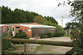
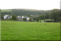
Ash House Farm
by Robin Stott for square SX8349 Across the valley is Stancombe Wood, a largely coniferous plantation.
|
|
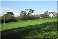
Old pines near Ash House
by Robin Stott geograph for square SX8349 Seen across a field of young oilseed rape.
Tags:
place:Ash
near:DartmouthX
top:Farm, Fishery, Market GardeningX
top:Housing, DwellingsX
top:LowlandsX
crop:Oilseed RapeX
tree:PineX
|
|
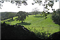
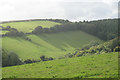
Valley south of Lower Ash Farm
by Robin Stott geograph for square SX8349 In the background is a plantation largely of conifers, Stancombe Wood. In the... (more)
|
|
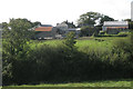
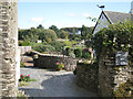
Lower Ash Farm
by Robin Stott geograph for square SX8349 |
|
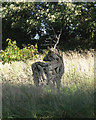
Stag sculpture, Lower Ash
by Robin Stott geograph for square SX8349 The stag is formed from tree branches and pieces of branchwood.
Tags:
place:Ash
bucket:CloseCropX
near:DartmouthX
top:LowlandsX
Private GardenX
StagX
top:Village, Rural SettlementX
Wooden SculptureX
|
|
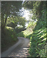
Lane to Eastdown, Lower Ash
by Robin Stott geograph for square SX8349 |
|
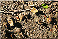
Beechmast in the middle of the lane, Ash
by Robin Stott for square SX8349 |
|
A glimpse of the garden, Higher Ash Farm
by Robin Stott geograph for square SX8349 Tags:
place:Ash
near:DartmouthX
top:Housing, DwellingsX
top:LowlandsX
Private GardenX
top:Village, Rural SettlementX
|
|
A schoolchild arrives back home, Ash
by Robin Stott geograph for square SX8349 The bus, operated by Totnes & Dartmouth Ring & Ride, "A Door To... (more)
Tags:
place:Ash
Community BusX
near:DartmouthX
HedgebanksX
top:LowlandsX
top:Roads, Road TransportX
top:Village, Rural SettlementX
|
|
Ashford ring road
by Richard Dorrell geograph for square TR0042 Category: Ring road This is the A292 Somerset Road.
The ring road was built in the mid 1970's,... (more)
|
|
Lakeside Nature Reserve
by Alan Hunt geograph for square SU8851 The Lakeside Nature Reserve, a mixture of lakes, woods and open grass in the... (more)
|
|
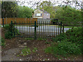
Gate, Lakeside Nature Reserve
by Alan Hunt geograph for square SU8851 The gate on Lakeside Road at the end of one of the paths across the reserve.
|
|
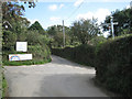
Lakeside Nature Reserve entrance
by Alan Hunt geograph for square SU8851 Looking out through the entrance gate of the Nature reserve onto Lakeside Road.
|
|
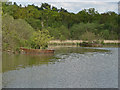
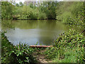
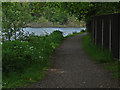
Lakeside Nature Reserve
by Alan Hunt geograph for square SU8851 One of the open ponds in this local nature reserve in the Blackwater Valley.
|
|
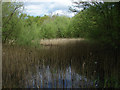
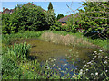
Pond, Lakeside Nature Reserve
by Alan Hunt geograph for square SU8851 A reed infested pond in the Lakeside Nature Reserve.
|
|
Basingstoke Canal aqueduct
by Alan Hunt geograph for square SU8851 Looking along the aqueduct from the towpath.
|
|
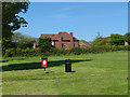
Rowan Field
by Alan Hunt geograph for square SU8850 Rowan Field recreation area off Shawfield Lane.
|
|
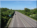
The Blackwater Valley Relief Road
by Alan Hunt geograph for square SU8850 The view north along the A331 from the bridge that carries the path from... (more)
|
|
Pond, South Lane
by Alan Hunt geograph for square SU8950 The small pond on the corner between South Lane and Parish Close. This appears... (more)
|
|
South Lane recreation area
by Alan Hunt geograph for square SU8950 The recreation ground on South Lane with 1980s housing beyond.
|
|
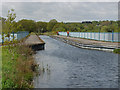
Canal tow path
by Alan Hunt geograph for square SU8953 The Basingstoke Canal tow path with Great Bottom Flash in the background.
|
|
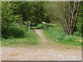
Footbridge, Lakeside Nature Reserve
by Alan Hunt geograph for square SU8851 A footbridge over a drain at the end of the car park in this local nature reserve.
|
|
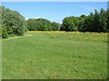
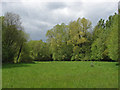
Lakeside Nature Reserve
by Alan Hunt geograph for square SU8851 An open area of grass surrounded by woodland.
|
|
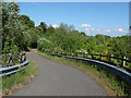
Lakeside Nature Reserve
by Alan Hunt geograph for square SU8851 The Blackwater Valley Path running between the lakes in this local nature reserve.
|
|
Corner of Stancombe Wood
by Robin Stott for square SX8349 Seen from the lane northwest of Bowden.
Tags:
place:Ash
Conifer PlantationX
near:DartmouthX
Hillside PastureX
Long ShadowsX
top:LowlandsX
top:Woodland, ForestX
|