|
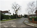
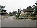
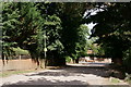
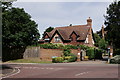
Southwark Place, Bickley
by Malc McDonald
geograph for square TQ4268
Southwark Place is a residential cul-de-sac in Bickley, in the outer suburbs of... (more)
|
|
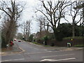
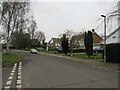
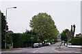
Oldfield Road, Bickley
by Malc McDonald
geograph for square TQ4368
Oldfield Road is a residential road in Bickley, in the outer suburbs of south... (more)
|
|
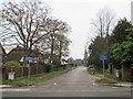
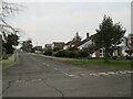
St. George's Road, Bickley
by Malc McDonald
geograph for square TQ4268
St. George's Road is a private road in Bickley, in the outer suburbs of... (more)
|
|
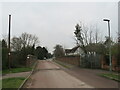
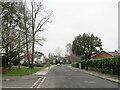
St. George's Road, Bickley
by Malc McDonald
geograph for square TQ4268
St. George's Road is a minor road in Bickley, in the outer suburbs of south... (more)
|
|
Inglewood Copse, Bickley
by Malc McDonald
geograph for square TQ4269
Inglewood Copse is a short residential cul-de-sac in Bickley, in the outer... (more)
|
|
St. George's Road West, Bickley
by Malc McDonald
geograph for square TQ4269
St. George's Road West is a residential road in Bickley, in the outer... (more)
|
|
The Spinneys, Bickley
by Malc McDonald
geograph for square TQ4269
The Spinneys is a residential road in Bickley, in the outer suburbs of south... (more)
|
|
St. George's Road West, Bickley
by Malc McDonald
geograph for square TQ4269
St. George's Road West is a residential road in Bickley, in the outer... (more)
|
|
Logs Hill, Bickley
by Malc McDonald
geograph for square TQ4269
Logs Hill is a minor road in Bickley, in the outer suburbs of south east London.... (more)
|
|
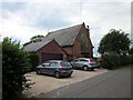
The Old Chapel House, Bickley
by Jeff Buck
geograph for square SJ5349
Converted chapel on Hetherson Green Lane at Bickley.
|
|
Lane Junction at Bickley
by Jeff Buck
geograph for square SJ5349
The junction of Hetherson Green Lane (ahead) and Bickley Town Lane.
|
|
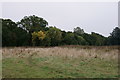
Jubilee Country Park
by Peter Trimming
geograph for square TQ4368
Located between Bickley and Petts Wood.
|
|
Bickley
by Peter Trimming
geograph for square TQ4368
Near the Jubilee Country Park.
|
|
Bickley
by Peter Trimming
geograph for square TQ4368
Hawthorne Road.
|
|
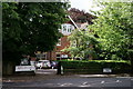
Bickley
by Peter Trimming
geograph for square TQ4169
Ripley Arts Centre, on Sundridge Avenue.
|
|
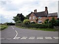
Bickley
by Peter Trimming
geograph for square TQ4169
Hill Brow, close to the junction with Sundridge Avenue.
|
|
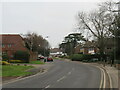
Bickley
by Peter Trimming
geograph for square TQ4269
Junction of Pines Road with Chislehurst Road.
|
|
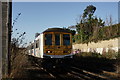
Arriving at Bickley
by Peter Trimming
geograph for square TQ4268
Class 319, arriving with a train for Sevenoaks.
|
|
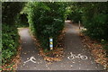
Jubilee Country Park
by Peter Trimming
geograph for square TQ4368
Overtaking lane on the right.
|
|
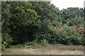
Thornet Wood
by Peter Trimming
geograph for square TQ4368
Located in the Jubilee Country Park.
|
|
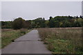
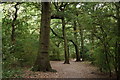
Thornet Wood
by Peter Trimming
geograph for square TQ4368
Path through the wood, which forms part of the Jubilee Country Park.
|
|
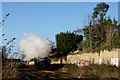
No.34046 'Braunton'
by Peter Trimming
geograph for square TQ4268
Running as No.34052 'Lord Dowding', with 'The Cathedrals... (more)
|