|
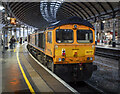
Locomotive, Newcastle
by Rossographer
for square NZ2463
A pair of GB Railfreight Class 66... (more)
|
|
Locomotive, Newcastle
by Rossographer
for square NZ2463
A pair of GB Railfreight Class 66... (more)
|
|
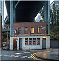
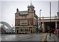
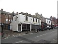
The Bridge Tavern, Newcastle
by Rossographer
geograph for square NZ2563
The Bridge Tavern public house (no longer the Newcastle Arms as per the sign),... (more)
|
|
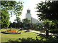
Civic Centre and gardens, Newcastle upon Tyne
by Andrew Tryon
geograph for square NZ2464
Newcastle City Council are based in the Civic Centre
|
|
The Bridge Hotel, Newcastle
by Rossographer
geograph for square NZ2563
The Bridge Hotel Link , constructed in 1899... ( more) |
|
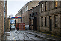
The Boiler Shop, Newcastle
by Rossographer
geograph for square NZ2463
Entrance to The Boiler Shop on South Street in Newcastle - dating from 1823 and... (more)
|
|
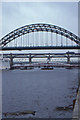
Tyne Bridges, 1987
by Christopher Hilton
geograph for square NZ2563
|
|
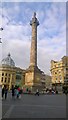
Grey's Monument
by Steven Haslington
geograph for square NZ2464
Grey's Monument is a Grade I listed monument to Charles Grey, 2nd Earl Grey... (more)
|
|
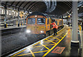
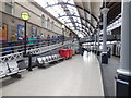
Newcastle Central Station
by Paul Gillett
for square NZ2463
View along platform 3
|
|
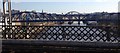
Bridges over the Tyne
by Dave Pickersgill
for square NZ2563
A series of bridges over the River Tyne, as seen from a train approaching... (more)
|
|
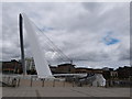
Gateshead Millennium Bridge
by Oliver Mills
geograph for square NZ2563
The tilting pedestrian bridge that crosses the river Tyne, between Gateshead and... (more)
|
|
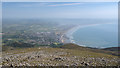
Newcastle from Slieve Donard
by Rossographer
geograph for square J3527
Looking down from Slieve Donard onto Newcastle below.
|
|
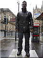
"Man with Potential Selves", Grainger Street
by Karen Blakeman
for square NZ2463
One of three street sculptures by Sean Henry (2003) in Grainger Street,... (more)
|
|
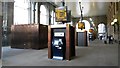
Inside the Portico, Newcastle Central Station
by Graham Robson
for square NZ2463
The large Portico at the main entrance to Newcastle Central Station has been... (more)
|
|
Newcastle city walls, Bath Lane
by Graham Robson
geograph for square NZ2464
Looking along a standing section of medieval city walls in the centre of... (more)
|
|
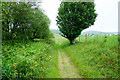
The Offa's Dyke Path heading towards Newcastle
by Jeff Buck
geograph for square SO2579
Heading north along the Offa's Dyke Path towards Newcastle.
|
|
The Offa's Dyke Path heading towards Newcastle
by Jeff Buck
geograph for square SO2579
Heading north along the Offa's Dyke Path towards Newcastle.
|
|
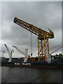
Hammerhead Crane at Newcastle Docks
by Colin Cheesman
geograph for square NZ2963
This crane is located on the bank of the River Tyne at Newcastle and is used for... (more)
|
|
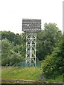
Kittiwake Tower, Newcastle
by Colin Cheesman
geograph for square NZ2663
Newcastle attracts many birds and one iconic species are the Kittiwakes. Around... (more)
|
|
Westgate Road, Newcastle upon Tyne
by Graham Robson
geograph for square NZ2464
A row of small terraced shops on Westgate Road in Newcastle.
|
|
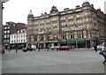
Thistle Newcastle City Centre, The County Hotel
by Paul Gillett
geograph for square NZ2463
Grade II Listed Victorian hotel opposite the Newcastle Central Station
|
|
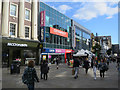
Northumberland Street, Newcastle upon Tyne
by Hugh Venables
geograph for square NZ2464
|
|
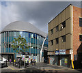
Empty premises by the Haymarket Hub
by Hugh Venables
geograph for square NZ2464
|
|
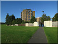
Path to Castle Leazes
by Hugh Venables
geograph for square NZ2365
Newcastle University accommodation.
|
|
Alterations to Newcastle Racecourse
by Graham Robson
geograph for square NZ2670
The eastern end of the long straight section of track at the racecourse appears... (more)
|
|
Offa's Dyke Path near Llanfair Hill
by Jeff Buck
geograph for square SO2579
Looking south along the Offa's Dyke Path between Knighton and Newcastle... (more)
|
|
Offa's Dyke near Llanfair Hill
by Jeff Buck
geograph for square SO2578
Offa's Dyke south of Newcastle near Llanfair Hill.
|
|
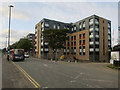
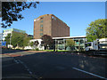
New student flats, Richardson Road
by Hugh Venables
geograph for square NZ2465
|
|
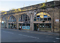
Businesses in the arches, Westgate Road
by Hugh Venables
geograph for square NZ2463
|
|
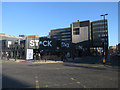
Stack, Northumberland Street
by Hugh Venables
geograph for square NZ2464
Shipping container based 'social hub'.
|
|
Sandyford Road past Northumbria University
by Hugh Venables
geograph for square NZ2565
|
|
Northumbria University, Sandyford Road
by Hugh Venables
geograph for square NZ2564
|
|
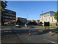
Closed Argos, Northumberland Street
by Hugh Venables
geograph for square NZ2464
The takeover of Argos by Sainsbury's has allowed significant amalgamation... (more)
|
|
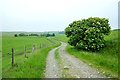
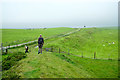
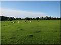
Cows in Castle Leazes
by Hugh Venables
geograph for square NZ2365
|
|
Empty site, corner of Westgate Road and St James' Boulevard
by Graham Robson
geograph for square NZ2464
A vacant site waiting for development on the corner of Westgate Road and St... (more)
|
|
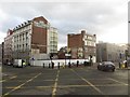
Redevelopment of the former Newgate Mall
by Graham Robson
geograph for square NZ2464
Redevelopment of the site of the former Newgate Mall shopping centre and hotel... (more)
|
|
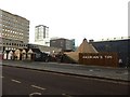
Hadrian's Tipi, Pilgrim Street
by Graham Robson
geograph for square NZ2464
A temporary market with food and beer tent has temporarily sprung up the site... (more)
|
|
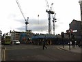
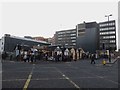
The site of the former Norham House
by Graham Robson
geograph for square NZ2464
Looking across the top of Newbridge Street towards the site of the recently... (more)
|
|
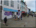
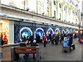
People viewing Fenwick's Christmas Window
by Graham Robson
for square NZ2464
A crowd of people are paying close attention to the Fenwick's Christmas... (more)
|