|
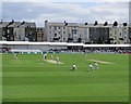
Scarborough: turned to leg
by John Sutton
geograph for square TA0389
The bowler, Nottinghamshire's Luke Wood, had taken the first five wickets... (more)
|
|
Yorkshire eyecatcher - Overton, West Yorkshire
by Martin Richard Phelan
geograph for square SE2516
This piece of mining machinery stands beside the A642 to announce the presence... (more)
|
|
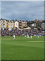
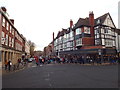
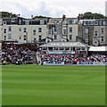
Scarborough: County Cricket at North Marine Road
by John Sutton
geograph for square TA0389
The scoreboard shows a Yorkshire recovery on the first day. Nottinghamshire had... (more)
|
|
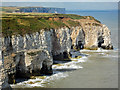
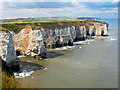
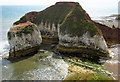
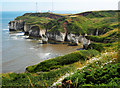
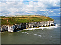
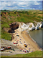
Natural Arches, Flamborough North Landing
by Scott Robinson
for square TA2472
A close up view of Natural Arches taken from Breil Nook. Bempton Cliffs can be... (more)
|
|
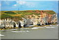
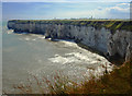
Breil Nook View, Flamborough
by Scott Robinson
geograph for square TA2471
The view looking north west from Breil Nook taking in The Saddle, Carter Lane... (more)
|
|
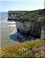
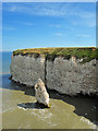
East Scar View, Flamborough
by Scott Robinson
geograph for square TA2472
The view in an easterly direction towards Breil Nook
|
|
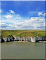
North Landing, Flamborough
by Scott Robinson
geograph for square TA2372
|
|
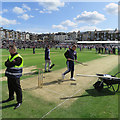
Scarborough Cricket Ground: working on the wicket
by John Sutton
geograph for square TA0389
Groundstaff smartening up the pitch during the lunch interval on the first day... (more)
|
|
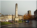
Cenotaph, Harrogate
by Malc McDonald
geograph for square SE3055
This image was taken during late autumn. The cenotaph was in sunlight, but the... (more)
|
|
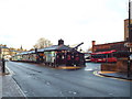
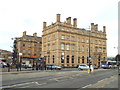
Harrogate Bus Station
by Malc McDonald
geograph for square SE3055
Harrogate bus station is next door to the railway station, making it easy for... (more)
|
|
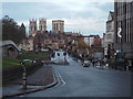
Station Road, York
by Malc McDonald
geograph for square SE5951
Station Road in York, looking towards the centre of the city. This image was... (more)
|
|
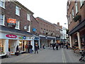
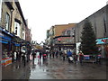
Feasegate, York
by Malc McDonald
geograph for square SE6051
A view along Feasegate in the centre of York.
The BHS store has closed down.... (more)
|
|
Piccadilly, York
by Malc McDonald
geograph for square SE6051
A view down Piccadilly, in the centre of York.
|
|
Finkle Street, York
by Malc McDonald
geograph for square SE6051
Finkle Street in York.
This image was taken in late autumn. The sun was low... (more)
|
|
College Street, York
by Malc McDonald
geograph for square SE6052
The timber-framed buildings are St. William's College. They date from... (more)
|
|
York Minster School
by Malc McDonald
geograph for square SE6052
The Minster school at York.
|
|
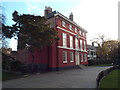
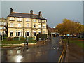
The Principal hotel, York
by Malc McDonald
geograph for square SE5951
The Principal hotel, outside York railway station, was built in the 1870s.
|
|
Oxford Street, Harrogate
by Malc McDonald
geograph for square SE3055
Oxford Street is a pedestrianised shopping street in the centre of Harrogate.
|
|
Monpellier Road, Harrogate
by Malc McDonald
geograph for square SE2955
This image was taken just after a rain shower. The road surface is still wet.... (more)
|
|
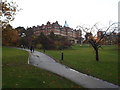
Path to the Majestic Hotel, Harrogate
by Malc McDonald
geograph for square SE2955
A path in the grounds of the Majestic Hotel in Harrogate.
The hotel, with 170... (more)
|
|
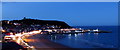
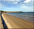
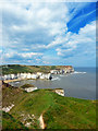
Scarborough South Bay
by PAUL FARMER
geograph for square TA0488
|
|
Manor Road Cemetery
by PAUL FARMER
geograph for square TA0388
|
|
Filey Bay
by PAUL FARMER
geograph for square TA1180
|
|
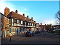
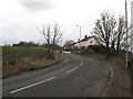
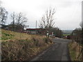
Old Road - Overton, West Yorkshire
by Martin Richard Phelan
geograph for square SE2516
This view south-west shows cottages on Old Road, Overton near Wakefield. This... (more)
|
|
Richmond Bridge from Lady Walk, Richmond Castle
by Christopher Styles
for square NZ1600
Looking up the Tees river, The Green Bridge crosses the river to Richmond Green... (more)
|
|
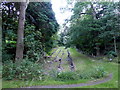
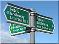
On the way to Bretton
by Dave Pickersgill
for square SE2812
Footpath sign near Yorkshire Sculpture park.
|
|
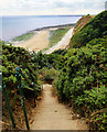
Dykes End, Danes Dyke
by Scott Robinson
geograph for square TA2169
The steps down to the beach from Cliff Plantation, Danes Dyke, Flamborough.
|
|
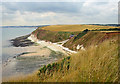
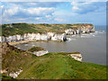
South Landing, Flamborough
by Scott Robinson
geograph for square TA2369
The view from East Nook of the South Landing on Flamborough Head.
|
|
High Stacks, Flamborough Head
by Scott Robinson
geograph for square TA2570
|
|
Stottle Bank Nook
by Scott Robinson
for square TA2571
A closer view of the Nook taken from across Selwicks Bay on Flamborough Head.
|
|
Selwicks Bay
by Scott Robinson
geograph for square TA2570
A different view across Selwicks Bay, Flamborough Head.
|
|
Selwicks Bay, Flamborough Head
by Scott Robinson
geograph for square TA2570
The view back along the coastline across Selwicks Bay to Stottle Bank Nook in... (more)
|
|
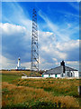
Flamborough Head
by Scott Robinson
geograph for square TA2570
The view across Selwicks Bay to Flamborough Head and Cough Hole. The fog signal... (more)
|
|
Breil Nook Views, Flamborough
by Scott Robinson
geograph for square TA2471
The view along the coast towards Flamborough Head taking in Breil Head and Cradle Head.
|
|
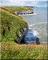
Queen Rock Sea Stack, Breil Nook, Flamborough
by Scott Robinson
geograph for square TA2471
Taken along the LDP Headland Way.
|
|
Flora & Fauna on East Scar, Flamborough
by Scott Robinson
geograph for square TA2472
Looking north west across the mouth of the North Landing bay towards North Cliff... (more)
|
|
Flamborough Cliffs Nature Reserve
by Scott Robinson
geograph for square TA2372
|
|
Old Road to the New - Overton, West Yorkshire
by Martin Richard Phelan
geograph for square SE2516
This photo shows the lane linking Old Road, Overton near Wakefield with the New... (more)
|
|
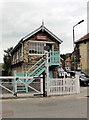
Grosmont Crossing Signal Box
by PAUL FARMER
geograph for square NZ8205
|
|
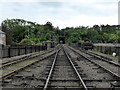
North Yorkshire Moors Railway at Grosmont
by PAUL FARMER
geograph for square NZ8205
|
|
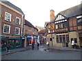
Scarborough: Tea Room at North Marine Road
by John Sutton
geograph for square TA0389
An essential feature of this lovely traditional cricket ground, photographed on... (more)
|
|
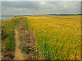
Barley Field, South Cliff, Flamborough
by Scott Robinson
geograph for square TA2469
Walking along the Headland Way LDP.
|
|
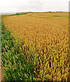
Wheat Field, Headland Way, Flamborough Head
by Scott Robinson
geograph for square TA2569
|
|
Flora, Flamborough Head
by Scott Robinson
geograph for square TA2570
The view back towards the lighthouse from the southern stretch of coastline.
|
|
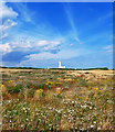
Flamborough Head Wispy Skies
by Scott Robinson
geograph for square TA2570
The back towards Flamborough Lighthouse from behind the fog signal station.
|
|
North Landing Beach, Flamborough
by Scott Robinson
geograph for square TA2372
|
|
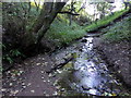
Stream, Primrose Valley
by PAUL FARMER
geograph for square TA1178
|
|
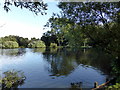
Lake at Primrose Valley Caravan Park
by PAUL FARMER
geograph for square TA1178
|
|
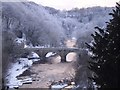
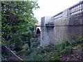
Glen Bridge
by PAUL FARMER
geograph for square TA0389
|
|
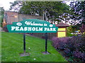
Peasholm Park Sign
by PAUL FARMER
for square TA0389
|