|
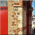
Construction detail, Bideford Pannier Market
by Robin Stott
for square SS4526
This is the corner of the building seen on the right in Derek Harper's view... (more)
|
|
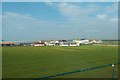
Cricket ground, Westward Ho!
by Robin Stott
geograph for square SS4329
Looking through the ballstop netting along Golf Links Road from the top deck of... (more)
|
|
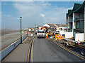
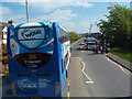
Hold-up on Golf Links Road, Westward Ho!
by Robin Stott
geograph for square SS4329
Photographed from the top deck of a no.21 bus, the North Devon Wave. Atlantis... (more)
|
|
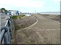
Slipway from the car park by The Quay, Appledore
by Robin Stott
geograph for square SS4630
The slipway extends southeast, upstream, from the car park. At the bus stand is... (more)
|
|
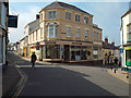
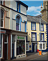
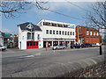
Manchester House at the corner of North Road, left, and Chingswell Street, Bideford
by Robin Stott
geograph for square SS4526
Many properties in the town are built of the hard cream local brick. North Road... (more)
|
|
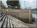
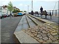
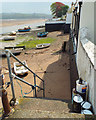
North end of the steps at the north end of the Quay, low tide, Bideford
by Robin Stott
geograph for square SS4526
At the higher level there are car parks, access to Victoria Park, and a pleasant... (more)
|
|
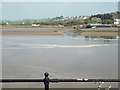
Sign of the incoming tide, River Torridge, Bideford
by Robin Stott
geograph for square SS4527
The salt water, moving visibly left to right, seems to advance first in the deep... (more)
|
|
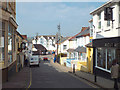
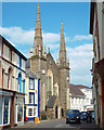
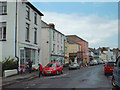
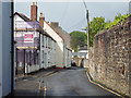
North on Chingswell Street, Bideford
by Robin Stott
geograph for square SS4526
A mixture of businesses, a pub and houses. Behind the building with the... (more)
|
|
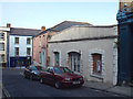
Derelict old building, Grenville Street, Bideford
by Robin Stott
geograph for square SS4526
Apparently not listed and old maps give no clue. Simply a shop, perhaps, or an... (more)
|
|
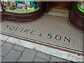
Mosaic floor to shop entrance, 12 High St, Bideford
by Robin Stott
for square SS4526
|
|
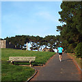
An evening jog round Chudleigh Fort, East-the-Water
by Robin Stott
geograph for square SS4526
This is a small park off Grange Road and Chudleigh Avenue. The fort commands a... (more)
|
|
Lavington United Reformed Church, Bridgeland Street, Bideford
by Robin Stott
geograph for square SS4526
The inscription on a stone below the near window reads: The Great Meeting-House... (more)
|
|
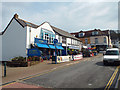
Shops and a Citizens Advice Bureau at the top of Bridgeland Street, Bideford
by Robin Stott
geograph for square SS4526
|
|
Traffic waits for children to cross Kingsley Road, Bideford
by Robin Stott
geograph for square SS4527
School's out. Photographed from a no.21 bus behind a 21A
|
|
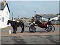
Onward travel horse and carriage near the car park and bus stop, Westward Ho!
by Robin Stott
geograph for square SS4329
In the background on the right is the new Baptist Church.
|
|
Shops at the west end of Golf Links Road, Westward Ho!
by Robin Stott
geograph for square SS4329
|
|
Atlantis apartments with a fancy roof, Westward Ho!
by Robin Stott
geograph for square SS4329
This is the landward side. On the seaward side these flats look out across Golf... (more)
|
|
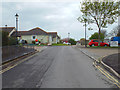
Glebefields, Northam
by Robin Stott
geograph for square SS4428
Leading to Glebe Court and Glebelands House residential home.
|
|
House at the corner of Lenards Road and Fore Street, Northam
by Robin Stott
geograph for square SS4428
|
|
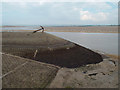
Base of slipway by The Quay, Appledore
by Robin Stott
geograph for square SS4630
The slipway extends southeast from the car park that has been built out into the... (more)
|
|
Promenade, The Quay, Appledore
by Robin Stott
geograph for square SS4630
|
|
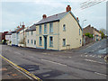
East-facing Marine Parade, Appledore
by Robin Stott
geograph for square SS4630
A pleasing group of vernacular buildings.
|
|
Entrance to the disused Richmond dry-dock, Appledore
by Robin Stott
geograph for square SS4630
In the background is the south side of the village. The story of the dry-dock is... (more)
|
|
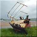
Detached bow section of a boat near the disused Richmond dry-dock, Appledore
by Robin Stott
for square SS4630
|
|
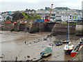
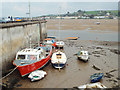
Boats moored below Marine Parade, Appledore, low tide
by Robin Stott
geograph for square SS4630
Contrast of scale. Instow is seen across the River Torridge.
|
|
Entrance to the disused Richmond dry-dock, Appledore
by Robin Stott
geograph for square SS4630
The story of the dry-dock is told on three boards facing Marine Parade, starting... (more)
|
|
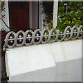
Ornamental rail to the top of a garden wall, Marine Parade, Appledore
by Robin Stott
for square SS4630
|
|
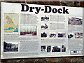
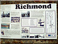
Richmond Dry-Dock, Appledore, board 3
by Robin Stott
for square SS4630
The three large boards are mounted on the boundary wall facing Marine Parade.... (more)
|
|
Richmond Dry-Dock, Appledore, board 2
by Robin Stott
for square SS4630
The three large boards are mounted on the boundary wall facing Marine Parade.... (more)
|
|
Richmond Dry-Dock, Appledore, board 1
by Robin Stott
for square SS4630
The three large boards are mounted on the boundary wall facing Marine Parade.... (more)
|
|
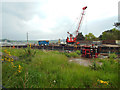
The long-disused Richmond dry-dock, Appledore
by Robin Stott
geograph for square SS4630
The story of the Richmond dry-dock, and shipbuilding at Appledore, is told on... (more)
|
|
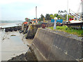
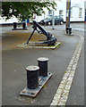
Redundant functional objects recycled as street furniture, Marine Parade, Appledore
by Robin Stott
geograph for square SS4630
|
|
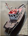
Low tide on the Torridge Bideford pilot unavailable
by Robin Stott
for square SS4526
|
|
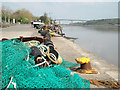
Fishing nets and floats on the Quay, Bideford
by Robin Stott
geograph for square SS4526
Downstream is the Torridge Bridge carrying the A39 road over the river. The... (more)
|
|
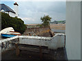
Public bench off New Quay Street overlooking the Torridge and Instow
by Robin Stott
geograph for square SS4630
A private house, left, occupies the built-out ground south of the former Richmond Dock.
|
|
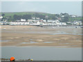
View from Appledore across the River Torridge to Instow
by Robin Stott
for square SS4730
There is a marked change of level on each side of the Jetty, centre.
|
|
Waterfront behind New Quay Street, Appledore
by Robin Stott
geograph for square SS4630
Looking upstream on the Torridge at low tide.
|
|
Northwest on New Quay Street, Appledore, after rain
by Robin Stott
geograph for square SS4630
New Quay Street winds round Appledore's southern waterfront.
|
|
Southeast on New Quay Street, Appledore, after rain
by Robin Stott
geograph for square SS4630
New Quay Street winds round Appledore's southern waterfront.
|
|
New Street, at the side of Appledore Community Hall
by Robin Stott
geograph for square SS4630
Unsuitable for motors, says the blue sign. The postbox number is EX39 78. The... (more)
|
|
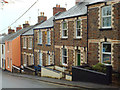
Stepped terraced houses of local stone and two-tone brick, Myrtle Street, Appledore
by Robin Stott
geograph for square SS4630
Myrtle Street is part of the main road into the village.
|
|
South end of Odun Road, Appledore
by Robin Stott
geograph for square SS4630
|
|
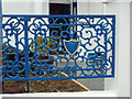
Ornate cast iron fence panel, Odun Road, Appledore
by Robin Stott
for square SS4630
|
|
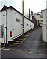
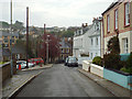
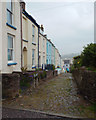
Looking down Bude Street, Appledore
by Robin Stott
geograph for square SS4630
A steep narrow street of stepped terraced houses. In the grey distance is Instow... (more)
|
|
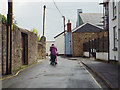
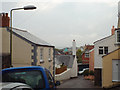
Green Lane, Appledore
by Robin Stott
geograph for square SS4630
An uphill, closely-packed part of the village, during a damp, gloomy spell.
|
|
Alpha Place off Green Lane, Appledore
by Robin Stott
geograph for square SS4630
A well-kept terrace on an appreciable slope. Note the paving of stones worn... (more)
|
|
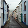
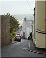
Looking down Meeting Street, Appledore
by Robin Stott
geograph for square SS4630
The view is from Green Lane through the drizzle across the Torridge to Instow.
|
|
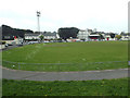
Floodlit football ground by Kingsley Road, Bideford
by Robin Stott
geograph for square SS4527
Photographed from the top of a bus to Appledore.
|
|
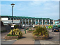
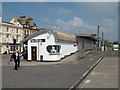
A bold new public building on the Quay, Bideford
by Robin Stott
geograph for square SS4526
The builders were still applying the finishing touches. It houses the Port... (more)
|
|
Bideford Post Office and neighbours, The Quay
by Robin Stott
geograph for square SS4526
To its left, beside Ropewalk, is the long boathouse of the Bideford Amateur... (more)
|