|
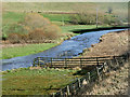
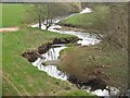
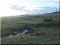
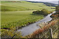
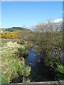
The Lyne Water, near to Hallyne
by David Dixon
geograph for square NT1841
The Lyne Water is a tributary of the River Tweed which rises in the Pentland... (more)
|
|
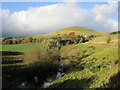
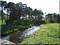
Lyne Water
by David Dixon
geograph for square NT1741
The Lyne Water is a tributary of the River Tweed which rises in the Pentland... (more)
|
|
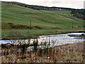
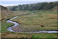
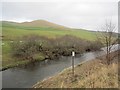
Lyne Water at Hamildean
by Alan O'Dowd
geograph for square NT1840
A view towards Hamildean Hill with the Lyne Water, a tributary of the River... (more)
|
|
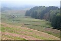
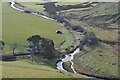
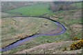
Meanders on the Lyne Water
by Jim Barton
for square NT1353
The Lyne Water between Baddinsgill and West Linton.
|
|
Small island, Lyne Water
by Jim Barton
for square NT2139
A channel in the Lyne Water cutting off a small island, seen from the former... (more)
|
|
Lyne Water and bridge, West Linton
by Jim Barton
for square NT1451
Bogsbank Road crosses the Lyne Water.
|
|
Lyne Water and Flemington Burn
by Jim Barton
geograph for square NT1645
The confluence of the Flemington Burn (L) with the Lyne Water near Flemington... (more)
|
|
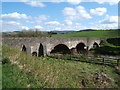
Former railway bridge, Lyne
by Jim Barton
for square NT2039
The bridge for the former Caledonian line from Peebles to Bigger and Symington... (more)
|
|
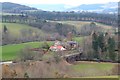
The Cairn burn and meter house
by M J Richardson
geograph for square NT1752
A tributary of the Lyne Water - not sure why this part is canalised and has a... (more)
|
|
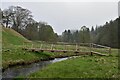
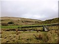
Footbridge over the Lyne Water
by Jim Barton
geograph for square NT1254
|
|
A bend in the Lyne Water
by Jim Barton
geograph for square NT1354
Looking down from the path traversing the west slopes of Faw Mount.
|
|
Beggarpath Bridge
by Barbara Carr
geograph for square NT2040
Over the Lyne Water, just north of its confluence with the River Tweed.
|
|
The Lyne Water near Baddinsgill
by Jim Barton
geograph for square NT1354
|
|
Lyne Water
by Richard Webb
geograph for square NT1741
|
|
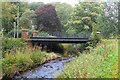
Bridge, West Linton
by Richard Webb
geograph for square NT1451
Bogsbank Road crosses the Lyne Water. There was a singing dipper beneath the bridge.
|
|
Footbridge over Lyne Water
by Alan O'Dowd
geograph for square NT1254
A tributary of the River Tweed.
|
|
Lyne Water
by Barbara Carr
geograph for square NT2040
Looking eastward from Beggarpath Bridge.
|
|
The Lyne Water
by Barbara Carr
geograph for square NT2040
Looking westward from Beggarpath Bridge.
|
|
Lyne Water
by Richard Webb
geograph for square NT1741
Bank vegetation has been flattened by floods.
|
|
Lyne Water, West Linton
by Richard Webb
geograph for square NT1451
|
|
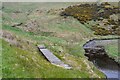
Old boardwalk by the Lyne Water
by Jim Barton
for square NT1354
The remains of a path from the Cross Borders Drove Road down to the footbridge.
|
|
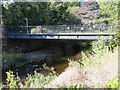
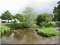
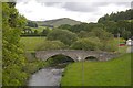
Lynesmill Bridge
by Richard Webb
geograph for square NT2040
A minor road near Lyne Station crosses this bridge. View from the railway viaduct.
|
|
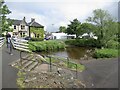
Bridge and ford, West Linton
by Richard Webb
geograph for square NT1451
Foot of Chapel Brae
|