|
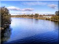
Ribble Viaduct, Preston
by Malc McDonald
geograph for square SD5328
The Ribble Viaduct carries the West Coast Main Line across the River Ribble in... (more)
|
|
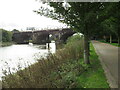
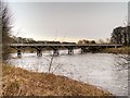
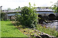
Old Tram Bridge across the River Ribble, Preston
by Malc McDonald
geograph for square SD5428
The name of the Old Tram Bridge might suggest that it used to carry trams across... (more)
|
|
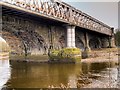
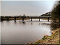
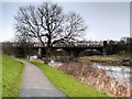
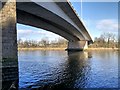
River Ribble, North Union Railway Bridge
by David Dixon
geograph for square SD5328
Also known as the Ribble Viaduct, this bridge carries the West Coast Main Line... (more)
|
|
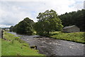
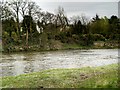
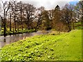
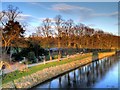
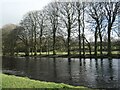
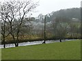
Ribble Way beside the River Ribble
by Bill Harrison
geograph for square SD8162
The long-distance footpath takes you through lovely scenery but is very muddy in... (more)
|
|
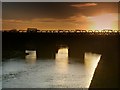
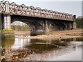
North Union Railway Bridge (Ribble Viaduct) at Preston
by David Dixon
geograph for square SD5328
The Ribble Viaduct, also known as the North Union Railway Bridge, silhouetted... (more)
|
|
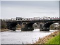
Pendolino Crossing The Ribble
by David Dixon
geograph for square SD5328
A southbound Virgin Trains' Pendolino crosses the Ribble Viaduct as it... (more)
|
|
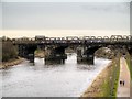
Ribble Viaduct, Preston
by David Dixon
geograph for square SD5328
A Northern Rail train crosses the Ribble Viaduct, also known as the North Union... (more)
|
|
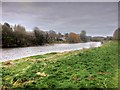
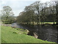
Ribble River Bank at Brockholes
by David Dixon
geograph for square SD5930
|
|
River Ribble at Brockholes
by David Dixon
geograph for square SD5930
|
|
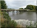
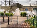
The Old Tram Bridge, Avenham Park
by David Dixon
geograph for square SD5428
The footbridge over the Ribble in Avenham Park is a modern replica of a timber... (more)
|
|
The Old Tram Road/Tram Bridge, Avenham Park
by David Dixon
geograph for square SD5428
The footbridge over the Ribble in Avenham Park is a modern replica of a timber... (more)
|
|
River Ribble, Old Tram Bridge
by David Dixon
geograph for square SD5428
The footbridge over the Ribble in Avenham Park is a modern replica of a timber... (more)
|
|
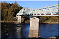
Riverside Walk and The Ribble Viaduct, Preston
by David Dixon
geograph for square SD5328
Also known as the North Union Railway Bridge, the bridge in the background... (more)
|
|
West Coast Main Line, The Ribble Viaduct at Preston
by David Dixon
geograph for square SD5328
Also known as the North Union Railway Bridge, this bridge carries the West Coast... (more)
|
|
River Hodder, Slaidburn Village Green
by David Dixon
geograph for square SD7152
The River Hodder is the largest tributary of the River Ribble. It rises on White... (more)
|
|
'New' Dinckley Footbridge over River Ribble
by Richard Cook
geograph for square SD6836
Replacement footbridge over River Ribble at Dinckley replacing the one that was... (more)
|
|
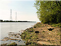
Ribble Shore
by David Dixon
geograph for square SD4929
The northern shore of the River Ribble, approximately 1000 yards downstream of... (more)
|
|
River Ribble from Stainforth Bridge
by John S Turner
geograph for square SD8167
Looking upstream along the River Ribble from Stainforth Bridge, which is the... (more)
|
|
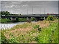
River Ribble, M6 Junction 31 Sliproad near Samlesbury
by David Dixon
geograph for square SD5830
The exit sliproad from the M6 at Junction 31 (Samlesbury) crossing the River... (more)
|
|
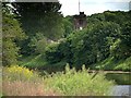
River Ribble, Samlesbury Church Tower
by David Dixon
geograph for square SD5830
The tower of the Church of St Leonard the Less at Samlesbury, seen above the... (more)
|
|
River Ribble, Avenham Park
by David Dixon
geograph for square SD5328
|
|
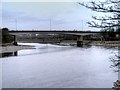
River Ribble, Guildway Bridge
by David Dixon
geograph for square SD5229
Newest bridge to cross the Ribble at Preston constructed to carry the A59 when... (more)
|
|
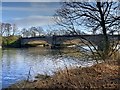
River Ribble, Penwortham New Bridge
by David Dixon
geograph for square SD5228
New Penwortham Bridge, built in 1912, carries Liverpool Road across the Ribble... (more)
|
|
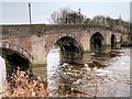
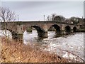
River Ribble, Old Penwortham Bridge
by David Dixon
geograph for square SD5328
The Old Penwortham Bridge is a Georgian masonry former road bridge which is... (more)
|
|
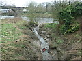
A tidal tributary of the River Ribble
by Christine Johnstone
geograph for square SD5328
Named as 'The Mains Brook' on the large-scale OS map surveyed in the... (more)
|
|
River Ribble, Guildway Bridge
by David Dixon
geograph for square SD5229
Newest bridge to cross the Ribble at Preston constructed to carry the A59 when... (more)
|
|
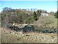
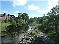
"A view of the river and Waddow Hall"
by Christine Johnstone
geograph for square SD7342
Section 4 of Walk No 1, Clitheroe Walks... (more)
|
|
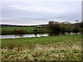
Ribble Valley Flood Plain from the Viewpoint at Brockholes Nature Reserve
by David Dixon
geograph for square SD5831
|
|
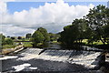
Weir and fish ladder, River Ribble, Settle
by Christine Johnstone
geograph for square SD8164
With the river in full and fast flow. Compare with a view when the water level... (more)
|
|
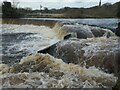
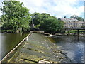
Water tumbling over a River Ribble weir
by Christine Johnstone
geograph for square SD8062
The weir is not shown on any 19th century large-scale maps, but it is there... (more)
|
|
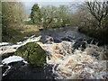
Queen's Rock, River Ribble, Settle
by Christine Johnstone
geograph for square SD8163
The river is fast and high after prolonged wet weather.
|
|
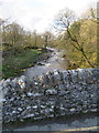
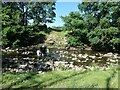
Confluence of Tems Beck and the River Ribble
by Christine Johnstone
geograph for square SD8062
The banks of the beck have been strengthened with stone blocks, some of which... (more)
|
|
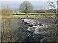
East bank of the River Ribble
by Christine Johnstone
geograph for square SD8062
South of Settle. The river is full and fast after a spell of wet weather.
|
|
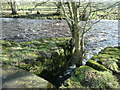
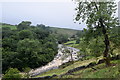
The River Ribble, south of Giggleswick
by Christine Johnstone
geograph for square SD8163
Looking upstream [locally north]. A civil parish boundary runs along the middle... (more)
|
|
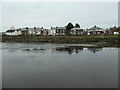
The River Ribble and houses on Preston's Riverside
by Christine Johnstone
geograph for square SD5328
A 'pleasant view' from the south bank.
|
|
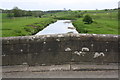
Settle Bridge taking B6480 over the River Ribble
by Roger Templeman
geograph for square SD8164
|
|
The River Ribble entering Settle
by Christine Johnstone
geograph for square SD8164
Quite lively after two days solid rain, and much more in the weeks before.
|
|
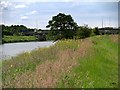
Ribble Riverbank Path near Brockholes Nature Reserve
by David Dixon
geograph for square SD5830
|
|
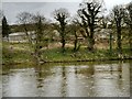
River Ribble, Seed House Farm
by David Dixon
geograph for square SD5930
Looking across the river from the bank at the Brockholes Nature Reserve towards... (more)
|
|
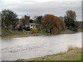
River Ribble, Samlesbury
by David Dixon
geograph for square SD5930
View taken from the Brockholes Nature Reserve... (more)
|
|
River Ribble from Penwortham New Bridge
by David Dixon
geograph for square SD5228
Looking downstream from Penwortham New Bridge.
|
|
Penwortham Bridge, Preston
by David Dixon
geograph for square SD5328
The Old Penwortham Bridge is a Georgian masonry former road bridge which is... (more)
|
|
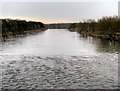
River Ribble, Preston
by David Dixon
geograph for square SD5428
|
|
Low water level in the River Ribble, June 2023
by Christine Johnstone
geograph for square SD8164
|
|
Almost dry weir on the River Ribble
by Christine Johnstone
geograph for square SD8165
After a few weeks of hot, dry weather. In other years and other seasons, the... (more)
|
|
Fording the Ribble near Hornby Laithe
by Christine Johnstone
geograph for square SD8166
And in doing so, crossing from Giggleswick civil parish to Stainforth civil... (more)
|
|
River Ribble seen from Cow Bridge on B6478
by Luke Shaw
geograph for square SD8256
|
|
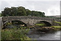
New Inn bridge, Horton in Ribblesdale
by Bill Harrison
geograph for square SD8072
The late 18th Century bridge over the River Ribble, which now carries the B6479,... (more)
|
|
Langcliffe weir
by Bill Harrison
geograph for square SD8165
Yet another view of this impressive weir on the River Ribble.
|
|
The tumultuous River Ribble
by Bill Harrison
geograph for square SD8168
This was taken in August; what's it like in January? The bridge carrying... (more)
|