Public Tags
Showing latest 50 of 134 images tagged with river:Rother tag.
|
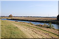
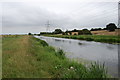
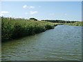
Fishing on the River Rother
by Julian P Guffogg geograph for square TQ8925 |
|
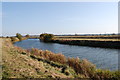
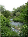
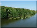
River Rother near Wittersham
by Julian P Guffogg geograph for square TQ8925 |
|
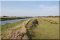
River Rother near Wittersham
by Julian P Guffogg geograph for square TQ8726 Tags:
top:Rivers, Streams, DrainageX
river:Rother
|
|
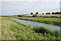
River Rother near Knelle Pumping Station
by Julian P Guffogg geograph for square TQ8526 Tags:
top:Rivers, Streams, DrainageX
river:Rother
|
|
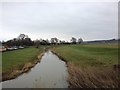
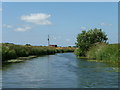
The River Rother
by Julian P Guffogg geograph for square TQ9225 Flowing east towards Rye and out to sea.
Tags:
top:Rivers, Streams, DrainageX
river:Rother
|
|
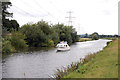
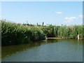
Boat on the River Rother
by Julian P Guffogg geograph for square TQ9025 |
|
River Rother, Rother Valley country park
by Christine Johnstone geograph for square SK4583 Looking downstream [locally north] from Pit Lane bridge. For more information... (more)
Tags:
type:GeographX
subject:RiverX
top:Rivers, Streams, DrainageX
river:Rother
Rother Valley Country ParkX
|
|
River Rother in the country park
by Andrew Hill geograph for square SK4581 Looking upstream as the river flows between Meadowgate Lake and the south end of... (more)
Tags:
Country ParkX
top:Park and Public GardensX
RiverX
top:Rivers, Streams, DrainageX
river:Rother
Rother ValleyX
|
|
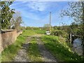
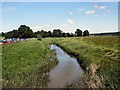
Field access track near Northbridge Street
by Adrian Taylor geograph for square TQ7324 This field access track leads from the old A21 road just north of the site of... (more)
|
|
River Rother near Midhurst, 1926
by John A Hawgood geograph for square SU8921 Written on the back of this photo is "The edge of the Rother River near... (more)
Tags:
type:GeographX
top:People, EventsX
PicnickersX
subject:RiverX
top:Rivers, Streams, DrainageX
river:Rother
top:Suburb, Urban FringeX
|
|
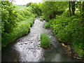
River Rother by railway bridge
by Andrew Hill geograph for square SK3974 A bend in the river as it exits from the railway bridge, passing extensive... (more)
|
|
River Rother
by Chris Whippet geograph for square TQ7825 |
|
Confluence of the Kent Ditch and the River Rother
by Christine Johnstone geograph for square TQ8025 Looking downstream. Seen from a ferry travelling between Bodiam and Newenden,... (more)
Tags:
top:CanalsX
Grey CloudsX
Kent DitchX
Navigable RiverX
River ConfluenceX
RiverbankX
top:Rivers, Streams, DrainageX
river:Rother
Rother LevelsX
plant:Water LilyX
Windy DayX
|
|
Confluence of the River Rother and the Kent Ditch
by Christine Johnstone geograph for square TQ8025 Seen from a ferry travelling between Newenden and Bodiam, see... (more)
|
|
River Rother viewed from Bodiam Bridge
by Paul Gillett geograph for square TQ7825 Near to Bodiam Castle which is just out of picture top left.
|
|
River Rother, Salehurst
by Maigheach-gheal geograph for square TQ7523 The River Rother from Church Bridge.
|
|
Drain outfall / sluice, north bank of River Rother
by Christine Johnstone geograph for square TQ8026 Seen from a ferry travelling between Bodiam and Newenden, see... (more)
Tags:
top:CanalsX
Drain OutfallX
Drain OutletX
Navigable RiverX
RipplesX
RiverbankX
top:Rivers, Streams, DrainageX
river:Rother
Rother LevelsX
SluiceX
plant:Water LilyX
Windy DayX
|
|
South bank, River Rother
by Christine Johnstone geograph for square TQ7825 Seen from a ferry travelling between Newenden and Bodiam, see... (more)
Tags:
sky:BlueX
top:CanalsX
Navigable RiverX
RiverbankX
top:Rivers, Streams, DrainageX
river:Rother
Rother LevelsX
|
|
Bend on the River Rother
by Christine Johnstone geograph for square TQ7925 Seen from a ferry travelling between Newenden and Bodiam, see... (more)
Tags:
sky:BlueX
top:CanalsX
Navigable RiverX
RiverbankX
top:Rivers, Streams, DrainageX
river:Rother
Rother LevelsX
|
|
South bank of the River Rother
by Christine Johnstone geograph for square TQ7925 Seen from a ferry travelling between Newenden and Bodiam, see... (more)
Tags:
sky:BlueX
top:CanalsX
Navigable RiverX
RiverbankX
top:Rivers, Streams, DrainageX
river:Rother
Rother LevelsX
|
|
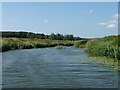
A long straight section on the River Rother
by Christine Johnstone geograph for square TQ7925 Seen from a ferry travelling between Newenden and Bodiam, see... (more)
Tags:
sky:BlueX
top:CanalsX
Navigable RiverX
RiverbankX
top:Rivers, Streams, DrainageX
river:Rother
Rother LevelsX
|
|
River Rother, East Sussex
by Christine Johnstone geograph for square TQ7925 No longer the county boundary, unlike downstream of the confluence with the Kent... (more)
Tags:
sky:BlueX
Blue Skies White CloudsX
top:CanalsX
Navigable RiverX
RiverbankX
top:Rivers, Streams, DrainageX
river:Rother
Rother LevelsX
|
|
Looking upstream, River Rother
by Christine Johnstone geograph for square TQ7925 Seen from a ferry travelling between Newenden and Bodiam, see... (more)
Tags:
Bird BoxX
Bird Nesting BoxX
sky:BlueX
top:CanalsX
Navigable RiverX
RiverbankX
top:Rivers, Streams, DrainageX
river:Rother
Rother LevelsX
|
|
Nesting boxes along the River Rother
by Christine Johnstone geograph for square TQ8025 Seen from a ferry travelling between Newenden and Bodiam, see... (more)
|
|
Pumping station, south bank of the River Rother
by Christine Johnstone geograph for square TQ8025 Seen from a ferry travelling between Newenden and Bodiam, see... (more)
|
|
Looking upstream along the River Rother
by Christine Johnstone geograph for square TQ8025 Seen from a ferry travelling between Newenden and Bodiam, see... (more)
|
|
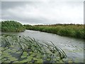
Water lilies, south bank of the River Rother
by Christine Johnstone geograph for square TQ8026 Seen from a ferry travelling between Newenden and Bodiam, see... (more)
Tags:
sky:BlueX
top:CanalsX
Navigable RiverX
RiverbankX
top:Rivers, Streams, DrainageX
river:Rother
Rother LevelsX
plant:Water LilyX
|
|
Drain sluice / outlet, at 3 metre spot height
by Christine Johnstone geograph for square TQ8025 On the south bank of the River Rother. Seen from a ferry travelling between... (more)
|
|
Nesting box, south bank of the River Rother
by Christine Johnstone geograph for square TQ8126 Built for barn owls, but used by other species. Seen from a ferry travelling... (more)
|
|
River Rother, north of Dyneshill Wood
by Christine Johnstone geograph for square TQ8126 Seen from a ferry travelling between Newenden and Bodiam, see... (more)
|
|
Bend in the River Rother, south-east of Ethnam
by Christine Johnstone geograph for square TQ8126 Seen from a ferry travelling between Newenden and Bodiam, see... (more)
|
|
Ethnam Sluice, north bank of the River Rother
by Christine Johnstone geograph for square TQ8126 Seen from a ferry travelling between Newenden and Bodiam, see... (more)
Tags:
sky:BlueX
top:CanalsX
Navigable RiverX
RiverbankX
top:Rivers, Streams, DrainageX
river:Rother
Rother LevelsX
SluiceX
|
|
Straight stretch of the River Rother
by Christine Johnstone geograph for square TQ8126 Looking upstream along the county boundary. Seen from a ferry travelling between... (more)
|
|
River Rother, looking upstream
by Christine Johnstone geograph for square TQ8226 Seen from a ferry travelling between Newenden and Bodiam, see... (more)
|
|
Nesting boxes, south bank of the River Rother
by Christine Johnstone geograph for square TQ8226 Erected for barn owls, but used by other species. Seen from a ferry travelling... (more)
Tags:
Bird BoxX
Bird Nesting BoxX
sky:BlueX
Blue Skies White CloudsX
top:CanalsX
Navigable RiverX
RiverbankX
top:Rivers, Streams, DrainageX
river:Rother
Rother LevelsX
plant:Water LilyX
|
|
Big bend on the River Rother
by Christine Johnstone geograph for square TQ8226 The nesting box on the pole [one of several] was intended for barn owls, but is... (more)
|
|
Wiggles along the River Rother
by Christine Johnstone geograph for square TQ8226 Seen from a ferry travelling between Newenden and Bodiam, see... (more)
|
![TQ8226 : East Sussex [south] bank of the River Rother by Christine Johnstone](https://s0.geograph.org.uk/geophotos/03/56/04/3560480_504139a3_120x120.jpg)
|
East Sussex [south] bank of the River Rother
by Christine Johnstone geograph for square TQ8226 Seen from a ferry travelling between Newenden and Bodiam, see... (more)
|
|
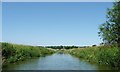
River Rother, county boundary
by Christine Johnstone geograph for square TQ8226 Seen from a ferry travelling between Newenden and Bodiam, see... (more)
|
![TQ8326 : East Sussex [south] bank, River Rother by Christine Johnstone](https://s0.geograph.org.uk/geophotos/03/56/03/3560372_930cfca5_120x120.jpg)
|
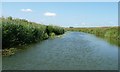
East Sussex [south] bank, River Rother
by Christine Johnstone geograph for square TQ8326 The bush is growing at the end of a drainage ditch. Seen from a ferry travelling... (more)
|
|
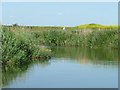
Water lilies on a River Rother bend
by Christine Johnstone geograph for square TQ8326 Seen from a ferry travelling between Newenden and Bodiam, see... (more)
Tags:
sky:BlueX
top:CanalsX
County BoundaryX
County Boundary (Unmarked)X
Navigable RiverX
RiverbankX
top:Rivers, Streams, DrainageX
river:Rother
Rother LevelsX
plant:Water LilyX
|
|
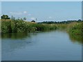
River Rother, county boundary
by Christine Johnstone geograph for square TQ8326 Seen from a ferry travelling between Newenden and Bodiam, see... (more)
Tags:
sky:BlueX
top:Boundary, BarrierX
top:CanalsX
County BoundaryX
County Boundary (Unmarked)X
Navigable RiverX
RiverbankX
top:Rivers, Streams, DrainageX
river:Rother
Rother LevelsX
|
|
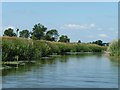
River Rother, upstream of Newenden Bridge
by Christine Johnstone geograph for square TQ8326 Seen from a ferry travelling between Newenden and Bodiam, see... (more)
Tags:
sky:BlueX
top:CanalsX
County BoundaryX
County Boundary (Unmarked)X
Navigable RiverX
RiverbankX
top:Rivers, Streams, DrainageX
river:Rother
Rother LevelsX
|
|
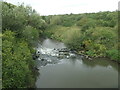
Overflow weir in action
by Christine Johnstone geograph for square SK3872 On a section of the Chesterfield Canal that is a canalised stretch of the River... (more)
Tags:
top:CanalsX
Chesterfield CanalX
canal:Chesterfield CanalX
Overflow WeirX
near:River RotherX
top:Rivers, Streams, DrainageX
river:Rother
|
|
Amphibious bistort, south bank of the Rother
by Christine Johnstone geograph for square TQ8126 I'd call it water bistort, but this is its proper name. Seen from a ferry... (more)
Tags:
plant:Amphibious BistortX
BistortX
sky:BlueX
top:CanalsX
Navigable RiverX
RiverbankX
top:Rivers, Streams, DrainageX
river:Rother
Rother LevelsX
|
|
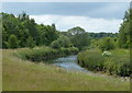
The River Rother
by Christine Johnstone geograph for square TQ8427 Upstream from the Kent & East Sussex Railway bridge.
|
|
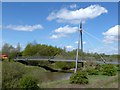
Bridge over the River Rother
by Graham Hogg geograph for square SK4583 This striking cable-stayed suspension bridge provides a link for cyclists and... (more)
|
![TQ8226 : Wildflowers on the Rother's Kent [north] bank by Christine Johnstone](https://s1.geograph.org.uk/geophotos/03/56/04/3560485_52d9d38d_120x120.jpg)
|
Wildflowers on the Rother's Kent [north] bank
by Christine Johnstone geograph for square TQ8226 Seen from a ferry travelling between Newenden and Bodiam, see... (more)
|
|
Walker on the Kent bank of the Rother
by Christine Johnstone geograph for square TQ8226 Seen from a ferry travelling between Newenden and Bodiam, see... (more)
|
|
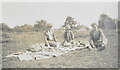
Picnic by the Rother near Midhurst, 1926
by John A Hawgood geograph for square SU8921 Location is approximate, caption on photo is "By the Rother near... (more)
Tags:
type:GeographX
subject:PeopleX
PicnickersX
top:Rivers, Streams, DrainageX
river:Rother
top:Suburb, Urban FringeX
|