Public Tags
Other tags: A478
Showing images tagged with road:A478 tag.
|
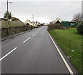
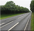
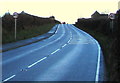
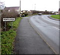
Up the A478, Pentlepoir
by Jaggery geograph for square SN1206 The A478 ascends towards the centre of the village. The grassy bank is at the... (more)
|
|
Bend in the A478, Begelly, Pembrokeshire
by Jaggery geograph for square SN1107 The A478 ascends past the Parsonage Lane junction.
Tags:
road:A478
Bend in RoadX
type:GeographX
Road JunctionX
top:Roads, Road TransportX
top:Village, Rural SettlementX
|
|
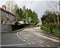
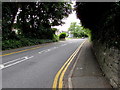
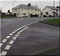
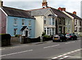
Bend in Narberth Road, Tenby
by Jaggery geograph for square SN1201 Along the A478 Narberth Road towards Tenby town centre past the left turn into... (more)
|
|
No left turn ahead, Narberth Road, New Hedges, Pembrokeshire
by Jaggery geograph for square SN1202 The sign faces southbound traffic on the A478 Narberth Road on the approach to... (more)
Tags:
A478
road:A478
type:GeographX
No Left TurnX
top:Roads, Road TransportX
top:Village, Rural SettlementX
|
|
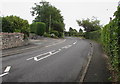
Narberth Road, New Hedges, Pembrokeshire
by Jaggery geograph for square SN1202 The A478 Narberth Road bypasses the centre of the village of New Hedges.
|
|
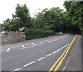
No parking on Narberth Road, Tenby
by Jaggery geograph for square SN1301 Double yellow lines on both sides of the A478 Narberth Road indicate no parking... (more)
Tags:
A478
road:A478
Double Yellow LinesX
type:GeographX
top:Roads, Road TransportX
top:Suburb, Urban FringeX
|
|
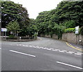
Junction of Gas Lane and the A478, Tenby
by Jaggery for square SN1301 From the A478, Gas Lane leads to Tenby Cottage Hospital,... (more)
|
|
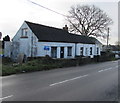
BT phonebox alongside the A478 in Pentlepoir
by Jaggery geograph for square SN1106 The A478 is the main road through the village. A Spar which contains the village... (more)
Tags:
road:A478
BT PhoneboxX
top:CommunicationsX
type:GeographX
top:Roads, Road TransportX
top:Village, Rural SettlementX
|
|
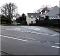
Junction of Hill Rise and the A478, Pentlepoir
by Jaggery geograph for square SN1206 Near the Pentlepoir boundary sign, Hill Rise from the right joins the A478.
Tags:
road:A478
Boundary SignX
top:Boundary, BarrierX
type:GeographX
Road JunctionX
top:Roads, Road TransportX
top:Village, Rural SettlementX
|
|
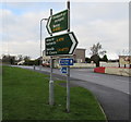
A478 directions sign, Pentlepoir
by Jaggery geograph for square SN1106 Facing the Station Road junction. Left for Tenby, right for Narberth and St... (more)
Tags:
A478
road:A478
Bilingual Road SignX
Directions SignX
type:GeographX
top:Roads, Road TransportX
top:Village, Rural SettlementX
Welsh/EnglishX
|
|
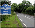
Croeso i Dinbych-y-pysgod/Welcome to Tenby
by Jaggery geograph for square SN1201 The bilingual (Welsh/English) sign is alongside the A478 Narberth Road at the... (more)
Tags:
A478
road:A478
BilingualX
top:Boundary, BarrierX
type:GeographX
top:Roads, Road TransportX
Welcome SignX
Welsh/EnglishX
|
|
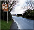
Caravan and camping sites directions sign, New Hedges, Pembrokeshire
by Jaggery geograph for square SN1202 Facing northbound traffic on the A478 Narberth Road. Site names shown in
July... (more)
Tags:
A478
road:A478
Directions SignX
type:GeographX
top:Roads, Road TransportX
top:Village, Rural SettlementX
|
|
Turn right ahead for New Hedges, Pembrokeshire
by Jaggery geograph for square SN1202 The sign faces the A478 Narberth Road from Tenby. St Anne's Church, a Tin... (more)
Tags:
A478
road:A478
Direction SignX
type:GeographX
top:Roads, Road TransportX
Tin TabernacleX
top:Village, Rural SettlementX
|
|
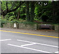
10 miles and 970 yards from Narberth, Tenby
by Jaggery for square SN1301 Viewed across the A478 Narberth Road. The marker to the left of the bench shows... (more)
Tags:
A478
road:A478
BenchX
type:Close LookX
Distance MarkerX
top:Roads, Road TransportX
top:Suburb, Urban FringeX
|
|
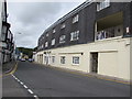
Regency Court, Tenby
by Jaggery geograph for square SN1300 Flats on the east side of the A478 Norton, viewed from the corner of St John's Hill.
|
|
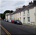
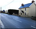
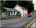
Norton Cottages, Tenby
by Jaggery geograph for square SN1300 Row of cottages on the east side of the A478 Norton.
Tags:
A478
road:A478
type:GeographX
top:Housing, DwellingsX
top:Roads, Road TransportX
Row of CottagesX
|
|
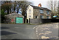
House at a bend in the A478, Begelly
by Jaggery geograph for square SN1107 On the corner of the A478 and Parsonage Lane.
|
|
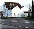
Main road houses in Clunderwen
by Jaggery geograph for square SN1218 Like many of the houses in the village, these are alongside the A478, the main... (more)
|
|
Along Narberth Road in New Hedges
by Jaggery geograph for square SN1202 A view NNE along the A478 Narberth Road in New Hedges,
a small village north... (more)
|
|
Down the A478 in Begelly, Pembrokeshire
by Jaggery geograph for square SN1107 Viewed from the corner of Parsonage Lane. Ahead for Kilgetty.
|
|
Brown sign 50 yards from Stone Pitt and Manian Lodge, Begelly
by Jaggery geograph for square SN1107 Facing northbound traffic on the A478 on the approach to Manian Lodge... (more)
Tags:
road:A478
Brown SignX
type:GeographX
top:Roads, Road TransportX
top:Village, Rural SettlementX
|

|
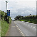
Start of the 30 zone at the northern edge of Begelly, Pembrokeshire
by Jaggery geograph for square SN1108 The 40mph speed limit on the A478 drops to 30mph. The sign shows that the... (more)
Tags:
road:A478
type:GeographX
top:Roads, Road TransportX
Start of the 30mph Speed LimitX
top:Village, Rural SettlementX
|
|
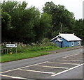
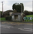
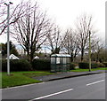
A478 bus stop and shelter, Pentlepoir
by Jaggery geograph for square SN1106 This stop near the Templebar Road junction is for buses to Tenby.
Tags:
road:A478
Bus Stop and ShelterX
type:GeographX
top:Roads, Road TransportX
top:Village, Rural SettlementX
|
|
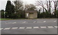
Bus stop and shelter opposite Hill Rise, Pentlepoir
by Jaggery geograph for square SN1206 This stop on the east side of the A478 is for buses to Tenby.
Tags:
road:A478
Bus Stop and ShelterX
type:GeographX
top:Roads, Road TransportX
top:Village, Rural SettlementX
|
|
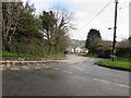
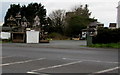
Eastern end of Templebar Road, Pentlepoir
by Jaggery geograph for square SN1106 Viewed across the A478.
Tags:
road:A478
type:GeographX
Road JunctionX
top:Roads, Road TransportX
top:Village, Rural SettlementX
|
|
Towards a bend in the A478, Tenby
by Jaggery geograph for square SN1301 From the corner of Gas Lane. The name sign on the left shows THE NORTON.
|
|
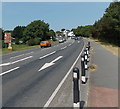
Reduce speed 140 yards ahead, Clunderwen
by Jaggery geograph for square SN1219 Advance warning that the National Speed Limit on the A478 drops to 30mph ahead.
|
|
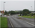
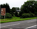
Road north from Clunderwen to Llandissilio
by Jaggery geograph for square SN1220 Looking north along the A478 towards Llandissilio. The southern edge of the... (more)
|
|
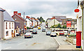
Clynderwen, 1993
by Ben Brooksbank geograph for square SN1219 View northward on the A478 (Tenby - Cardigan) road.
Tags:
road:A478
top:Business, Retail, ServicesX
ClynderwenX
top:Roads, Road TransportX
top:Village, Rural SettlementX
|
|
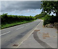
End of the 30 zone at the northern edge of Begelly, Pembrokeshire
by Jaggery geograph for square SN1108 The speed limit on the A478 increases to 40mph.
Tags:
road:A478
End of 30mphX
type:GeographX
top:Roads, Road TransportX
Speed Limit 40mphX
top:Village, Rural SettlementX
|
|
White houses in the north of Begelly, Pembrokeshire
by Jaggery geograph for square SN1108 On the east side of the A478 between Fir Grove and Broom Lane.
Tags:
road:A478
type:GeographX
top:Housing, DwellingsX
top:Roads, Road TransportX
top:Village, Rural SettlementX
White HousesX
|
|
Chestnut House, Pen-y-Bryn, Begelly
by Jaggery geograph for square SN1107 Viewed across the A478. Manion Lodge Link... (more)
Tags:
road:A478
type:GeographX
top:Housing, DwellingsX
top:Roads, Road TransportX
top:Village, Rural SettlementX
|
|
CCTV cameras near a bus shelter, Pentlepoir
by Jaggery geograph for square SN1206 Alongside the A478.
Tags:
road:A478
Bus ShelterX
CCTV CamerasX
type:GeographX
top:Roads, Road TransportX
top:Village, Rural SettlementX
|
|
Southern boundary of Pentlepoir, Pembrokeshire
by Jaggery geograph for square SN1105 The sign for the village of Pentlepoir is alongside the A478 facing the hamlet of Wooden.
Tags:
road:A478
top:Boundary, BarrierX
type:GeographX
top:Roads, Road TransportX
Village Boundary SignX
top:Village, Rural SettlementX
|
|
Entrance to Driftwood Timber Systems, Holborn Farm, Pentlepoir
by Jaggery geograph for square SN1105 On the west side of the A478.
Tags:
road:A478
top:Business, Retail, ServicesX
type:GeographX
top:Roads, Road TransportX
top:Village, Rural SettlementX
|
|
Zion House and Royal Mail van, Norton, Tenby
by Jaggery geograph for square SN1300 Viewed across the A478 Norton, near the Gas Lane junction.... (more)
Tags:
road:A478
top:CommunicationsX
type:GeographX
top:Housing, DwellingsX
top:Roads, Road TransportX
Royal Mail VanX
|
|
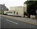
BT Telephone Exchange, Norton, Tenby
by Jaggery geograph for square SN1300 Viewed across the A478 Norton.
Tenby Exchange, code SWTB, serves about 3,240... (more)
|