
|
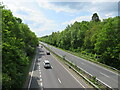
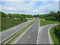
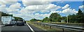
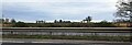
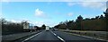
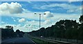
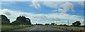
A5 westbound at the crossing of the River Tern
by Christopher Hilton
geograph for square SJ5711
|
|
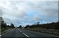
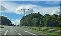
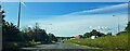
A3 near Liphook
by Malc McDonald
geograph for square SU8432
A view of the trunk A3 road near Liphook in Hampshire. The road is a dual carriageway.
|
|
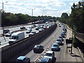
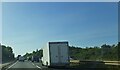
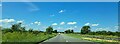
A3 and Tolworth Rise North, Old Malden
by Malc McDonald
geograph for square TQ2066
The A3 Kingston-by-Pass is flanked on both sides by minor roads for local... (more)
|
|
Dual carriageway section of Cardiff Road, Barry
by Jaggery
geograph for square ST1469
This is the SW side of a c200 metre long section of dual carriageway
on the... (more)
|
|
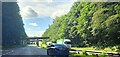
A14 traffic crawls under a bridge east of Beyton
by Christopher Hilton
geograph for square TL9463
At the time of this photograph, carriageway replacement works were taking place... (more)
|
|
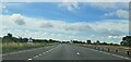
A14 eastbound, south of Swinford
by Christopher Hilton
geograph for square SP5778
The warning of pedestrians crossing in 400 yards signals the approach of a point... (more)
|
|
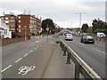
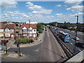
Woodford Avenue, near Gants Hill
by Malc McDonald
geograph for square TQ4288
The A1400 Woodford Avenue in north east London, looking towards Gants Hill. The... (more)
|
|
A14 traffic crawls south of Tostock
by Christopher Hilton
geograph for square TL9663
The lorry on the opposite carriageway is joining on the slip-road from Woolpit.... (more)
|
|
A1 southbound at the junction with New Close Lane
by Christopher Hilton
geograph for square SE5112
On the northbound carriageway, slow-moving traffic was entering a stretch of... (more)
|
|
A3 near Liphook
by Malc McDonald
geograph for square SU8432
A junction on the trunk A3 road near Liphook in Hampshire. Slip roads enable... (more)
|
|
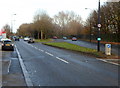
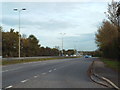
Saturday afternoon traffic on Western Avenue, Perivale
by Malc McDonald
geograph for square TQ1682
A view westwards over Western Avenue, in west London's suburbs. The road... (more)
|
|
A40 Western Avenue and slip-road, Perivale
by Malc McDonald
geograph for square TQ1682
Western Avenue is a busy trunk road in west London's suburbs, which forms... (more)
|
|
A1400 Woodford Avenue near Redbridge
by Malc McDonald
geograph for square TQ4289
The A1400 Woodford Avenue, photographed on a dull and very wet May evening... (more)
|
|
A14, approaching Junction 47A
by Christopher Hilton
geograph for square TL9862
At the time of this photograph, carriageway replacement works were taking place... (more)
|
|
Junction 47, A14
by Christopher Hilton
geograph for square TL9763
At the time of this photograph, carriageway replacement works were taking place... (more)
|
|
A14 approaching Junction 47
by Christopher Hilton
geograph for square TL9663
At the time of this photograph, carriageway replacement works were taking place... (more)
|
|
A14 approaching Junction 47
by Christopher Hilton
geograph for square TL9663
At the time of this photograph, carriageway replacement works were taking place... (more)
|
|
A14 traffic crawls under a bridge south of Tostock
by Christopher Hilton
geograph for square TL9562
At the time of this photograph, carriageway replacement works were taking place... (more)
|
|
Looking north on the A14 viaduct at Thrapston
by Christopher Hilton
geograph for square SP9977
Beyond the eastbound carriageway can be seen the disused railway viaduct that... (more)
|
|
A1 southbound, approaching Stretton
by Christopher Hilton
geograph for square SK9417
The two carriageways are widely separated here, and a linear nature reserve of... (more)
|
|
A1 southbound, approaching Stretton
by Christopher Hilton
geograph for square SK9417
The two carriageways are widely separated here, and a linear nature reserve of... (more)
|

|
A1 southbound, south of Darrington
by Christopher Hilton
geograph for square SE4819
Slow-moving traffic was entering a stretch of roadworks: repairs on the... (more)
|
|
Queuing traffic on the A1 at Darrington
by Christopher Hilton
geograph for square SE4820
Slow-moving traffic was entering a stretch of roadworks: repairs on the... (more)
|
|
A1 north of Darrington: looking west across the central reservation to the fields beyond
by Christopher Hilton
geograph for square SE4820
Taken from a stationary car at the start of a stretch of roadworks: repairs on... (more)
|
|
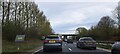
A1 northbound at Barnsdale Bar: approaching roadworks
by Christopher Hilton
for square SE5014
Ahead, at the Wentbridge viaduct, carriageway repairs meant that a contraflow... (more)
|
|
A1 northbound at Barnsdale Bar: approaching roadworks
by Christopher Hilton
geograph for square SE5014
Ahead, at the Wentbridge viaduct, carriageway repairs meant that a contraflow... (more)
|
|
A1 northbound: traffic queuing at the approach to Barnsdale Bar
by Christopher Hilton
geograph for square SE5113
Traffic was queuing on the approach to roadworks on the Wentbridge viaduct,... (more)
|
|
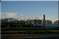
Petrol station on the A14 westbound, Newmarket
by Christopher Hilton
geograph for square TL6163
Taken from the corresponding petrol station on the eastbound carriageway.
|
|
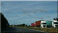
Lorry traffic on A14, north of Trimley St Martin
by Christopher Hilton
geograph for square TM2638
On the far carriageway some lorries are halted in a layby.
|
|
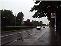
A127 Southend Arterial Road near Little Warley
by Malc McDonald
geograph for square TQ6088
A view of the westbound carriageway of the busy A127 road, near Little Warley in Essex.
|
|
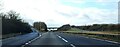
Looking south across the A14, south of Tostock
by Christopher Hilton
for square TL9562
|
|
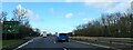
A14 westbound approaching Junction 12
by Christopher Hilton
geograph for square SP9877
|
|
A14 westbound approaching Thrapston
by Christopher Hilton
geograph for square TL0178
|
|
A14 westbound approaching Thrapston
by Christopher Hilton
geograph for square TL0177
|
|
A14 westbound approaching Thrapston
by Christopher Hilton
geograph for square TL0177
|
|
A14 westbound approaching Bythorn
by Christopher Hilton
geograph for square TL0675
|
|
A14 westbound, just west of junction 1
by Christopher Hilton
geograph for square SP6477
|
|
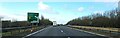
A14 westbound, south of Welford
by Christopher Hilton
geograph for square SP6377
On the side of the cutting, a fingerpost marks where a public footpath leaves... (more)
|
|
A14 descending Cot Hill
by Christopher Hilton
geograph for square SP6277
|

|
A1 southbound south of Colsterworth
by Christopher Hilton
geograph for square SK9322
|
|
A1 southbound, south of Colsterworth
by Christopher Hilton
geograph for square SK9322
|
|
A1 southbound, leaving Great Ponton
by Christopher Hilton
geograph for square SK9229
|
|
A1 southbound, Great Ponton
by Christopher Hilton
geograph for square SK9230
|
|
A1 southbound, dropping into Great Ponton
by Christopher Hilton
geograph for square SK9230
|
|
A1 southbound, approaching the turning to Little Ponton
by Christopher Hilton
geograph for square SK9231
|
|
A1 southbound: southern end of the Grantham bypass
by Christopher Hilton
geograph for square SK9132
|
|
A1 southbound at North Muskham
by Christopher Hilton
geograph for square SK7958
|
|
A1 southbound at North Muskham
by Christopher Hilton
geograph for square SK7958
|
|
A1 southbound approaching Scorcher Hills Lane
by Christopher Hilton
geograph for square SE5112
|
|
A1 northbound, Foston by-pass
by Christopher Hilton
geograph for square SK8542
The modern A1 here cuts a corner that saw the old Great North Road go through... (more)
|