Public Tags
Tag: Route
Other tags: subject:Route
Showing latest 50 of 586 images tagged with Route tag.
|
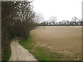
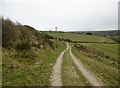
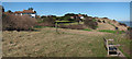
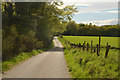
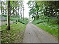
Pilgrims Way
by Oast House Archive geograph for square TQ8654 Category: Recreational Route A tractor is discing the field to the right.
|
|
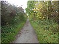
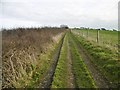
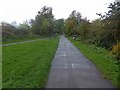
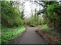
Only just in the square on the Harland Way cycle route
by Steve Fareham geograph for square SE3850 Tags:
subject:Cycle RouteX
Former Railway RouteX
Former Railway TrackX
route:Harland WayX
top:PathsX
ncn:Route 67X
top:Sport, LeisureX
SustransX
near:WetherbyX
|
|
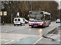
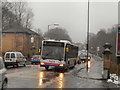
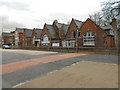
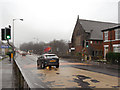
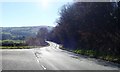
Manchester Road (A56)
by David Dixon geograph for square SD8008 A First Manchester Scania L94 (fleet number 80217) on Manchester Road, Bury,... (more)
|
|
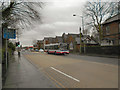
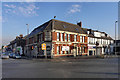
Manchester Road, Redvales
by David Dixon geograph for square SD8008 A 524 bus en-route for Bury, pulls up at the bus stop outside the Manchester... (more)
|
|
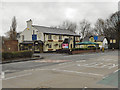
Blackford Bridge
by David Dixon geograph for square SD8007 A First Bus Mercedes Citaro, on route 137 from Manchester Shudehill to Bury,... (more)
Tags:
route:A56X
First BusX
MercedesX
top:Roads, Road TransportX
Single Decker BusX
top:Suburb, Urban FringeX
TrafficX
|
|
Rea valley Route
by Stephen Lowry geograph for square SP0479 Part of my commute to work in the West Heath area
Tags:
Bike RouteX
BirminghamX
top:City, Town CentreX
CommuteX
CopseX
Cycle RouteX
subject:Cycle RouteX
type:GeographX
NCNX
NCN 5X
NCN5X
ParkX
top:Park and Public GardensX
PathX
top:PathsX
Route
top:Sport, LeisureX
TreesX
|
|
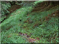
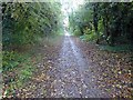
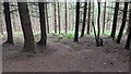
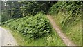
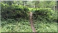
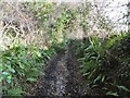
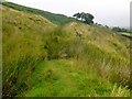
Right of Way route through the forest near Resourie bothy
by wrobison geograph for square NM8670 A very boggy and difficult to follow route. Some notes in the bothy give... (more)
|
|
Grassed over and gone
by Neil Owen geograph for square ST7059 This piece of landscape appears unremarkable enough but it was the scene of two... (more)
Tags:
top:CanalsX
Former CanalX
Former Railway RouteX
type:GeographX
top:Historic Sites and ArtefactsX
top:RailwaysX
subject:Route
top:Village, Rural SettlementX
|
|
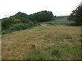
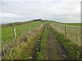
Corfe Castle, other route
by Mike Faherty geograph for square SY9782 Other route with public access, descending Rollington Hill towards Sandy Hill Lane.
Tags:
top:Farm, Fishery, Market GardeningX
type:GeographX
subject:HillX
top:LowlandsX
Other Route with Public AccessX
top:Roads, Road TransportX
subject:Route
|
|
Grange, other route
by Mike Faherty geograph for square SY9181 "Other route with public access" from SY9081 : Grange, red flag, along the ridge... (more)
Tags:
top:Farm, Fishery, Market GardeningX
type:GeographX
top:LowlandsX
Other Route with Public AccessX
top:Roads, Road TransportX
subject:Route
|
|
Grange, other route
by Mike Faherty geograph for square SY9081 "Other route with public access", from SY9081 : Grange, red flag along the ridge... (more)
Tags:
top:Farm, Fishery, Market GardeningX
type:GeographX
top:LowlandsX
Other Route with Public AccessX
top:Roads, Road TransportX
subject:Route
|
|
The end of Harland Way at Spofforth
by Steve Fareham geograph for square SE3650 Tags:
subject:Cycle RouteX
Former Railway RouteX
Former Railway TrackX
route:Harland WayX
top:PathsX
ncn:Route 67X
near:SpofforthX
top:Sport, LeisureX
SustransX
|
|
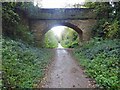
Bridge over former railway track to Spofforth
by Steve Fareham geograph for square SE3849 Tags:
subject:Cycle RouteX
Former Railway RouteX
Former Railway TrackX
route:Harland WayX
top:PathsX
top:RailwaysX
ncn:Route 67X
top:Sport, LeisureX
near:WetherbyX
|
|
Harland Way cycle route junction
by Steve Fareham geograph for square SE3949 Tags:
subject:Cycle RouteX
Former Railway RouteX
Former Railway TrackX
route:Harland WayX
top:PathsX
top:Sport, LeisureX
near:WetherbyX
|
|
Bridge ahead on The Harland Way
by Steve Fareham geograph for square SE3949 Harland Way was named after the late Peter Harland Wetherby Lion's President.
Tags:
subject:Cycle RouteX
Former Railway RouteX
Former Railway TrackX
route:Harland WayX
top:PathsX
ncn:Route 67X
top:Sport, LeisureX
near:WetherbyX
|
|
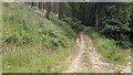
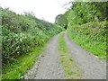
Route Of Former Railway
by Rude Health geograph for square SX5587 Looking down the route of the old railway that I used from Great Links Tor to... (more)
|
|
The former Wetherby South railway junction
by Christine Johnstone geograph for square SE3948 Once west for Harrogate, east for Church Fenton. Now part of the Harland Way... (more)
|
|
Manchester Road Community Centre, Redvales, Bury
by David Dixon geograph for square SD8008 |
|
Swan and Cemetery
by David Dixon geograph for square SD8008 The Swan and Cemetery restaurant and pub, on Manchester Road, at Redvales is... (more)
Tags:
route:A56X
BarX
top:Business, Retail, ServicesX
InnX
PubX
Public HouseX
RestaurantX
top:Suburb, Urban FringeX
|
|
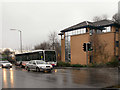
Blackford Bridge
by David Dixon geograph for square SD8007 The traffic lights at the junction of the A56, Manchester Road, with Hollins... (more)
|
|
Manchester Road (A56)
by David Dixon geograph for square SD8007 Looking along the A56, Manchester Road, from the pedestrian-controlled crossing,... (more)
|
|
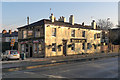
The Staff of Life
by David Dixon geograph for square SD8009 The Staff of Life public house on Manchester Road (A56), Bury.
|
|
Pack Horse Hotel
by David Dixon geograph for square SD8009 A large pub/hotel (currently closed) at the junction of Parkhills Road and... (more)
|
|
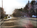
Dunham Road (A56)
by David Dixon geograph for square SJ7587 |
|
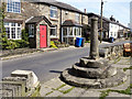
Affetside Cross, Watling Street
by David Dixon geograph for square SD7513 The cross at Affetside is a listed grade II structure, believed by many to be of... (more)
|
|
Anonymous bridge over the Harland Way
by Christine Johnstone geograph for square SE3948 The Leeds section of this cycle and footpath route [a former railway line] is... (more)
Tags:
BenchX
Cycle and FootpathX
Footpath CyclewayX
Former Railway RouteX
Former Railway Track BedX
route:Harland WayX
Litter BinX
top:PathsX
former:RailwayX
former:Railway LineX
top:RailwaysX
Road Bridge Over Dismantled RailwayX
Road Bridge Over Disused RailwayX
Road Bridge Over RailX
bridge:Road Over RailwayX
top:Roads, Road TransportX
Route of Former RailwayX
|
|
Route to Quarry Hill bridleway
by Christine Johnstone geograph for square SE4048 From the east side of the former railway triangle in Wetherby, now the Harland Way.
Tags:
path:BridlewayX
Bridleway SignX
Bridleway SignpostX
Cycle and FootpathX
Footpath CyclewayX
Former Railway RouteX
Former Railway Track BedX
route:Harland WayX
top:PathsX
sign:Public BridlewayX
former:RailwayX
former:Railway LineX
top:RailwaysX
top:Roads, Road TransportX
Route of Former RailwayX
|
|
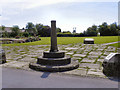
Affetside Cross and Millennium Green
by David Dixon geograph for square SD7513 A listed grade II structure, believed by many to be of Roman origin (possibly... (more)
|
|
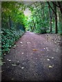
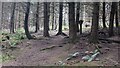
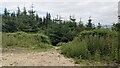
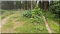
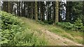
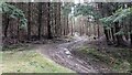
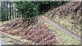
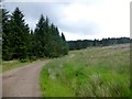
MTB route in the Mortimer Forest (Bringewood)
by Fabian Musto geograph for square SO4673 A number of MTB (mountain bike) routes passes through the Mortimer Forest, and... (more)
|
|
MTB route in the Mortimer Forest (Bringewood)
by Fabian Musto geograph for square SO4673 A number of MTB (mountain bike) routes passes through the Mortimer Forest, and... (more)
|
|
MTB route in the Mortimer Forest (Bringewood)
by Fabian Musto geograph for square SO4673 A number of MTB (mountain bike) routes passes through the Mortimer Forest, and... (more)
|
|
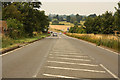
Watling Street
by Richard Croft geograph for square SP6458 Looking north crossing the A5 Watling Street at Stowehill
|
|
Saxon Shore Way
by Oast House Archive geograph for square TR3846 Category: Recreational Route On top of the White Cliffs towards Kingsdown.
|
|
MTB route in the Mortimer Forest (Bringewood)
by Fabian Musto geograph for square SO4573 A number of MTB (mountain bike) routes passes through the Mortimer Forest, and... (more)
|
|
MTB route in the Mortimer Forest (Bringewood)
by Fabian Musto geograph for square SO4673 A number of MTB (mountain bike) routes passes through the Mortimer Forest, and... (more)
|
|
MTB route in the Mortimer Forest (Bringewood)
by Fabian Musto geograph for square SO4673 A number of MTB (mountain bike) routes passes through the Mortimer Forest, and... (more)
|
|
MTB route in the Mortimer Forest (Bringewood)
by Fabian Musto geograph for square SO4673 A number of MTB (mountain bike) routes passes through the Mortimer Forest, and... (more)
|
|
MTB route in the Mortimer Forest (Bringewood)
by Fabian Musto geograph for square SO4673 A number of MTB (mountain bike) routes passes through the Mortimer Forest, and... (more)
|
|
MTB route in the Mortimer Forest (Bringewood)
by Fabian Musto geograph for square SO4673 A number of MTB (mountain bike) routes passes through the Mortimer Forest, and... (more)
|
|
MTB route in the Mortimer Forest (Bringewood)
by Fabian Musto geograph for square SO4673 A number of MTB (mountain bike) routes passes through the Mortimer Forest, and... (more)
|
|
The Deeside Way near Coalford, Aberdeenshire
by Andrew Tryon geograph for square NO8199 View facing west along part of the route of the Deeside Way long distance trail... (more)
Tags:
place:AberdeenshireX
Country TrailX
place:DeesideX
type:GeographX
top:Roads, Road TransportX
subject:Route
place:ScotlandX
|
|
The scenic route to Llanfair Talhaiarn
by Eirian Evans geograph for square SH9371 And ultimately to Llanrwst. One of the quietest of scenic routes.
|
|
Chideock, Pettycrate Lane
by Mike Faherty geograph for square SY4192 "Other route with public access", from Golden Cap to the village. For... (more)
|
|
Seatown, Langdon Lane
by Mike Faherty geograph for square SY4192 Other route with public access, from Sea Hill Lane to Langdon Woods; becoming... (more)
Tags:
type:GeographX
top:LowlandsX
Other Route with Public AccessX
top:Roads, Road TransportX
subject:Route
|
|
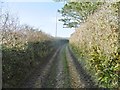
Morden, public route
by Mike Faherty geograph for square SY9095 From West Morden Farm to the main highway.
Tags:
top:Farm, Fishery, Market GardeningX
type:GeographX
top:LowlandsX
Public RouteX
top:Roads, Road TransportX
subject:Route
|
|
Morden, public route
by Mike Faherty geograph for square SY8995 From the bridleway to Winterborne Zelston to the main highway, passing West... (more)
Tags:
top:Farm, Fishery, Market GardeningX
type:GeographX
top:LowlandsX
Public RouteX
top:Roads, Road TransportX
subject:Route
|
|
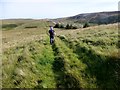
En Route To Ravens Knowe
by Rude Health geograph for square NT7607 We used a footpath that kept out of the forest aiming NE to join the Pennine Way... (more)
Tags:
Cheviot HillsX
Greyhound LawX
top:MoorlandX
top:PathsX
Ravens KnoweX
subject:Route
top:UplandsX
|
|
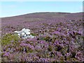
En Route To Foel-boeth
by Rude Health geograph for square SH8642 Deep purple heather to wade through en route to Foel-boeth.
|
|
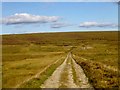
En Route To Innerdouny Hill
by Rude Health geograph for square NO0107 I used this forestry track from Littlerig to find a trouble free route to Innerdouny Hill.
Tags:
Forestry TrackX
Innerdouny HillX
place:LittlerigX
top:Roads, Road TransportX
subject:Route
top:UplandsX
top:Woodland, ForestX
|
|
En Route To Burn Fell
by Rude Health geograph for square SD6854 Climbing the hillside towards Burn End en route to Burn Fell trig point.
|