
|
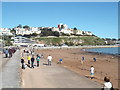
Babbacombe Road, Torquay
by Malc McDonald
geograph for square SX9265
Babbacombe Road in Torquay.
Although the sky is clear and blue, the road... (more)
|
|
Blue skies and fluffy clouds
by Scott Robinson
geograph for square SJ7349
Looking northwards towards the Wychwood Park housing development
|
|
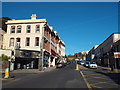
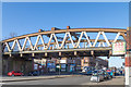
Torwood Street, Torquay
by Malc McDonald
geograph for square SX9263
A view looking up Torwood Street, near the centre of Torquay.
|
|
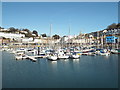
Old Harbour, Torquay
by Malc McDonald
geograph for square SX9163
Boats moored in the Old Harbour at Torquay, on a pleasant and sunny Good Friday afternoon.
|
|
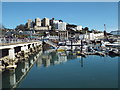
Torquay Harbour
by Malc McDonald
geograph for square SX9163
Reflections in the water at Torquay Harbour.
|
|
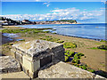
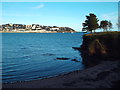
Torre Abbey Sands, Torquay
by Malc McDonald
geograph for square SX9163
A view of Torre Abbey Sands at Torquay. This image was taken on a pleasant,... (more)
|
|
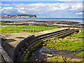
Rocks on the shore at Torquay
by Malc McDonald
geograph for square SX9063
Rocks exposed by the low tide, at Torquay.
|
|
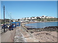
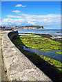
Waterfront at Torquay
by Malc McDonald
geograph for square SX9063
A view along the water's edge at Torquay, taken on a sunny Good Friday afternoon.
|
|
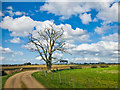
Blue skies above Cheshire
by Scott Robinson
geograph for square SJ7249
Looking south east over fields around Chorlton, Cheshire.
|
|
The rail bridge over Great Western Road at Anniesland in Glasgow's west end
by Garry Cornes
geograph for square NS5468
A west view along Great Western Road of the rail bridge at Anniesland. Just to... (more)
|
|
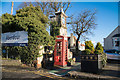
A red telephone box at the entrance to Aberdour Railway Station
by Garry Cornes
geograph for square NT1985
A traditional red telephone box at the entrance to Aberdour railway station in... (more)
|
|
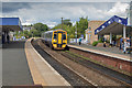
A Class 158 Diesel Multiple Unit Train at Kirkcaldy, Fife, Scotland
by Garry Cornes
geograph for square NT2791
A Class 158 Diesel Multiple Unit train pulling into Platform 1 of Kirkcaldy... (more)
|
|
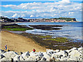
Reflective Skies
by Scott Robinson
geograph for square TA0487
The view south from the sea wall below Holbeck Gardens towards White Nab on a... (more)
|
|
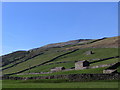
Stone Barn at Muker in Swaledale
by I Love Colour
geograph for square SD9097
Category: Barn
Stone barns in the fields to the west of the village of Muker in Swaledale. Dry... (more)
|
|
North Cliff Waymarker
by Scott Robinson
geograph for square TA2272
Waymarker on North Cliff, Flamborough. This footpath is part of the Headland Way.
|
|
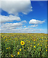
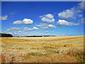
Sunflower Field
by Scott Robinson
geograph for square TA2272
A wider view of the previous shot of the field of Sunflowers above North Cliff,... (more)
|

|
Sunflower Surprise
by Scott Robinson
geograph for square TA2272
The field adjacent to the footpath was teeming with Sunflowers.
|
|
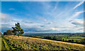
Sixpenny Hill Views
by Scott Robinson
geograph for square TA2271
The across farmland towards Sixpenny Hill, Flamborough.
|
|
Farm land views
by Scott Robinson
geograph for square TA2271
|
|
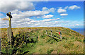
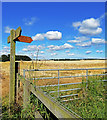
Footpath Waymarker
by Scott Robinson
geograph for square TA2271
Follow this footpath towards the Coastline for a great view north of Bempton Cliffs
|
|
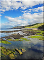
Glorious Views
by Scott Robinson
geograph for square TA0487
The view south across seaweed strewn rocks from the sea wall below Holbeck... (more)
|
|
Low Tide View
by Scott Robinson
geograph for square TA0487
The view south from the sea wall below Holbeck Gardens towards White Nab on a... (more)
|
|
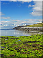
South Bay Sea Defences
by Scott Robinson
geograph for square TA0487
Sea defences in South Bay, Scarborough with views are across to the Harbour and Castle.
|
|
Sea Wall Views Across South Bay
by Scott Robinson
geograph for square TA0487
Views across to Scarborough headland from the sea wall adjacent to the Star Disk
|
|
Scarborough South Bay View
by Scott Robinson
geograph for square TA0487
The view across South Bay at low tide from the Star Disk below Holbeck Gardens
|
|
South Bay Low Tide
by Scott Robinson
geograph for square TA0487
Low tide in South Bay, Scarborough below Holbeck Gardens
|
|
South Bay Views
by Scott Robinson
geograph for square TA0487
The view across South Bay, Scarborough towards the Castle and Harbour.
|
|
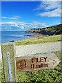
Waymarker Cleveland Way
by Scott Robinson
for square TA0487
8 miles to go until the end of the Cleveland Way. White Nab is in the background.
|
|
Cleveland Way Views
by Scott Robinson
for square TA0586
The view across Black Rocks at low tide to White Nab whilst on the Cleveland... (more)
|
|
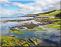
Black Rocks to White Nab
by Scott Robinson
for square TA0586
The view south across Black Rocks towards White Nab from the outcrop formed by... (more)
|
|
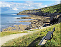
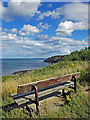
A bench with a view
by Scott Robinson
geograph for square TA0486
The view back towards White Nab
|
|
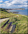
South Bay bench view
by Scott Robinson
geograph for square TA0486
|
|
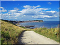
Scarborough South Bay View
by Scott Robinson
geograph for square TA0486
The view of Scarborough's South Bay heading down the slipway which was made... (more)
|
|
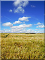
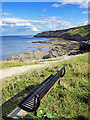
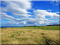
Fairway on South Cliff Golf Course
by Scott Robinson
geograph for square TA0586
|

|
Chichester Cathedral
by Peter Trimming
for square SU8504
I'm not a huge fan of wide angle/converging verticals shots. However, with... (more)
|
|
Caulkleys Bank View
by Scott Robinson
geograph for square SE6778
Far reaching views to the east from this prominent bank near Hovingham and Stonegrave.
|
|
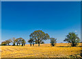
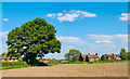
Large Oak Tree, Weston
by Scott Robinson
geograph for square SJ7352
Crossing a farmers field just outside Weston village.
|
|
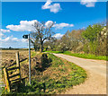
Waybutt Lane, Chorlton
by Scott Robinson
geograph for square SJ7349
Looking north along Waybutt lane, Chorlton. This lane runs alongside the... (more)
|
|
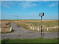
Beach Road, Cley-next-the-Sea
by Malc McDonald
geograph for square TG0444
Beach Road, leading off the A149 across Cley Marshes towards Cley Eye in north Norfolk.
|
|
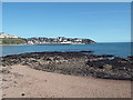
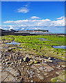
Corbyn's Beach and Corbyn's Head, Torquay
by Malc McDonald
geograph for square SX9063
Corbyn's Beach and Corbyn's Head in Torquay, photographed as the tide rises.
|
|
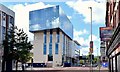
Block "B", University of Ulster site, Belfast - June 2015(2)
by Albert Bridge
geograph for square J3374
Block B seen from the northern end of the York Street/Frederick Street corner.... (more)
|

|
Block "B", University of Ulster site, Belfast - June 2015(1)
by Albert Bridge
geograph for square J3374
The mushroom of Block B rising above the trees beside the Dunbar Link.... (more)
|
|
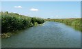
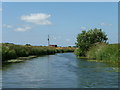
River Rother, East Sussex
by Christine Johnstone
geograph for square TQ7925
No longer the county boundary, unlike downstream of the confluence with the Kent... (more)
|
|
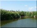
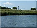
Nesting boxes along the River Rother
by Christine Johnstone
geograph for square TQ8025
Seen from a ferry travelling between Newenden and Bodiam, see... (more)
|
|
Pumping station, south bank of the River Rother
by Christine Johnstone
geograph for square TQ8025
Seen from a ferry travelling between Newenden and Bodiam, see... (more)
|
|
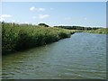
Confluence of the River Rother and the Kent Ditch
by Christine Johnstone
geograph for square TQ8025
Seen from a ferry travelling between Newenden and Bodiam, see... (more)
|
|
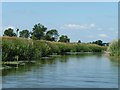
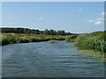
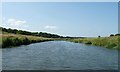
Looking upstream along the River Rother
by Christine Johnstone
geograph for square TQ8025
Seen from a ferry travelling between Newenden and Bodiam, see... (more)
|
|
Drain sluice / outlet, at 3 metre spot height
by Christine Johnstone
geograph for square TQ8025
On the south bank of the River Rother. Seen from a ferry travelling between... (more)
|
|
Nesting box, south bank of the River Rother
by Christine Johnstone
geograph for square TQ8126
Built for barn owls, but used by other species. Seen from a ferry travelling... (more)
|
|
River Rother, north of Dyneshill Wood
by Christine Johnstone
geograph for square TQ8126
Seen from a ferry travelling between Newenden and Bodiam, see... (more)
|