|
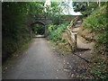
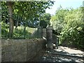
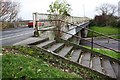
Forest Way, Forest Row
by Malc McDonald
geograph for square TQ4334
Forest Way, passing through Forest Row in East Sussex. The bridge was built to... (more)
|
|
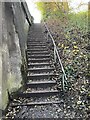
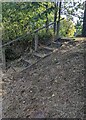
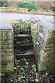
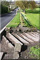
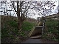
Steps up to road level from old railway line
by Jonathan Hutchins
geograph for square SJ8049
|
|
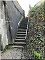
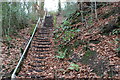
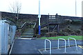
Steps up to road level from old railway line
by Jonathan Hutchins
geograph for square SJ8049
|
|
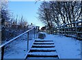
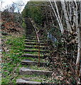
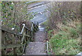
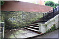
Steps up from Blackhill Park
by Robert Graham
geograph for square NZ1051
These steps on the northern side of the Blackhill and Consett Park lead up to... (more)
|
|
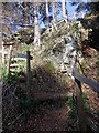
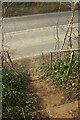
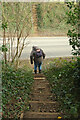
Steps up from a track, Ganarew, Herefordshire
by Jaggery
for square SO5316
Ascending from the far end of this Link... ( more) |
|
The 'One Hundred Steps' below Penmaen
by M J Roscoe
geograph for square ST1797
Flight of steps from the Sirhowy Valley Walk up to the B4251 through woodland,... (more)
|
|
Long flight of steps, Godreaman
by Jaggery
geograph for square SO0000
The steps ascend from a bank of the Aman River to Brynmair Road.
|
|
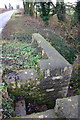
Bridge parapet on Bucknell Road near Hawkwell Farm
by Roger Templeman
for square SP5624
|
|
Steps in bridge up to Bucknell Road
by Roger Templeman
for square SP5624
|
|
Steps down to B4251, Penmaen
by M J Roscoe
geograph for square ST1797
The road at the bottom of the steps is on the widened track bed of the former... (more)
|
|
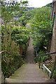
Steep Fields Steps, Hebden Bridge
by Christopher Hilton
geograph for square SD9927
Hebden Bridge spills down steep valley sides, with roads frequently contouring... (more)
|
|
Watch your steps!
by Stanley Howe
geograph for square NJ5600
From the foot of the Sloc O'Dess; to the public road should you make it.
|
|
Steps from Citadel Street East to Hoe Approach
by Christine Johnstone
geograph for square SX4754
On the northern boundary of Plymouth's Hoe. The lower street [Citadel... (more)
|
|
Steps from Pollard Lane into Bramley Fall Park
by Roger Templeman
geograph for square SE2436
|
|
Steps from woodland path up to Delph Lane
by Roger Templeman
geograph for square SE2935
|
|
D'Arcy Dalton Way at the A4300
by Derek Harper
for square SP3031
|
|
X marks the spot on Goldenacre Path
by Christine Johnstone
geograph for square NT2576
Tree marked for pruning along side the steps up to Ferry Road.
|
|
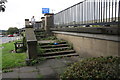
Station Steps to Main Road, New Cumnock
by Billy McCrorie
geograph for square NS6114
|
|
D'Arcy Dalton Way at the A4300
by Derek Harper
geograph for square SP3031
Footpath 329 7/30 crosses the main road, whereupon it becomes 329 7/40.
|
|
Steps down from Pelham Bridge
by Roger Templeman
geograph for square SK9770
|

|
Hebden Terrace, Midgehole Road
by Christopher Hilton
geograph for square SD9929
|
|
Bridge taking Eastern Way over Durranhill Road
by Luke Shaw
geograph for square NY4255
|
|
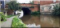
Grand Union Canal at Nottingham Road bridge (Bridge 38)
by Luke Shaw
geograph for square SK5420
|
|
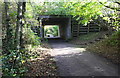
Trackbed of dismantled railway at Charity Lane bridge
by Roger Templeman
geograph for square NY0024
|