|
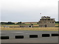
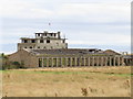
Control Tower, Crail Disused Airfield
by Andrew Curtis
geograph for square NO6209
The control tower (watch tower) for Crail Airfield is situated at the southern... (more)
|

|
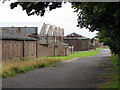
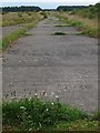
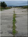
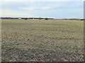
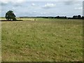
Former taxiway of Tibenham Airfield
by Geographer
geograph for square TM1489
Off Hill Road
|
|
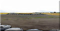
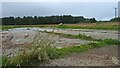
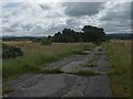
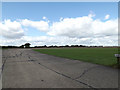
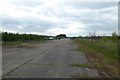
Runways, Crail Disused Airfield
by Andrew Curtis
geograph for square NO6209
|
|
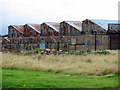
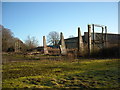
Northlight Hangar, Crail Airfield
by Andrew Curtis
geograph for square NO6209
|
|
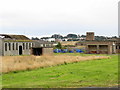
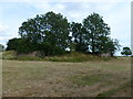
Crail Airfield
by Andrew Curtis
geograph for square NO6209
|
|
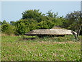
Crail Airfield
by Andrew Curtis
geograph for square NO6209
|
|
Northlight Hangar, Crail Airfield
by Andrew Curtis
geograph for square NO6209
Buildings at Risk Register: Link |
|
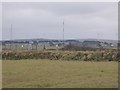
Control tower, RAF Dallachy, Moray
by Claire Pegrum
geograph for square NJ3663
From Link :... ( more) |
|
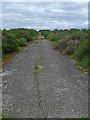
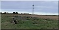
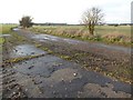
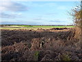
Reserve or standby runway at Langham airfield
by Richard Law
geograph for square TF9841
The main, most substantial runway appears to be a little way to the SE of this... (more)
|
|
Hardstanding, RAF Dallachy, Moray
by Claire Pegrum
geograph for square NJ3663
Originally there were 35 of these diamond shape hardstandings around the edge of... (more)
|
|
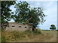
Defended fighter pen, King's Cliffe airfield
by Richard Humphrey
geograph for square TL0197
See Link and... ( more) |
|
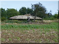
Mushroom pillbox on former airfield at King's Cliffe
by Richard Humphrey
geograph for square TL0297
See Link and... ( more) |
|
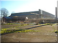
Former RAF Yatesbury air base
by Vieve Forward
for square SU0571
The former RAF Yatesbury West Camp air base seen from a distance (photograph... (more)
|
|
Wiltshire Microlight Centre, Yatesbury Field
by Vieve Forward
for square SU0670
The Wiltshire Microlight Centre, Yatesbury Field.... (more)
|
|
Airfield Buildings at Earls Colne Airfield
by Geographer
geograph for square TL8427
|
|
Looking towards Runway No.24 at Earls Colne Airfield
by Geographer
geograph for square TL8527
Off Earls Colne Airfield Road
|
|
Runway, RAF Dallachy, Moray
by Claire Pegrum
geograph for square NJ3662
|
|
Perimeter track, RAF Dallachy, Moray
by Claire Pegrum
geograph for square NJ3563
|
|
Runway, RAF Dallachy, Moray
by Claire Pegrum
geograph for square NJ3563
|
|
Perimeter track, RAF Dallachy, Moray
by Claire Pegrum
geograph for square NJ3562
|
|
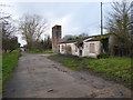
RAF Stanton Harcourt guard room/gatehouse and water tower
by Vieve Forward
geograph for square SP4105
Guard room/gatehouse and water tower of former RAF Stanton Harcourt airfield.... (more)
|
|
Defended fighter pen at RAF King's Cliffe
by Richard Humphrey
geograph for square TL0197
See Link and... ( more) |
|
Mushroom pillbox at RAF King's Cliffe
by Richard Humphrey
geograph for square TL0297
See Link and... ( more) |
|
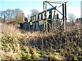
Hangar 45, former RAF Yatesbury air base
by Vieve Forward
geograph for square SU0571
|
|
Hangar at north east corner of former RAF Yatesbury air base
by Vieve Forward
geograph for square SU0571
North side of a Grade II* listed WW1/WW2 hangar at the former RAF Yatesbury West... (more)
|
|
Hangars at north east corner of former RAF Yatesbury air base
by Vieve Forward
geograph for square SU0571
In the foreground are the remains of south side of a Grade II* listed WW1/WW2... (more)
|
|
Seething Airfield
by Geographer
geograph for square TM3195
Off Toad Lane
|
|
Air Raid Shelter, RAF Fraserburgh, Aberdeenshire
by Claire Pegrum
geograph for square NK0264
|
|
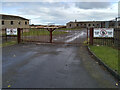
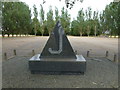
Entrance to former Crail Airfield
by Richard Sutcliffe
geograph for square NO6209
Crail Airfield is the best preserved example of a Second World War Naval... (more)
|
|
Elvington Airfield
by DS Pugh
geograph for square SE6547
Looking across the airfield from the end of a bridleway near Langwith House.
|
|
Runway No.24 at Earls Colne Airfield
by Geographer
geograph for square TL8427
|
|
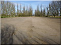
Entrance of Old Buckenham Airfield
by Geographer
geograph for square TM0793
Looking towards Abbey Road
|
|
Airfield Buildings at Earls Colne Airfield
by Geographer
geograph for square TL8427
|
|
The site of RAF Defford Airfield
by Philip Halling
geograph for square SO9043
The former RAF Defford Airfield which was constructed in 1941 and became... (more)
|
|
Perimeter road, Defford Airfield
by Philip Halling
geograph for square SO9043
Perimeter road around the eastern boundary of the former RAF Defford Airfield... (more)
|
|
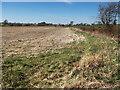
Remains of runway at Polebrook Airfield
by Richard Humphrey
geograph for square TL1086
See Link for more information and for an... ( more) |
|
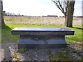
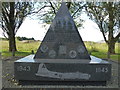
U.S.A.A.F. Memorial at R.A.F. Polebrook / USAAF Station 110 - Rear view - (Photo 7)
by Richard Humphrey
geograph for square TL1086
See Link for more information and for an... ( more) |
|
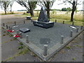
U.S.A.A.F. Memorial at R.A.F. Polebrook / USAAF Station 110 - (Photo 6)
by Richard Humphrey
geograph for square TL1086
See Link for more information and for an... ( more) |
|
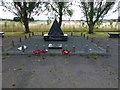
U.S.A.A.F. Memorial at R.A.F. Polebrook / USAAF Station 110 - (Photo 5)
by Richard Humphrey
geograph for square TL1086
See Link for more information and for an... ( more) |
|
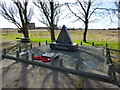
U.S.A.A.F. Memorial at R.A.F. Polebrook / USAAF Station 110 - (Photo 4)
by Richard Humphrey
geograph for square TL1086
See Link for more information and for an... ( more) |
|
U.S.A.A.F. Memorial at R.A.F. Polebrook / USAAF Station 110 - (Photo 3)
by Richard Humphrey
geograph for square TL1086
See Link for more information and for an... ( more) |
|
U.S.A.A.F. Memorial at R.A.F. Polebrook / USAAF Station 110 - (Photo 2)
by Richard Humphrey
for square TL1086
See Link for more information and for an... ( more) |
|
Defended fighter pen at King's Cliffe Airfield
by Richard Humphrey
geograph for square TL0197
See Link and... ( more) |
|
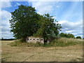
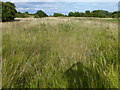
Overgrown former airfield at King's Cliffe
by Richard Humphrey
geograph for square TL0297
|
![SP2118 : Little Rissington Airfield [2] by Michael Dibb](https://s0.geograph.org.uk/geophotos/04/22/38/4223812_c00480be_120x120.jpg)
|
Little Rissington Airfield [2]
by Michael Dibb
geograph for square SP2118
A general view of the rather bleak airfield from the bridleway including a part... (more)
|
|
Airstrip near Couplaw Farm, Stonehouse
by wrobison
geograph for square NS7643
Marked on the OS map but there are no signs that it is used as such. It is... (more)
|
|
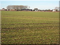
Flying from the airfield
by DS Pugh
geograph for square SE5742
Looking across part of the former airfield of RAF Acaster Malbis. Construction... (more)
|
|
Snitterfield Airfield
by Philip Halling
geograph for square SP1959
Snitterfield Airfield viewed from the south, today this is the home of Stratford... (more)
|
|
St Eval airfield radio transmitter station
by Philip Halling
geograph for square SW8668
St Eval airfield radio transmitter station. It is on the site of a former... (more)
|
|
Chetwynd Airfield helicopter training area
by Richard Law
geograph for square SJ7323
The former grass airstrip of Chetwynd Airfield, now used by the RAF as part of... (more)
|