Public Tags
Showing latest 50 of 171 images tagged with subject:Mill Pond tag.
|
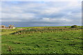
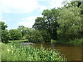
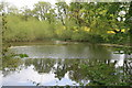
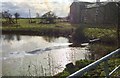
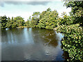
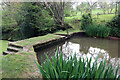
Mill pond at Chapel Mill, Mains of Usan, Angus
by Adrian Diack geograph for square NO7255 This photo shows the former mill pond at Chapel Mill close to what was the... (more)
Tags:
top:CoastalX
top:Derelict, DisusedX
type:GeographX
top:Lakes, Wetland, BogX
top:LowlandsX
subject:Mill Pond
Mill Pond at Chapel MillX
top:Rivers, Streams, DrainageX
|
|
Mill Pond
by valenta geograph for square NH6149 I can't find any definitive evidence that this was a mill pond, but local... (more)
Tags:
Former Mill PondX
type:GeographX
top:Lakes, Wetland, BogX
top:LowlandsX
former:Mill Pond
subject:Mill Pond
subject:PondX
top:Woodland, ForestX
|
|
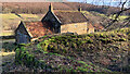
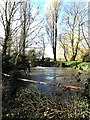
Mill pond dam wall for the former mill of Low Elm House
by Mick Garratt geograph for square SE6195 Tags:
top:Derelict, DisusedX
former:FarmX
type:GeographX
subject:Mill Pond
former:Mill Pond
top:Water ResourcesX
|
|
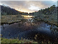
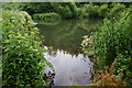
Westerly part of the mill pond at Chapel Mill, Usan, Angus
by Adrian Diack geograph for square NO7255 The former mill pond at Chapel Mill is in two parts or sections. This photo... (more)
Tags:
top:CoastalX
top:Derelict, DisusedX
type:GeographX
top:GrasslandX
top:LowlandsX
subject:Mill Pond
Mill Pond at Chapel MillX
top:Rivers, Streams, DrainageX
|
|
Bourne Mill
by PAUL FARMER geograph for square TM0023 Tags:
place:EssexX
EssexX
type:GeographX
top:Historic Sites and ArtefactsX
subject:MillX
Mill Pond
subject:Mill Pond
National TrustX
National Trust PropertyX
subject:PondX
former:Water-MillX
|
|
Mill Pond in Lumsdale
by Andy Stephenson geograph for square SK3160 One of the ponds providing power for the mills below.
The mills and the... (more)
Tags:
top:Energy InfrastructureX
Former Mill PondX
type:GeographX
top:Historic Sites and ArtefactsX
Industrial ArchaeologyX
Industrial Archaeology SiteX
LumsdaleX
near:MatlockX
Mill Pond
subject:Mill Pond
top:Water ResourcesX
|
|
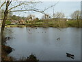
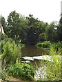
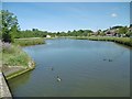
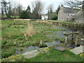
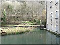
Pleasley Mill Pond
by Alan Walker geograph for square SK5064
This photograph is looking across the northern end of the Mill Pond. The pond... (more)
|
|
Langcliffe High Mill and its mill pond
by Christine Johnstone geograph for square SD8165 Langcliffe High Mill was built in 1783-4. When it opened it was entirely... (more)
Tags:
Cotton Spinning MillX
type:GeographX
top:IndustryX
subject:Mill Pond
former:MillpondX
Paper & Packaging SuppliersX
former:Paper MillX
|
|
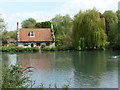
Mill Pond at Friday Street (1)
by David Hillas geograph for square TQ1245 This mill pond is at Friday Street RH5 6JR and used to power a hammer mill... (more)
Tags:
at:Friday StreetX
place:Friday StreetX
Friday StreetX
type:GeographX
Mill Pond
subject:Mill Pond
top:Village, Rural SettlementX
|
|
Bourne Pond
by PAUL FARMER geograph for square TM0023 Tags:
type:GeographX
top:Lakes, Wetland, BogX
subject:Mill Pond
former:Mill Pond
Mill Pond
Nature ReserveX
subject:Nature ReserveX
subject:PondX
top:Woodland, ForestX
|
|
Ebridge Mill seen across the restored mill pond
by Evelyn Simak geograph for square TG3129 Since 2000 the East Anglian Waterways Association has been holding work parties... (more)
|
|
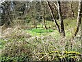
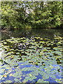
Dry mill pond
by Ian Calderwood geograph for square SK2069 Some mud-loving plants are growing in the bed of the former mill pond for Lumford Mill.
Tags:
Aquatic PlantsX
top:Derelict, DisusedX
type:GeographX
top:IndustryX
former:Mill Pond
subject:Mill Pond
|
|
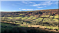
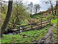
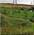
Elm Houses, Bransdale West side
by Mick Garratt for square SE6195 View across the dale to Elm Houses (centre).
Tags:
type:Cross GridX
top:Derelict, DisusedX
former:FarmX
subject:Mill Pond
former:Mill Pond
top:Water ResourcesX
|
|
Mill Pond at Friday Street (2)
by David Hillas geograph for square TQ1245 This photo shows the mill pond with Friday Street Road at the far end. A... (more)
Tags:
Friday StreetX
at:Friday StreetX
place:Friday StreetX
type:GeographX
subject:Mill Pond
Mill Pond
top:Village, Rural SettlementX
|
|
Old mill pond, Crawfordsburn (August 2017)
by Albert Bridge geograph for square J4681 Part of the old mill pond, now very shallow, in Crawfordsburn Glen. The... (more)
Tags:
CrawfordsburnX
top:Derelict, DisusedX
type:GeographX
subject:Mill Pond
former:MillpondX
top:Park and Public GardensX
|

|
Bourne Mill
by PAUL FARMER geograph for square TM0023 Tags:
county:EssexX
place:EssexX
type:GeographX
top:Historic Sites and ArtefactsX
subject:MillX
subject:Mill Pond
Mill Pond
top:Suburb, Urban FringeX
Water MillX
former:Water-MillX
|
|
Southern end, mill pond, Langcliffe High Mill
by Christine Johnstone geograph for square SD8165 Langcliffe High Mill was built in 1783-4. It was one of Yorkshires largest and... (more)
Tags:
Cotton Spinning MillX
type:GeographX
top:Lakes, Wetland, BogX
subject:Mill Pond
former:MillpondX
|
|
Northern end, mill pond, Langcliffe High Mill
by Christine Johnstone geograph for square SD8165 Langcliffe High Mill was built in 1783-4. It was one of Yorkshires largest and... (more)
Tags:
Cotton Spinning MillX
type:GeographX
top:Lakes, Wetland, BogX
subject:Mill Pond
former:MillpondX
|
|
Mill pond, Brake Mill, Stakenbridge
by Chris Allen geograph for square SO8979 Brake Mill is now a house and is hidden against the mill dam. It is easier and... (more)
Tags:
type:GeographX
subject:Mill Pond
top:Village, Rural SettlementX
top:Water ResourcesX
county:WorcestershireX
|
|
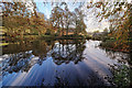
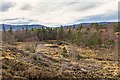
Mill Pond Glaic Na Ceardaich
by valenta geograph for square NH6134 The clear-felling of Clune Wood has opened up views over the Mill Pond compared... (more)
Tags:
wood:Clune WoodX
type:GeographX
area:Glaic Na CeardaichX
top:Historic Sites and ArtefactsX
top:Lakes, Wetland, BogX
former:Mill Pond
subject:Mill Pond
top:UplandsX
top:Woodland, ForestX
|
|
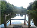
View across Old Mill Pond towards Kite Hill
by Paul Coueslant geograph for square SZ5491 A tidal mill in this location was first described in the foundation documents of... (more)
|
|
Mill pond, Newchurch Mill
by Chris Allen geograph for square SO3551 This is the surviving pond that fed the ruinous Newchurch Mill.
Tags:
top:Derelict, DisusedX
top:Historic Sites and ArtefactsX
subject:Mill Pond
top:Water ResourcesX
|
|
Mill Pond at Flatford Mill
by Geographer geograph for square TM0733 Near Willy Lott's house
Tags:
at:FlatfordX
at:Flatford MillX
top:Lakes, Wetland, BogX
Mill Pond
subject:Mill Pond
Willy Lotts HouseX
|
|
Mill Pond at Ellingham Mill
by Geographer geograph for square TM3691 Off Mill Pool Lane
Tags:
at:EllinghamX
at:Ellingham MillX
subject:Mill Pond
Mill Pond
off:Mill Pool LaneX
top:Rivers, Streams, DrainageX
|
|
Old mill pond above Dane's Mill
by Ian Calderwood geograph for square SK0161 Now completely silted-up.
|
|
Old mill dam
by Leanmeanmo geograph for square NU1327 It's marked as a mill dam on old maps. The mill pond looks to be fed quite... (more)
Tags:
type:GeographX
top:Geological InterestX
top:GrasslandX
top:Lakes, Wetland, BogX
top:LowlandsX
Mill Pond
subject:Mill Pond
top:Rivers, Streams, DrainageX
top:Water ResourcesX
WellX
|
|
Hermitage, mill pond
by Mike Faherty geograph for square SU7505 The northern section of Slipper Millpond, once serving a mill to the South.... (more)
Tags:
top:Estuary, MarineX
type:GeographX
subject:LagoonX
top:Lakes, Wetland, BogX
top:LowlandsX
subject:Mill Pond
subject:PondX
top:Village, Rural SettlementX
|
|
Rivelin Valley Trail, Rivelin Valley, Sheffield
by David Hallam-Jones geograph for square SK3187 The Nether Cut Wheel mill-pond outlet. The River Rivelin was dammed here to... (more)
Tags:
type:GeographX
top:Historic Sites and ArtefactsX
subject:Mill Pond
Nether Cut WheelX
top:Rivers, Streams, DrainageX
top:Sport, LeisureX
top:Suburb, Urban FringeX
|
|
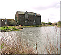
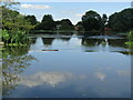
Mill Pond, Forge Mill
by David P Howard geograph for square SP0468 Looking north across the mill pond at Forge Mill from the footpath on the south side.
Tags:
top:Historic Sites and ArtefactsX
top:Lakes, Wetland, BogX
subject:Mill Pond
top:Water ResourcesX
|
|
Former mill pond at New Bridge, Meltham
by Humphrey Bolton geograph for square SE0810 This supplied water for New Bridge Mill (Woollen) in 1850. The mill seems to... (more)
|
|
Out of use mill pond, New Abbey
by Christine Johnstone geograph for square NX9666 The stain on the walls show that this pond is at least a foot below its normal... (more)
Tags:
top:Energy InfrastructureX
type:GeographX
top:Historic Sites and ArtefactsX
subject:Mill Pond
place:New AbbeyX
Overgrown PondX
Water PowerX
|

|
Mill Pond
by valenta geograph for square NH6134 Mill pond, recorded on the 1st edition OS 6-inch map of 1875. The pond is silted... (more)
Tags:
top:Derelict, DisusedX
top:Historic Sites and ArtefactsX
top:Lakes, Wetland, BogX
subject:Mill Pond
top:UplandsX
top:Woodland, ForestX
|
|
Header pond for the Corn Mill
by jeff collins geograph for square SX8362 This pond now a haven for wildfowl of many kinds, was constructed to provide the... (more)
|
|
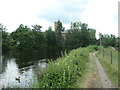
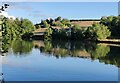
Addlestone - Coxes Mill Pond
by Colin Smith geograph for square TQ0664 On the River Wey Navigation immediately upstream of Coxes Lock and Coxes Mill.... (more)
Tags:
place:AddlestoneX
top:CanalsX
Coxes MillX
type:GeographX
top:Historic Sites and ArtefactsX
top:Lakes, Wetland, BogX
subject:Mill Pond
River Wey NavigationX
top:Rivers, Streams, DrainageX
|
|
Olchon House Mill - mill pond and dam
by Chris Allen geograph for square SO3029 Seen on a Mills Open weekend event. This was an excellent event and it was so... (more)
Tags:
type:GeographX
top:Historic Sites and ArtefactsX
Mill DamX
subject:Mill Pond
place:Olchon ValleyX
top:Water ResourcesX
WatermillX
|
![SX8963 : Cockington buildings [27] by Michael Dibb](https://s0.geograph.org.uk/geophotos/06/18/86/6188640_f383c5b6_120x120.jpg)
|
Cockington buildings [27]
by Michael Dibb geograph for square SX8963 The Mill, a former water mill, now in use as a cafeteria, is seen at the end of... (more)
Tags:
top:Business, Retail, ServicesX
type:GeographX
top:LowlandsX
subject:Mill Pond
top:Village, Rural SettlementX
|
|
Mill pond sluices, Belvedere Mill, Chalford
by Christine Johnstone geograph for square SO8902 The millpond is fed by the River Frome. The former textile mill is listed Grade... (more)
|
|
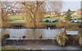
Mill Pond, Church Warsop, Notts.
by David Hallam-Jones geograph for square SK5668 The mill pond, created using the River Meden, the weir and the perished sluice... (more)
Tags:
top:GrasslandX
top:Historic Sites and ArtefactsX
top:LowlandsX
subject:Mill Pond
top:Rivers, Streams, DrainageX
top:Sport, LeisureX
top:Village, Rural SettlementX
|
|
Willy Lotts House & Mill Pond at Flatford Mill
by Geographer geograph for square TM0733 The farmhouse was originally named Gibbonsgate Farm after the adjacent field but... (more)
Tags:
at:FlatfordX
at:Flatford MillX
Flatford RoadX
formerly:Gibbonsgate FarmX
top:Lakes, Wetland, BogX
subject:Mill Pond
Willy Lotts HouseX
|
|
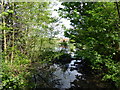
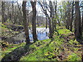
Mill pond on the Udale Burn
by Julian Paren geograph for square NH7164 This pond was created to serve a mill lower down the Udale Burn.
|
|
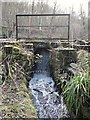
Outflow of the Udale mill pond
by Julian Paren geograph for square NH7164 There is much evidence on the ground that the pond served a mill lower down the... (more)
Tags:
type:GeographX
top:IndustryX
top:Lakes, Wetland, BogX
subject:Mill Pond
top:Rivers, Streams, DrainageX
top:Water ResourcesX
|
|
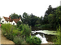
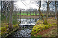
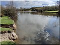
West-northwest view across the mill pond at Bateman's, East Sussex
by Adrian Diack geograph for square TQ6723 This photo shows the view in a west-northwest direction across the mill pond at... (more)
Tags:
top:Country EstatesX
type:GeographX
top:Lakes, Wetland, BogX
subject:Mill Pond
top:Village, Rural SettlementX
top:Woodland, ForestX
|
|
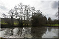
Northwest view of the mill pond at Bateman's, Burwash, East Sussex
by Adrian Diack geograph for square TQ6723 Bateman's and Park Mill are owned by the National Trust. The mill was a... (more)
Tags:
place:BatemansX
top:Country EstatesX
type:GeographX
top:Lakes, Wetland, BogX
subject:Mill Pond
top:Village, Rural SettlementX
top:Water ResourcesX
top:Woodland, ForestX
|
|
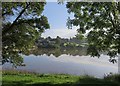
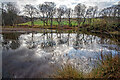
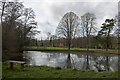
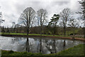
Mill pond at Bateman's, Burwash, East Sussex
by Adrian Diack geograph for square TQ6723 A view of the mill pond at Bateman's with reflections of trees bordering... (more)
Tags:
top:Country EstatesX
type:GeographX
top:Lakes, Wetland, BogX
subject:Mill Pond
top:Village, Rural SettlementX
top:Water ResourcesX
top:Woodland, ForestX
|
|
Mill pond at Golden Valley
by Mat Fascione geograph for square SO7737 |
|
Mill pond at Golden Valley
by Mat Fascione geograph for square SO7737 |
|
Former Wellfield Mill Pond
by Kevin Waterhouse geograph for square SD9517 Mill pond is heavily silted
|

|
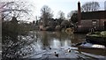
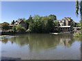
Social distancing near The Mill Pond in Cambridge
by Richard Humphrey geograph for square TL4457 On the day this photo was taken people were only allowed to meet one other... (more)
|
|
The Mill Pond in Cambridge and not a punt in sight
by Richard Humphrey geograph for square TL4457 The Government lockdown measures introduced during the Coronavirus Covid-19... (more)
|
|
Mill pond, Waternish Farm
by Richard Dorrell geograph for square NG2657 Water from the pond still runs through the mill race and over a water wheel, but... (more)
Tags:
top:Energy InfrastructureX
type:GeographX
top:Lakes, Wetland, BogX
subject:Mill Pond
top:Water ResourcesX
|