Public Tags
Tag: Waterlogged·Ground
Showing latest 50 of 87 images tagged with Waterlogged Ground tag.
|
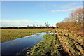
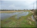
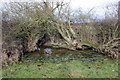
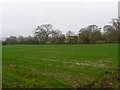
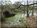
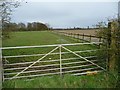
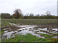
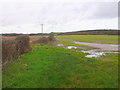
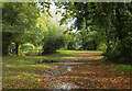
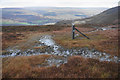
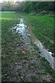
Footpath to Holt
by Jeff Buck geograph for square SJ4152 Waterlogged ground near the River Dee south of Holt.
Tags:
top:Farm, Fishery, Market GardeningX
place:HoltX
PathX
subject:PathX
top:Rivers, Streams, DrainageX
country:WalesX
Waterlogged FarmlandX
Waterlogged Ground
Waterlogged LandX
county:WrexhamX
|
|
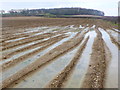
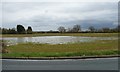
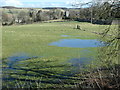
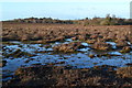
Waterlogged Fields at Cook's Lane Wood
by Nigel Mykura geograph for square ST7315 These large water filled tractor ruts are in a low-lying field adjacent to a... (more)
|

|
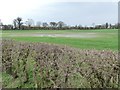
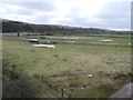
Waterlogged Field near Hazelbury Bryan
by Nigel Mykura geograph for square ST7609 the recent prolonged lane has resulted in waterlogged fields even like this one... (more)
|
|
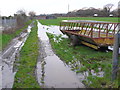
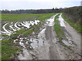
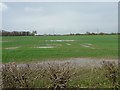
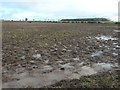
Waterlogged track, near Lower Kingswood
by Malc McDonald geograph for square TQ2453 A waterlogged track, with the village of Lower Kingswood visible in the... (more)
Tags:
subject:BridlewayX
rights of way:BridlewayX
BridlewayX
top:Flat LandscapesX
type:GeographX
near:KingswoodX
near:Lower KingswoodX
top:PathsX
Public BridlewayX
near:ReigateX
county:SurreyX
near:TadworthX
subject:TrackX
WaterloggedX
Waterlogged Ground
Waterlogged LandX
Waterlogged PathX
|
|
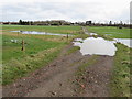
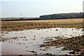
Waterlogged Field near Botany Bay Farm
by Nigel Mykura geograph for square SY8896 The lower portion of this wheat field had been saturated with ground water lying... (more)
|
|
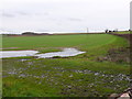
Waterlogged Field
by Nigel Mykura geograph for square SY8786 This waterlogged field is sandwiched in between the Dorchester to Wareham... (more)
|
|
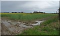
Waterlogged farmland near Poulton
by Jeff Buck geograph for square SJ3959 Waterlogged land at Poulton Hall Farm.
Tags:
county:CheshireX
country:EnglandX
FarmX
top:Farm, Fishery, Market GardeningX
FarmlandX
place:PoultonX
Waterlogged FarmlandX
Waterlogged FieldX
Waterlogged Ground
|
|
Waterlogged ground near Asda, Caerphilly
by Jaggery geograph for square ST1588 A small pond has formed near the path from Lewis Drive to Asda... (more)
|
|
Muddy Track to Waterley Wood
by Nigel Mykura geograph for square SY8895 Both the track and the adjacent field were much churned up by farm vehicles... (more)
|
|
Waterlogged field, north side of Corban Lane
by Christine Johnstone geograph for square SE5659 Rising from 15 to 16 metres above sea level.
Tags:
top:Farm, Fishery, Market GardeningX
subject:FarmlandX
Groundwater FloodingX
taken from:The Field EntranceX
Waterlogged FarmlandX
Waterlogged FieldX
Waterlogged Ground
|
|
Waterlogged field, north-east of Shipton
by Christine Johnstone geograph for square SE5559 After a very wet winter and some rainy days.
|
|
Waterlogged field, east of Belmont
by Christine Johnstone geograph for square SE5460 After a very wet winter and a few rainy days.
|
|
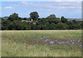
Waterlogged farmland, north of Shipton Grange
by Christine Johnstone geograph for square SE5460 On the north side of Chapman's Lane. After a very wet winter and some rainy days.
|
|
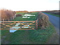
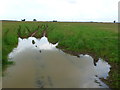
Waterlogged corner of a field
by Jeff Buck geograph for square SJ4152 The waterlogged corner of a field near Holt. The reflection of an old gate in... (more)
Tags:
top:Farm, Fishery, Market GardeningX
place:HoltX
country:WalesX
WaterloggedX
Waterlogged Ground
county:WrexhamX
|
|
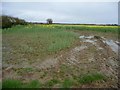
Path to the River Dee
by Jeff Buck geograph for square SJ4152 Waterlogged path near the River Dee to the south of Holt.
Tags:
place:HoltX
PathX
subject:PathX
top:Rivers, Streams, DrainageX
country:WalesX
Waterlogged FarmlandX
Waterlogged Ground
Waterlogged LandX
county:WrexhamX
|
|
Horse Paddocks at Baylea Farm
by Nigel Mykura geograph for square SY8685 AS with much of the heathland at present this paddock was waterlogged due to... (more)
|
|
Fields at Lower Woodbury
by Nigel Mykura geograph for square SY8693 View south east across waterlogged fields towards the northern edge of Wareham Forest.
|
|
Oke Apple House
by Nigel Mykura geograph for square ST7910 This large house stands on its own in landscaped gardens including a decorative... (more)
|
|
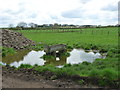
Trough on waterlogged ground, north of Murton
by Christine Johnstone geograph for square SE6552 Presumably the flooded ground has been trodden down by cattle.
|
|
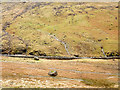
Waterlogged ground of field above Linburn Beck
by Trevor Littlewood geograph for square NZ1329 Following a lengthy cool spell with high rainfall, even in late July the ground... (more)
|
|
Two large boulders on waterlogged ground
by Trevor Littlewood geograph for square NY2009 Lingmell Beck flows beyond the dry stone wall. The ground with the boulders is... (more)
Tags:
subject:BoulderX
BouldersX
top:Boundary, BarrierX
type:GeographX
top:Rivers, Streams, DrainageX
top:Rocks, Scree, CliffsX
StreamsX
top:UplandsX
Waterlogged Ground
|
|
Waterlogged land and fallen tree near Holly Farm
by Christine Johnstone geograph for square SJ9486 The dark shape is the exposed root plate of the fallen tree. The flooded land is... (more)
Tags:
Fallen TreeX
type:GeographX
top:LowlandsX
tree:RootplateX
Waterlogged Ground
Waterlogged LandX
|
|
Waterlogged land just below the summit of Crosset Hill
by Christine Johnstone geograph for square NY9922 On the western edge of Romaldkirk, after weeks of rain.
Tags:
top:Farm, Fishery, Market GardeningX
subject:FieldX
type:GeographX
place:RomaldkirkX
Village EdgeX
Waterlogged FieldX
Waterlogged Ground
|
|
Waterlogged land near Bellister Haugh
by Christine Johnstone geograph for square NY7063 On the south bank of the River South Tyne. Ten days after Storm Ciara and two... (more)
|
|
Waterlogged cattle pasture, east of Cowcorse
by Christine Johnstone geograph for square NX9556 On the horizon is Torrorie Young Wood.
Tags:
Cattle PastureX
top:Farm, Fishery, Market GardeningX
subject:FarmlandX
type:GeographX
Waterlogged Ground
Waterlogged PastureX
|
|
Waterlogged farmland near Newtown Bridge
by Christine Johnstone geograph for square SO8785 On the south bank of the Stourbridge Canal.
Tags:
Canal BankX
top:Farm, Fishery, Market GardeningX
subject:FarmlandX
type:GeographX
Waterlogged FarmlandX
Waterlogged Ground
|
|
Partially flooded stubble field, north of Corban Lane
by Christine Johnstone geograph for square SE5659 After a very wet winter and a few days of rain.
|
|
Partially flooded field, west of North Hall Moor
by Christine Johnstone geograph for square SE5659 After a very wet winter and a few rainy days.
|
|
Trees along a field boundary, north of Ember Hill farm
by Christine Johnstone geograph for square SE5261 Much of the land is waterlogged after a very wet winter and a few rainy days.
|
|
Fields south-east of Fir Tree and Beechwood Farms
by Christine Johnstone geograph for square SE5261 Waterlogged after a very wet winter and a few rainy days.
Tags:
top:Farm, Fishery, Market GardeningX
subject:FarmlandX
at:The Field EntranceX
Waterlogged FieldX
Waterlogged Ground
|
|
Waterlogged grassland
by Alan Hunt geograph for square TQ0350 The rains may have stopped but the low lying fields are still waterlogged, here... (more)
|
|
Boggy Fields at West Moors
by Nigel Mykura geograph for square SU0702 West Moors and Ferndown are separated by the Uddens Water, the A31 Ferndown... (more)
|
|
Field gate near Bindon Abbey
by Nigel Mykura geograph for square SY8586 This brand new gate had been installed at the very wet entrance to a pasture... (more)
|
|
Living up to its Name
by Nigel Mykura geograph for square SP2278 This field is on Bradnock's Marsh Lane between Bradnock's Marsh and... (more)
|
|
Waterlogged Field
by Nigel Mykura geograph for square SP0709 The heavy rain of recent months had resulted in waterlogged fields and large... (more)
|
|
North-west boundary, field of oil seed rape
by Christine Johnstone geograph for square SE5262 On the north-east side of High Moor Lane. Going yellow earlier this year it... (more)
Tags:
top:Farm, Fishery, Market GardeningX
subject:FarmlandX
crop:Oil Seed RapeX
crop:Oilseed RapeX
taken from:The Field EntranceX
Waterlogged FarmlandX
Waterlogged FieldX
Waterlogged Ground
|
|
Entrance to a field of oilseed rape, High Moor Lane
by Christine Johnstone geograph for square SE5262 Looking south-east towards the distant Beechwood Farm.
Tags:
top:Farm, Fishery, Market GardeningX
subject:FieldX
crop:Oil Seed RapeX
crop:Oilseed RapeX
taken from:The Field EntranceX
Waterlogged FarmlandX
Waterlogged FieldX
Waterlogged Ground
|
|
Fields at Lower Woodbury
by Nigel Mykura geograph for square SY8693 These wheat fields were still waterlogged from the heavy rain of recent months.... (more)
|
|
Oak Coppice, Bere Woods
by Nigel Mykura geograph for square SY8694 Bere Woods lies mainly to the east of Woodbury Hill an ancient iron age hill... (more)
|
|
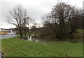
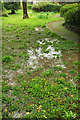
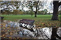
Waterlogged ground
by Stephen Craven geograph for square TQ4375 Looking away from the Long Pond in Eltham Park North.
|
|
Bridleway near Ratten Row
by Adrian Taylor geograph for square NY3139 This is the public bridleway from Caldbeck to Brownrigg. The gate on the left... (more)
|
|
Overflow car park, Maidencombe
by Derek Harper geograph for square SX9268 Overflowing with water at this end, with waterlogged ground.
Tags:
top:CoastalX
type:GeographX
top:GrasslandX
top:Lakes, Wetland, BogX
Overflow Car ParkX
top:Roads, Road TransportX
gate:TimberX
TreesX
Waterlogged Ground
|
|
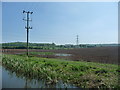
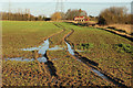
Waterlogged field near to Low Thornley
by Trevor Littlewood geograph for square NZ1760 The buildings at Low Thornley can be seen through trees. Ahead, beyond the... (more)
Tags:
Electricity PylonX
top:Energy InfrastructureX
top:Farm, Fishery, Market GardeningX
subject:FieldX
FieldX
type:GeographX
Tractor Wheel RutsX
Waterlogged Ground
top:Woodland, ForestX
|
|
Waterlogged ground south of Fair Oak Road
by David Martin geograph for square SU4618 |
|
Waterlogged ground, Tessier Gardens
by Derek Harper for square SX9265 Another reminder of how wet it has been this spring. "Devon had its fourth... (more)
Tags:
top:Air, Sky, WeatherX
type:Close LookX
plants:Lesser CelandineX
ParkX
top:Park and Public GardensX
PathX
top:PathsX
Trees and BushesX
Waterlogged Ground
|
|
Line of grouse butts above Clough Edge
by Bill Boaden geograph for square SK0696 This demonstrates the waterlogged state of the ground. The valley beyond is Longdendale.
|
|
Waterlogged ground on Matley Heath
by David Martin geograph for square SU3308 Tags:
top:Heath, ScrubX
subject:HeathlandX
top:Lakes, Wetland, BogX
New Forest National ParkX
Waterlogged Ground
|
|
After the Rain, Clapham Common
by Des Blenkinsopp geograph for square TQ2874 A lot of rain overnight has left the Common a bit waterlogged in places.
|
|
Langford Lowfields
by Richard Croft geograph for square SK8260 Waterlogged tractor wheel ruts by the footpath at Langford Lowfields
|
|
Waterlogged field by the Lemon
by Derek Harper geograph for square SX8470 Well, it is a flood plain, and there has been a lot of rain recently. There is... (more)
Tags:
Flood PlainX
type:GeographX
GrasslandX
top:GrasslandX
top:Lakes, Wetland, BogX
top:LowlandsX
National Trust LandX
top:PathsX
Waterlogged Ground
top:Woodland, ForestX
WoodsX
|