Public Rights of Way in Bournemouth
![Creative Commons Licence [Some Rights Reserved]](https://s1.geograph.org.uk/img/somerights20.gif)
Great Britain 1:50 000 Scale Colour Raster Mapping Extracts © Crown copyright Ordnance Survey. All Rights Reserved. Educational licence 100045616.
Contents
- INTRODUCTION
- Nature of the rights of way
- Research
- Numbering
- Notes on the maps used
- The smartphone experiment
- THE RIGHTS OF WAY
- 'A' series (Westbourne and Talbot Woods wards)
- 'B' series (West Cliff ward)
- 'C' series (Central ward)
- 'D' series (East Cliff ward)
- 'E' series (Kinson ward) - E01 to E20
- 'E' series - E21 to E40
- 'E' series - E41 to E56
- 'F' series (Boscombe West ward)
- 'G' series (Boscombe East ward)
- 'H' series (West Southbourne ward)
- 'I' series (Southbourne ward) - I01 to I11
- 'I' series - I12 to I20
- 'I' series - I21 to I33
- 'J' series (Littledown ward)
- 'K' series (Strouden Park ward) - K01 to K17
- 'K' series - K18 to K26
- 'K' series - K27 to K35
- 'K' series - K36 to K50
- 'L' series (Moordown ward)
- 'M' series (Muscliff ward) - M01 to M14
- 'M' series - M15 to M18
- 'N' series (Winton ward) - N01 to N08
- 'N' series - N09 to N16
- 'N' series - N17 to N42
- 'O' series (Ensbury Park and Redhill Park wards)
- 'U' series (Wallisdown ward) - U01 to U18
- 'U' series - U20 to U43
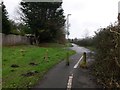
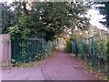
'K' series - K36 to K50
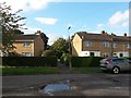
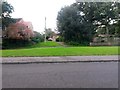
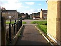
Number: K36
Designation: Public footpath
Length: 24m
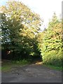
Route: Ibbertson Way [SZ 1191 9466] to open space [SZ 1189 9468]
Map:
Commentary: Short paved path between houses, to public open space within the estate.
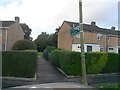
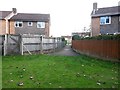
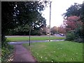
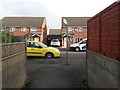
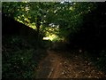
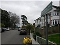
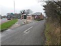
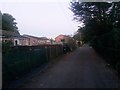
Number: K37
Designation: Public footpath
Length: 40m
Route: Ibbertson Way [SZ 1189 9464] to Barrow Drive [SZ 1186 9465]
Map:
Commentary: Short path linking these two nearby dead ends.
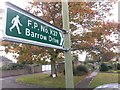
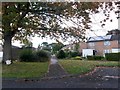
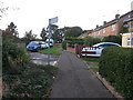
Seen in the distance here, from Barrow Drive:
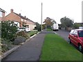
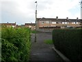
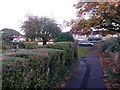
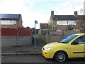
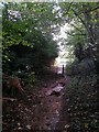
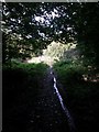
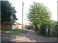
Number: K38
Designation: Public footpath
Length: 23m
Route: Woodbury Avenue [SZ 1181 9480] to Barrow Way [SZ 1181 9478]
Map:
Commentary: Short, steepish path between the two roads.
 (background)
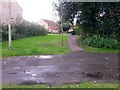
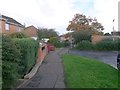
Number: K39
Designation: Public footpath
Length: 26m
Route: Ibbertson Road [SZ 1196 9463] to Ibbertson Close [SZ 1198 9462]
Map:
Commentary: Short estate path.
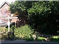
Number: K40
Designation: Public footpath
Length: 32m
Route: Throop Road [SZ 1123 9574] to borough boundary [SZ 1124 9577]
Map:
Commentary: Very short segment of this footpath to Hurn and Parley; at the millstream it continues as footpath E62 2 under Dorset Local Authority.
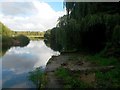
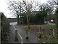
Number: K41
Designation: Byway open to all traffic
Length: 51m
Route: Throop Road [SZ 1146 9560] to River Stour [SZ 1148 9566]
Map:
Commentary: short gated track to the riverbank. Offers no onward access once at the bank. Historically continued as a ford to Pig Shoot Lane.
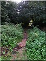
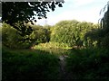
 (heading off to the right)
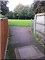
 Number: K42
Designation: Public footpath
Length: 16m
Route: Cooper Dean Drive [SZ 1182 9398] to Queen's Park [SZ 1182 9396]
Map:
Commentary: Short path providing corner-cut to start of path alongside Wessex Way.
Footpath K42 is the short spur to the left, cutting the corner off for pedestrians but off limits to cyclists.
Footpath K43 is the similar route ahead, but only the last 26 metres, which brings it up from the road to roughly level with the tree. The only reason I can think for this, is that the land towards us from the end of the 26m is officially part of Queen's Park and therefore public anyway.
(There are public rights of way in other parts of the borough which stop when they reach public parks and open spaces.)
Number: K43
Designation: Public footpath
Length: 23m
Route: Cooper Dean Drive [SZ 1185 9399] to Queen's Park [SZ 1183 9397]
Map:
Commentary: first 26 metres of path (now shared foot/cycle) alongside Wessex Way. Ends just short of path K42 (see above).
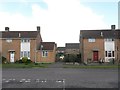
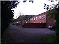
Number: K44
Designation: Byway open to all traffic
Length: 53m
Route: Strouden Avenue [SZ 1035 9383] to recreation ground [SZ 1038 9388]
Map:
Commentary: Northernmost segment of Howard Road, tarmacked about 15 years ago (previously gravel).
Number: K45
Designation: Public footpath
Length: 407m
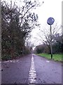
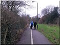
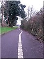
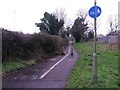
Route: 29 Throop Road [SZ 1235 9440] to Holdenhurst Village Road [SZ 1268 9464]
Map:
Commentary:
Paved route alongside the main A338, approximating to the historical Holdenhurst Road prior to the main road being built in the early 1960s. Marked out as a shared foot/cycle path.
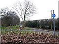
Holdenhurst Road is a major road from the town centre towards Holdenhurst village, which now comes to an end at King's Park, on the other side of the A338 about half a mile south of the Cooper Dean roundabout. The road restarts at the approach to Holdenhurst village, and this path provides access to pedestrians (and these days, cyclists) from Cooper Dean alongside the dual carriageway.
Number: K46 (no longer listed)
Designation: Public footpath
Route: Wessex Way [SZ 1241 9436] to Castle Lane East [SZ 1249 9414]
Commentary: Original southern end of Throop Road, extending to Castle Lane East, severed when the A338 was built (1960s), remaining public right of way probably until the hospital was built (around 1990).
Map:
Commentary: Course was roughly in line with the hedge/fence here, at the Castle Lane end:
Number: K47
Designation: Public footpath
Length: 77m
Route: Ibbertson Road [SZ 1200 9469] to Throop Road [SZ 1209 9468]
Map:
Commentary: Straight path across large triangular green between these two roads. Tarmac surface evident but fizzles out. Mapped dead-straight course is interrupted by car park for block of flats.
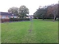
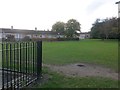
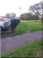
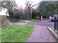
Number: K48
Designation: Public footpath
Length: 351m
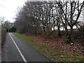
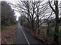
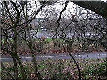
Route: Broad Avenue [SZ 1092 9417] to Mallard Road [SZ 1067 9442]
Map:
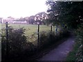
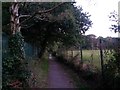
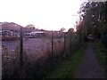
Commentary: Part of a historical route pre-dating the development of the suburbs. Starts at the dead end of Broad Avenue (itself part of the historical route):
 (to left)
Heads between school fields and back of shopping centre:
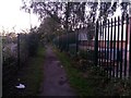
And the final stretch is a rear access driveway:
Number: K49
Designation: Public footpath
Length: 121m
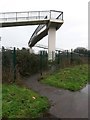
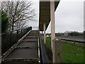
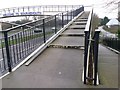
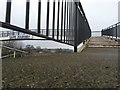
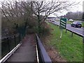
Route: Holdenhurst Village Road [SZ 1285 9480] to Riverside Avenue [SZ 1286 9474]
Map:
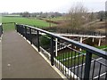
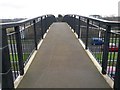
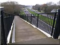
Commentary: Footbridge over the main A338, and associated approaches.
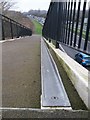
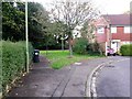
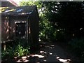
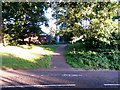
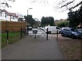
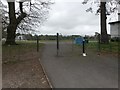
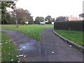
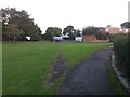
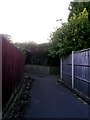
Number: K50
Designation: Public footpath
Length: 14m
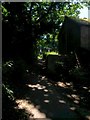
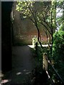
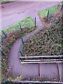
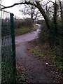
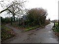
Route: St. Barnabas' church [SZ 1173 9422] to K34 [SZ 1174 9423]
Map:
Commentary: Very short passageway from the bottom of the church car park, to link up with path K34.
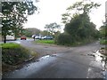
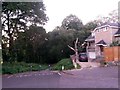
Here, we see its start at the bottom-right corner of the car park, viewed from Mount Pleasant Drive:
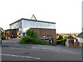
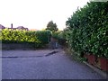
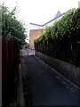
And here we see it, off to the left, leaving footpath K34:
Great Britain 1:50 000 Scale Colour Raster Mapping Extracts © Crown copyright Ordnance Survey. All Rights Reserved. Educational licence 100045616.
( Page < < prev 1 ... 14 15 16 17 18 19 20 21 22 23 24 25 26 ... next >> )