River Severn The Worcestershire Severn
![Creative Commons Licence [Some Rights Reserved]](https://s1.geograph.org.uk/img/somerights20.gif)
Great Britain 1:50 000 Scale Colour Raster Mapping Extracts © Crown copyright Ordnance Survey. All Rights Reserved. Educational licence 100045616.
Contents
- The Worcestershire Severn
- Shropshire Border to Bewdley
- Bewdley
- Bewdley to Stourport-on-Severn
- Stourport on Severn
- Stourport-on-Severn to Holt Fleet
- Holt Fleet to Bevere Lock
- Bevere Lock to Worcester
- Worcester
- Worcester to Upton-on-Severn
- Upton-on-Severn
- Upton-on-Severn to Tewkesbury (Gloucestershire)
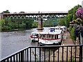
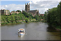
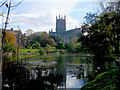
Worcester
 Map © Crown Copyright")
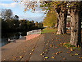
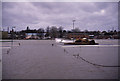
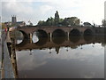
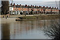
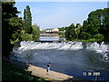
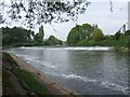
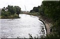
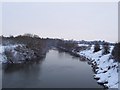
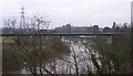
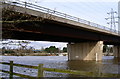
The river flows past the 'Faithful City' of Worcester. Until the Southern Bypass was built there was only the single bridge crossing at Worcester Bridge.
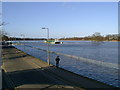
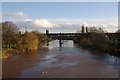
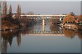
The current Worcester Bridge dates from 1781 and was extensively re-built in 1931-2.
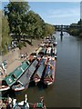
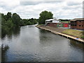
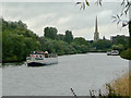
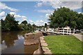
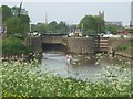
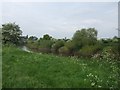
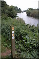
The Worcester & Birmingham Canal meets the river at Diglis Junction.
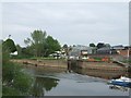
The Worcester & Birmingham Canal runs for thirty miles into the centre of Birmingham at Gas Street Basin. It has eighty five locks and five tunnels. When completed in 1815 the canal halved the distance for boats between Worcester and Birmingham.
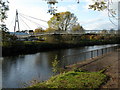
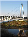
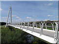
A new cable stayed footbridge was opened in 2010 below Diglis Weir.
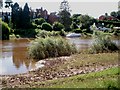
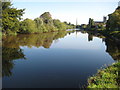
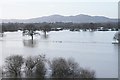
The River Teme has its confluence with the Severn near Powick. It was on the flood plain that the first skirmish of the Civil War took place in 1642 and the final battle in 1651 leading to the flight to exile of King Charles II.
The River Teme rises on the Welsh Border west of Ludlow with its tributaries the River Corve and River Clun before flowing through Radnorshire and Herefordshire to Powick.
The Worcester Southern Bypass bridge marks the southern limit of the city and Civil War battlefield. The Parliamentary forces constructed a bridge of boats in September 1651 to attack the Royalist forces on Powick fields.
Great Britain 1:50 000 Scale Colour Raster Mapping Extracts © Crown copyright Ordnance Survey. All Rights Reserved. Educational licence 100045616.
( Page < < prev 1 2 3 4 5 next >> )