River Trent - The Staffordshire Trent

( Page 1 2 3 4 5 6 )
Creative Commons Licence [Some Rights Reserved]   Text © Copyright October 2009, John M; licensed for re-use under a Creative Commons Licence.
Images also under a similar Creative Commons Licence.


The next major influence on the River Trent is mineral extraction of sands and gravels. This will be a major feature of the River Trent Washlands. The first major site is at King's Bromley where there are large gravel pits and a flour mill. The next historic crossing point is at Yoxall Bridge.

SK1217 : River Trent (southern channel) by John M SK1217 : River Trent (southern channel) looking downstream by John M SK1317 : River Trent upstream of Yoxall Bridge by John M SK1317 : Yoxall Bridge by John M
SK1317 : Yoxall bridges over the Trent by Tim Heaton SK1317 : The new Yoxall Bridge by John M SK1317 : River Trent downstream of Yoxall Bridge by John M SK1317 : Gauging station on the Trent below Yoxall Bridge by Tim Heaton

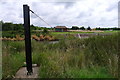
Mean river flows measured here are 12.96m3/s or 170000 gallons per minute.

SK1416 : Windpump on the Trent by Tim Heaton SK1416 : The Trent near Orgreave by Tim Heaton SK1416 : A quiet stretch of the River Trent near Orgreave by Jonathan Clitheroe SK1516 : The Trent near Orgreave by Tim Heaton SK1616 : The River Trent as seen from Wychnor Park by Humphrey Bolton

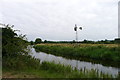
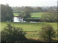
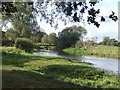
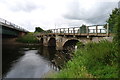
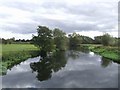
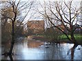
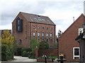
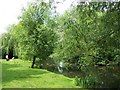
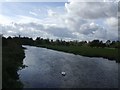
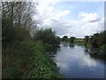
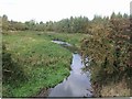
Flowing across the plain the river is joined from the north by the River Swarbourn north of Alrewas. Alrewas lies near the crossing point of the Roman Ryknield Street over the River Trent. A cotton mill was built in the village in 1793 to take advantage of water power and transport on the Trent and Mersey Canal.

SK1616 : View across flood plain by Andy Potter SK1615 : River Trent - upstream at Alrewas by John M SK1615 : Bailey Bridge over the River Trent by John M SK1615 : River Trent downstream at Alrewas by John M
SK1615 : Old Mill beside the River Trent, Alrewas by Geoff Pick SK1615 : Former Cotton Mill by John M SK1615 : Mill Stream, Alrewas by Geoff Pick SK1615 : Mill Stream, Alrewas by Geoff Pick SK1615 : Bailey Bridge over the mill stream by John M

Alrewas to Wychnor Bridges


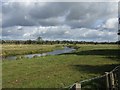
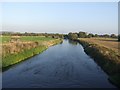
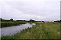
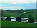
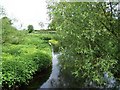
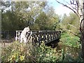
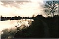
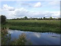
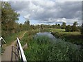
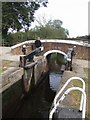
The Trent & Mersey Canal rejoins the river at Alrewas and shares a short section before heading north to Burton-on-Trent. The river and canal are constrained here by the high ground of Needwood Forest to the north.

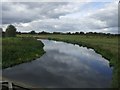
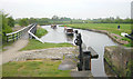
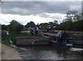
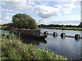
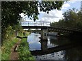
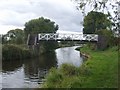
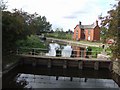
A lock drops the canal to river level beside the mill stream before joining the main river channel. A weir allows the main river flow to be taken off.
SK1715 : River Trent near Alrewas by Martin Clark SK1715 : Lock on the River Trent/Trent and Mersey Canal by John M SK1715 : River Trent downstream of Alrewas by John M SK1715 : Winter sun on the river by Chris Eaton SK1715 : Weir on the River Trent by John M

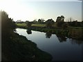
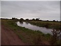
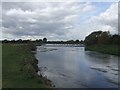
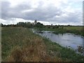
Following the main river channel to the A38 beside Essington Meadows.

SK1715 : River Trent downstream of the Trent and Mersey Canal by John M SK1715 : River Trent at Wychnor by John M SK1815 : River Trent at Wychnor by John M SK1815 : River Trent upstream of A38 bridge by John M SK1815 : River Trent - Wychnor Bridge by John M

Further smaller weirs and sluices on the canal section allow water levels to be managed. Wychnor Lock marks the end of the shared river section.

SK1715 : Trent and Mersey Canal/River Trent by John M SK1715 : Trent and Mersey Canal near Wychnor, Staffordshire by John M SK1816 : Trent and Mersey Canal - Bridge 44 by John M SK1816 : Sluice on the Trent and Mersey Canal at Wychnor Bridges by John M SK1816 : Trent and Mersey Canal - Wychnor Lock by John M SK1816 : Flood channel of the River Trent by John M

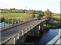
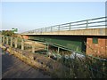
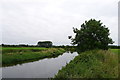
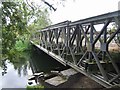
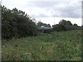
There are three river crossings on the A38 (Ryknield Street) with the threads rejoining east of the road.

KML

( Page 1 2 3 4 5 6 )
You are not logged in login | register