The Battle of Ashdown
![Creative Commons Licence [Some Rights Reserved]](https://s1.geograph.org.uk/img/somerights20.gif)
Great Britain 1:50 000 Scale Colour Raster Mapping Extracts © Crown copyright Ordnance Survey. All Rights Reserved. Educational licence 100045616.
The interest in writing about this battle was all started when I came across this mural in a tunnel under the A34 along the Ridgeway Path. Part of it showed the battle of Ashdown.

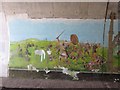
I had heard of the battle before and realised it must have taken place locally if they had painted the mural where it was. After reading some of the history I thought I knew where most of this took place and set out to show how the areas looked now. I found some of the history from sources in books or on the internet some of which could be myth or fact. The words I have written are my thoughts on what happened using the history I have read. I welcome comments and your thoughts about it.
The Battle of Ashdown took place on 8 January, 871 in Berkshire. Alfred the Great (a local lad from Wantage), then a prince of only 21, led the army of his brother, King Ethelred of Wessex, in a victorious battle against the invading Danes.
So where should I start the account? Well after reading the account in Royal Berkshire History of what happened I found this out:
King Alfred was a local lad being brought up in the Royal Palace that was around Wantage and by the time he was 22 his brother King Ethelred 1st had been holding the country together against the Danes for some years. By that time the Danes had been marching across the country from East Anglia and had sailed up the Thames to Reading where they had made a stronghold between the River Thames and Kennet. From there they had made a raiding party towards Aldermaston & Englefield only to be defeated by one of the local Earls Aethelwolf. The Saxon Aethelwolf, joined by Ethelred pushed them back to their stronghold in Reading where they tried to overcome the defences. In the fighting Aethelwolf was killed and the Saxons only escaped across the twin fords at Tyford when the Danes got lost in the marshes.
A few days later flushed with the victory the Danes marched out to attack the Saxons at Wallingford.
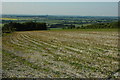
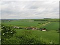
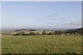
Where was Alfred? Well, stood with his brother on Kingstanding Hill in Cholsey watching the goings on
From this vantage point he could have seen most of the area and signs of smoke rising from fires.
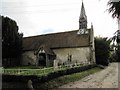
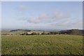
In the account Alfred had wanted to attack the Danes but his brother King Ethelred wanted to pray for guidance and went to a local church in the Astons which was most likely this one which is at the base of Blewburton Hill another good vantage point.
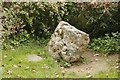
Alfred went back to gather his men stopping off at the Blowing Stone which, when blown, gives a sound like a calf bellowing. Alfred was supposed to have blown it and called the local militia to arms. You can make it sound but you have to try hard. I wonder if the Saxon horns sounded to call the troops as he blew in the stone and a legend was born. The Blowing Stone was probably at Rams Hill before some enterprising smith dragged it down the hill to be placed outside his smithy which, by 1809 had become the Blowing Stone Inn. The inn now no longer exists the stone sits in the garden of a house.
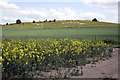
One account has the battle taking place at White Horse Hill. Alfred amassed his men near Ashbury at Alfred's Castle while his brother camped at Compton Beauchamp below Uffington Castle where the Danes had amassed.
Alfred got impatient and attacked the Danes and won the battle. Seems a little improbable as he was going uphill and the Danes had the advantage. The fact no Danish relics were found in the area backs this up.
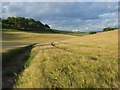
They could well have chased them along the Ridgeway cutting down the stragglers as they went ending up at Thorn Hill where again the Danes were defeated.
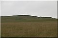
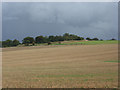
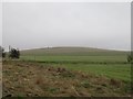
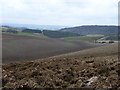
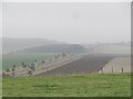
After reading another account I feel the most likely place the battle took place was at Lowbury Hill just off the Ridgeway
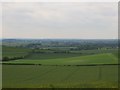
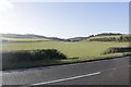
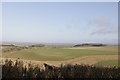
I think the Danes would have headed off along the Thames to Wallingford and if Alfred knew the area he would have had someone keeping watch at Lough Down near Streatley where you can see from the Goring Gap to Wallingford. A message could then have been sent to Alfred on Kingstanding Hill who was camped up with his men.
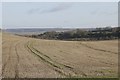
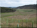
One thought was that the Danes came up along the Ridgeway from Streatley along by Thurl Down which eventually brings you around to the south side of Lowbury Hill and Deans Bottom where they were trapped and defeated.
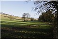
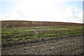
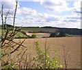
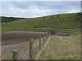
Deans Bottom seems like the place as artefacts have been found here but I think the Danes would have headed back along the Thames to Moulsford and gone along Moulsford Bottom which takes you past Kingstanding Hill, where Alfred could have been watching the Danes
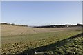
Moulsford Bottom brings you around Unhill Bottom then onto Deans Bottom
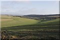
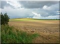
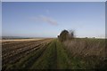
Alfred would just have to walk along the Fairmile to be looking down on the Danes
You can read my Blog on the battle here Link
Great Britain 1:50 000 Scale Colour Raster Mapping Extracts © Crown copyright Ordnance Survey. All Rights Reserved. Educational licence 100045616.