Traversing the Brecon Beacons
![Creative Commons Licence [Some Rights Reserved]](https://s1.geograph.org.uk/img/somerights20.gif)
Great Britain 1:50 000 Scale Colour Raster Mapping Extracts © Crown copyright Ordnance Survey. All Rights Reserved. Educational licence 100045616.
Contents
- Traversing the Brecon Beacons
- The plan
- The start
- Reaching access land
- Twyn Du
- Carn Pica and Waun Rydd
- Bwlch y Ddwyallt, Craig Cwareli and Craig Cwmoergwm
- Fan y Big and Bwlch ar y Fan
- Blaen Taf Fechan and Cribyn
- Pen y Fan
- Corn Du
- The finish
- Phil's route
- Graham's route
- Jonathan's route
- And finally ...
Traversing the Brecon Beacons
The plan
 from the car park south of Aber SO099197
  to the car park south of Storey Arms SN987199.
As befits keen Geographers, over 400 pictures were taken between them. An immodest selection appears on Geograph in the relevant locations. This article links them together. All the pictures used in this article are also displayed on a map by following this link Link
The plan was to walk up the eastern ridge of
 Twyn Du SO0820
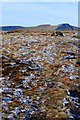 then along Waun Rydd SO0620
 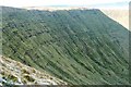 Bwlch y Ddwyallt SO0520
 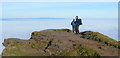 and Fan y Big SO0320
to the main peaks of
 Cribyn SO024212
 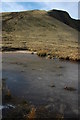 Pen y Fan SO012215
 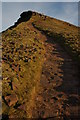 and Corn Du SO007213
 We positioned a car at the far end and drove back to the start, where it was just getting light. The walk plan showed a distance of 15 kilometres and 1100 metres of height gained. So we needed all the daylight we could get for this trip and reasoned on heading west towards the setting sun where the last kilometre or so would be on a good path and could safely be completed in twilight if necessary.

The start
 Map © Crown Copyright")
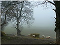
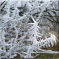
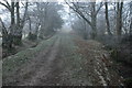
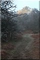
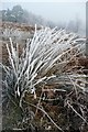
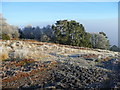
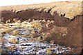
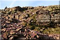
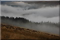
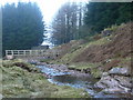
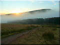
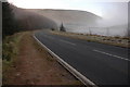
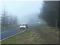
It was indeed cold, raw and foggy as we made our way past Berth-lwyd-fawr and towards the access land.
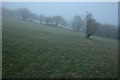
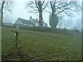
The hoar frost was much in evidence, although every few metres we were climbing into thinner cloud.
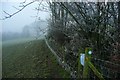
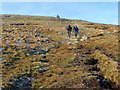
Reaching access land
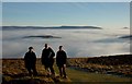
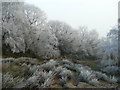
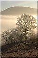
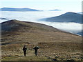
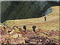
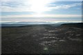
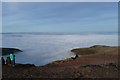
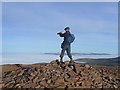
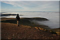
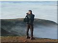
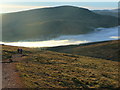
Once onto the access land SO0920 we saw how stunning our day was going to be and three snap-happy Geographers went to work.
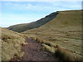
Twyn Du
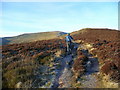
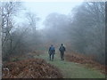
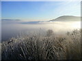
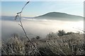
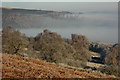
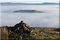
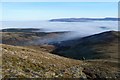
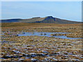
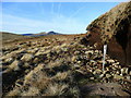
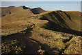
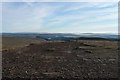
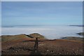
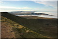
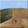
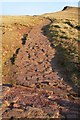
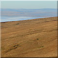
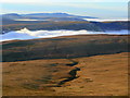
The climb up Twyn Du ridge SO0820 is steady and gentle, on a good path through sheep grazing moorland. The views east above the cloud were extensive, with Talybont Forest SO0922, the Black Mountains and Tor y Foel SO115194 prominent and Table Mountain SO226207 and The Sugar Loaf SO272188 clearly visible in the distance. Seeing pockets of land such as Buckland Hill SO139212 breaking above the cloud was particularly fascinating.
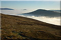
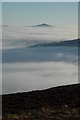
The path now follows level moorland, with a steep climb up Craig y Fan to Carn Pica in prospect ahead. So plenty of opportunities were taken to stop and admire that view eastwards again.
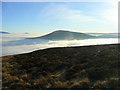
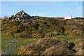
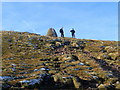
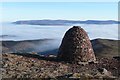
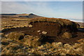
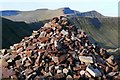
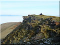
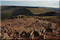
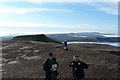
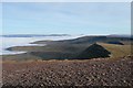
Carn Pica and Waun Rydd
Carn Pica SO069201 stands prominently at the edge of the Waun Rydd plateau above Craig y Fan. It has recently been rebuilt, as a picture by Nigel Davies shows. Another excuse for a stop, and to check with two GPSs that Carn Pica is indeed in that square. It is, by about 20 metres, although it is interesting to see that two identical GPS units (Garmin Etrex) often differed by up to five metres (never more) throughout the day.
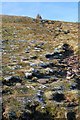

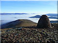
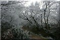
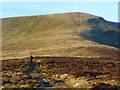
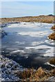
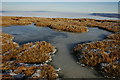
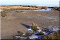
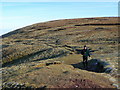
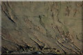
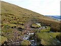
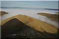
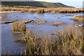
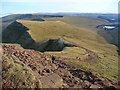
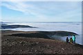
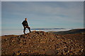
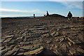
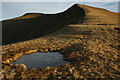
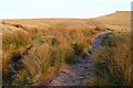
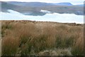
Continuing west, the path on the Waun Rydd plateau SO0620 turns gently northwards past frozen summit pools and eroded sections of peat. The view towards the main Brecon Beacons peaks opens up.
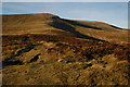
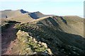
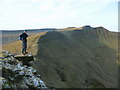
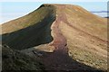
Bwlch y Ddwyallt, Craig Cwareli and Craig Cwmoergwm

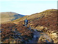
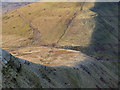
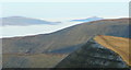
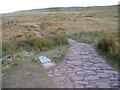
The plateau now narrows to a col, with an aerial view of the first of the steep north-facing glaciated cwms, Cwm Cwareli, and gentler slopes to the south. A good path hugs the tops of the head walls of successive cwms, following Bwlch y Ddwyallt, Craig Cwareli and Craig Cwmoergwm, to Fan y Big. Each corner turned reveals another massive drop to the north, where the sun never shines, and it is also from this area that the main peaks of the Brecon Beacons line up for their family portrait. We are joined by The Beacons Way, a 161 kilometre long distance path that seems to wander all over the National Park collecting every point of interest on route.
silver = Corn Du
gold = Pen y Fan
bronze = Cribyn
4th = Fan y Big
silver = Corn Du
gold = Pen y Fan
bronze = Cribyn
4th = Fan y Big
silver = Corn Du
gold = Pen y Fan
bronze = Cribyn
4th = Fan y Big
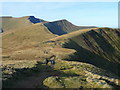
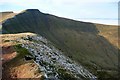
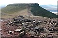
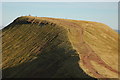
Fan y Big and Bwlch ar y Fan
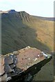
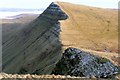
Fan y Big is really just a promontory where the cliffs surrounding Cwm Oergwm and Cwm Cynwyn join. Its claim to fame is "the diving board", an airy slab of rock near the summit projecting out a couple of metres above the head wall of Cwm Cynwyn. Certain people are persuaded to stand on it to have their photo taken.

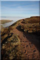
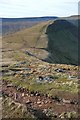
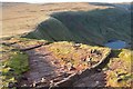
There follows a steep descent to Bwlch ar y Fan (Pass of the Beacon). This is the lowest point of the ridge and has been used for centuries as the pass from south to north. Good tracks lead up from Cwm Taf Fechan to the south and Cwm Cynwyn to the north, both of which are popular access routes and quick, safe descents in an emergency. This meeting of the ways was a convenient point for lunch.
Blaen Taf Fechan and Cribyn
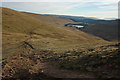
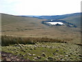
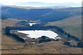
Jonathan followed the Beacons Way round the south side of Cribyn to collect some photos of the Taf Fechan. This is a level path avoiding the slog up Craig Cwm Cynwyn, a bonus if you are covering the whole 161 kilometre Beacons Way. There are good views southwards towards Blaen Taf Fechan (the Head of the Little Taf) which becomes part of Afon Taf, the main South Wales river flowing into the sea at Cardiff. A short distance down is Upper Neuadd Reservoir SO0219 which is a popular starting point for walks from the south.
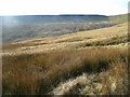
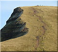
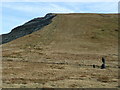
Meanwhile Phil and Graham climbed Cribyn. This is another point where head walls join, Craig Cwm Cynwyn and Craig Cwm Sere, separated by the steep descent of Bryn Teg. The top of Cribyn, looking down Bryn Teg, is probably the most exposed point on the whole walk.
Pen y Fan
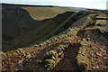
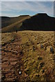
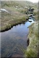
The most strenuous part of the route is probably the 130 metre descent from Cribyn to the col and the 220 metre ascent of Pen y Fan on the far side. The much-eroded path has been significantly improved with stone, including stepping stones across the pools at the col. Here are more views looking both ways.
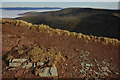
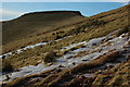
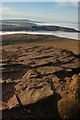
The final haul up to the summit gets steeper at the point where the old red sandstone cap is met. The whole area was once glaciated. The retreating ice eroded the old red sandstone from all but the peaks of Pen y Fan and Corn Du, thus leaving them the highest points in the area.
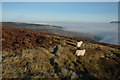
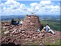
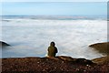
Finally you are standing on the 883 metre summit of Pen y Fan, the highest point in Southern Britain. Pen y Fan means "Head of the Beacon". This is the panoramic view composed of seven separate photos (is it somehow possible to make a true panorama out of these?) Apart from the peaks to the east that we have just visited, Cribyn, Fan y Big, Waun Rydd etc, one can still see the Black Mountains beyond, plus the distinctive Sugarloaf. Slightly further north than the northern end of the Black Mountains we could make out with the naked eye Brown Clee Hill SO594866 87 kilometres and Titterstone Clee Hill SO591779 81 kilometres. To the south-east, south and south-west are the various upland areas between the South Wales valleys. Again, with the naked eye, we could make out the Quantock Hills and Exmoor over 80 kilometres due south. Beyond the two visiting Geographers and nearby summit of Corn Du, to be visited shortly, the peaks of Fforest Fawr can be seen, Fan Fawr SN9619, Fan Nedd SN9118, Fan Gyhirych SN8819 and Fan Brycheiniog SN8221. The most extensive view, though, is probably to the north-west where the successive layers of upland above the cloud revealed Mynydd Epynt, centred around SN9443, the moorland around Drygarn Fawr SN8658, and Pumlimon Fawr SN7886. By careful examination we were also able to confirm that we could see Aran Fawddwy SH8622 102 kilometres distant on a bearing of 351 degrees grid (above the head of the guy sitting on his own in the fifth photo - trust me!).
The summit was incredibly free of people, thus the Geographers had to make the best of the human interest around them, mainly each other.
Corn Du
Heading south-west we crossed the slight col between Pen y Fan and Corn Du, and were soon sheltering from the wind again on the lee side (west) of that mountain.
The finish
Ahead of schedule and with some daylight left, we decided to descend by three different routes to add a bit of variety to our pictures.
Phil's route
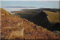
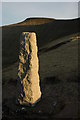
Phil took the north-west ridge, Craig Cwm Llwch, with a view back to Corn Du. He went past the obelisk to Tommy Jones, the 5-year old boy who died after getting lost on the mountain, then followed the watershed west and south-west over Y Gyrn towards Storey Arms.
Graham's route
Graham started on the same route, with a view down to Llyn Cwm Llwch, a glacier tarn, then headed west on the direct path to Storey Arms, crossing the headwaters of the Taf Fawr.
Jonathan's route
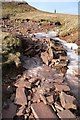
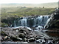
Jonathan headed south-west to Bwlch Duwynt, then down the direct route to the car park past frozen waterfalls on the Taf Fawr.
And finally ...
And we all reached the bottom, back in the valley mist, just as the sun was going down, to end a perfect day.
The icing on the cake for us was that three photographs from the trip, one from each contributor, reached the top ten in the Geograph of the Year week 52 shortlist.
Great Britain 1:50 000 Scale Colour Raster Mapping Extracts © Crown copyright Ordnance Survey. All Rights Reserved. Educational licence 100045616.