Geo-Trips :: A Circular Walk on the Severn Way
Severn Stoke
A walk from Severn Stoke, Sun, 8 Feb 2015 by Philip Halling
The Severn Way follows the course of the River Severn from its source high on Plynlimon in mid Wales, from where it flows to the east, entering England and flowing through Shropshire before turning south and flowing through Worcestershire and Gloucestershire. If following the path downstream the way ends in Bristol which is a little odd in that the city is on the River Avon, not the Severn, though I suppose this is to reward the walker with an objective, rather then finishing somewhere on the riverbank when the river's estuary becomes the Bristol Channel.
Between Severn Stoke and Kempsey in south Worcestershire the Severn Way splits offering the walker the option of following the riverbank or taking the shorter route which omits a bend in the river. This provides the option of a fine circular walk of approximately five miles, though it is possible to shorten the walk slightly.
Starting from SO848444 at the end of Ham Lane, a country lane which leads off the A38 from by the war memorial in Severn Stoke, one walks north following the bank of the river. After about half a kilometre the Severn Way bifurcates, the original route forks right, however it is now possible to follow a permissive path following the riverbank. This riverbank path is now signposted as the Severn Way. Walking this riverside walk one passes Cliffey Wood and Cleevelode, both of which are across the river on the west side. At Cleevelode there is a riverside caravan park. On the day of my walk the caravans were perfectly mirrored in the river. Incidentally the name 'lode' appears at many locations on the River Severn, lode being a former crossing point. Continuing on the riverbank until near Oak Farm the path now rejoins the original route of the Severn Way; it is here the river is left as one turns right and after a short distance the path emerges on the country road, Old Road South. At the road turn right and walk to its junction with the A38. Take care crossing the road and turn right. Walk on the pavement on the other side. Once round the corner after a short distance one crosses back over the A38 and follows the Severn Way signs which passes gravel workings being undertaken by the company Lafarge Tarmac. The small hamlet of Clifton is soon reached, as an alternative it is possible to briefly leave the Severn Way to pass through the hamlet. Much of the land here was owned by the Earls of Coventry who used to live in nearby Croome Court, now in the care of the National Trust. Evidence of their ownership is not hard to find even today, I spotted inscribed stones on a cottage and a farm building, both stating it was built by the Earl of Coventry. Returning to the Severn Way the path crosses the site entrance to the gravel workings along with a conveyor for transporting the aggregates. The footpath follows the field headland with fine views across arable fields with the Malvern Hills lining the western horizon. Sheepcote Farm is passed and then a farm track takes one back to the River Severn where turning left and retracing the earlier steps one returns to the starting point at the end of Ham Lane.
Click the blue circles to see a photograph taken from that spot and read further information about the location. The blue lines indicate the direction of view. There is also a slideshow of this trip. ( )
↓ Scroll down here ↓
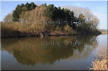
Brickpits Plantation and the River Severn
Brickpits Plantation in the River Severn near Severn Stoke.
On the banks of the River Severn
View to the North Hill, the most northerly of the Malvern Hills, from the Severn... more
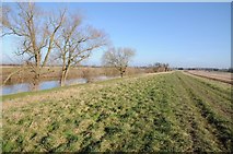
Riverside land opposite Cliffey Wood
The River Severn and riverside flood defence opposite Cliffey Wood to the north of... more
Sheepcote Farm
Sheepcote Farm viewed from the Severn Way long distance footpath which follows the... more
Severn Way opposite Cliffey Wood
At this point the Severn Way splits with the option of following the riverbank or... more
Meadowland opposite The Rhydd
Meadowland beside the River Severn opposite The Rhydd and Cliffey Wood. Dripshill... more
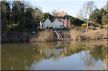
Riverside houses
Riverside houses overlooking the River Severn at the Rhydd.
Houses at the Rhydd
Houses at the Rhydd viewed from across the River Severn from the Severn Way.
Riverside footpath
This riverside footpath opposite the Rhydd beside the River Severn is now an... more
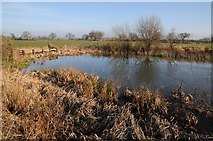
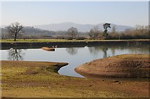
Pond in meadowland beside the Severn
This pond in meadowland will regularly be replenished by floodwater from the... more
Riverside arable field
Arable field of winter cereals beside the River Severn opposite the Rhydd.

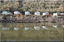
Riverside caravan park, Clevelode
Caravans reflected in the mirrorlike water of the River Severn at a caravan park a... more
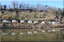
Caravan park at Clevelode reflected in the Severn
Caravans at Clevelode caravan park reflected in the mirrorlike River Severn.
Caravans reflected in the River Severn
Caravans at Clevelode caravan park reflected in the mirror-like River Severn.
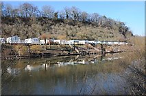
Caravans reflected in the River Severn
Caravans at Clevelode caravan park reflected in the mirrorlike River Severn.
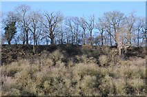
Winter trees at Clevelode
Bare winter trees on a bank above the River Severn at Clevelode.
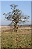
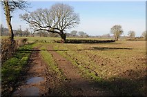
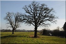
Tree in a hedgerow
Tree in a hedgerow on meadowland opposite Clevelode.
Hedgerow trees
Hedgerow trees in meadowland near Clifton beside the River Severn.
The Severn Way opposite Clevelode
The Severn Way following the flood bank opposite Clevelode.
The Severn Way near opposite Clevelode
View to the south along the Severn Way opposite Clevelode.
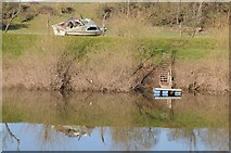
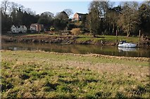
High and dry
A river cruiser has been left high and dry above the banks of the River Severn... more
Riverside near Clifton
The Severn Way follows the bank of the River Severn here near the hamlet of Clifton.
The Severn Way near Clifton
The Severn Way following the riverbank near Clifton.
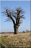
Oak tree
A bare oak tree in winter on the bank of the River Severn near Clifton.
View to the south-west on the Severn Way
The Severn Way near Clifton The River Severn is on the right with the wooded... more
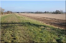
The Severn Way south-west of Kempsey
The Severn Way south-west of Kempsey with arable land to the right of the flood... more
View towards the Bogs
View towards the Bogs from the Severn Way near Clifton.
The Severn Way near Clifton
View towards the southwest on the Severn Way near Clifton. Dripshill Wood and be... more
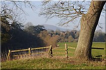
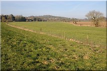
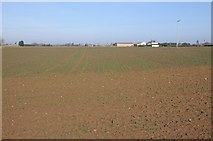
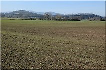
Farmland near Baynhall
Farmland and arable land near Baynhall viewed here from the Severn Way.

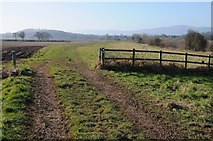
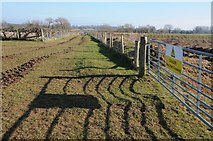
New kissing gate on the Severn Way
New kissing gate on the Severn Way beside the River Severn near Baynhall.
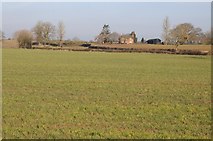
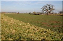
Oak Farm
View to Oak Farm across an arable field.
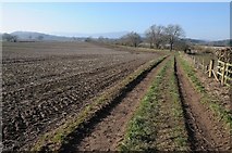
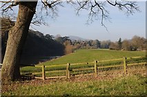
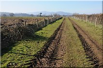
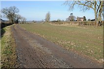
Farmland track near Baynhall
Farmland track near Baynhall leading to the banks of the River Severn, the Malvern... more
Farmland track near Baynhall
Farmland track and arable land near Baynhall. The Malvern Hills are on the horizon.
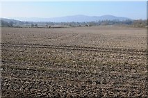
View across arable land
View across arable land to the Malvern Hills.
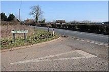
Old Road South
Old Road South junction with the A38 at Baynhall.
Farm track and Severn Way route
This farm track off the A38 near Clifton is followed by the Severn Way long distance path.
Severn Way passing quarry workings
Severn Way passing quarry workings at Clifton.
Former gravel workings, Clifton
Flooded former gravel workings beside the Severn Way at Clifton. The Malvern... more
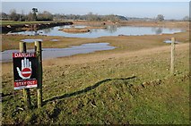
Danger Stay out
Sign beside the Severn Way warning of the dangers of former gravel workings at Clifton.
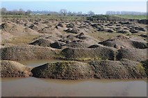
Gravel workings
Gravel workings between the Severn Way and the A38 at Clifton.
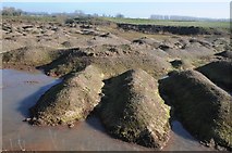
Gravel workings at Clifton
Gravel workings between the Severn Way and A38 at Clifton.
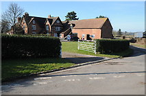
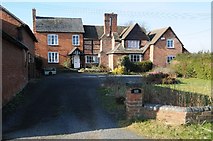
Clifton Court
Part brick, part timber-framed farmhouse dating from the 17th century with later... more
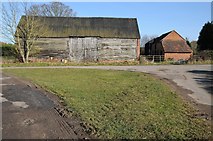
Barn in Clifton
Traditional farm barn with timber walls in the hamlet of Clifton.
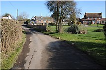
Dwellings in Clifton
A range of dwellings such as houses and cottages on various ages in the hamlet of Clifton
Lower House, Clifton
A farmhouse which appears to have been extended over the years. When I last... more
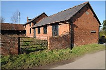
Clifton Lower Farm
The stone below the end gable of this farm building informs these farm buildings... more
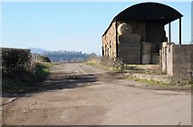
Dutch barn, Clifton Lower Farm
A Dutch barn partially filled with large straw bales at Clifton Lower Farm. The... more
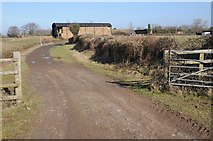
Severn Way approaching Clifton
Severn Way approaching Clifton with the Dutch barn of Clifton Lower Farm in the... more
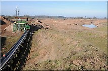
Gravel extraction at Clifton
Conveyor carrying gravel extracted from gravel workings at Clifton.
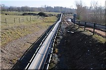
Conveyor at Clifton
Conveyor for transporting gravel from quarry workings at Clifton.
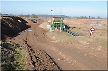
Aggregate workings at Clifton
Gravel quarrying workings at Clifton. A conveyor can be seen in the near distance.
Arable land at Clifton
View across arable land on the floodplain near Clifton. Caravans below the bank... more
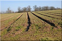
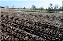
Arable field near Sheepscote Farm
A crop of onions in a field near Sheepscote Farm, the wood beyond the field is... more
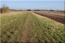
The Severn Way near Sheepcote Farm
Near Clifton the Severn Way splits with the more direct route pictured here... more
Sheepcote Farm
Sheepcote Farm pictured here from the Severn Way long distance path.
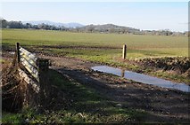
Farmland bridge
Farmland bridge giving access to arable farmland on the Severn floodplain near... more
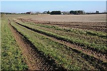
The Severn Way near Sheepcote Farm
Just to the south of Sheepcote Farm the Severn Way slips with a more direct route... more
The Severn Way approaching Sheepcote Farm
The Severn Way follows this track as it approaches Sheepcote Farm, the house of... more
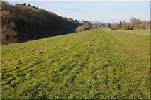
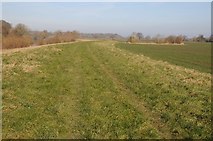
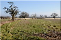
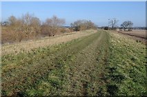
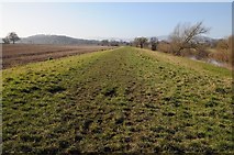
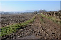
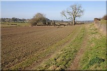
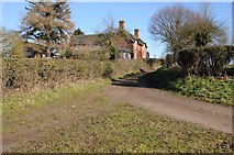
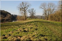
The Severn Way near Severn Stoke
The Severn Way near Severn Stoke follows a flood bank for much of the way. The... more

View to Severn Stoke church
View to Severn Stoke church from the Severn Way.
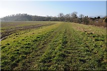
River side walk
The Severn Way long distance footpath between Severn Stoke and Kempsey. Cliffey... more
All images © Philip Halling and available under a
Creative Commons licence  .
.