2008
HP5807 : Former TACAN site, Valla Field
taken 15 years ago, near to Westing, Unst, Shetland Islands, Scotland
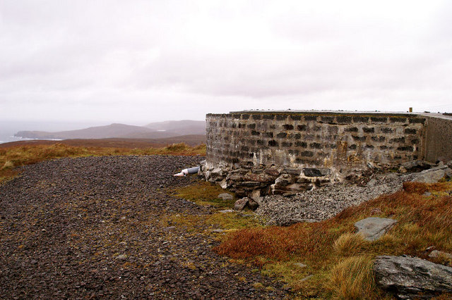
Former TACAN site, Valla Field
A TACAN (TACtical Air Navigation) dome, used to assist military aeroplane navigation, formerly stood here and was maintained by RAF Saxa Vord. It has been removed since the RAF base became an unmanned remote station. The hill of Sneuga can be seen in the distance. See also HP5807 : RAF TACAN Navigation Aid
 Map © Crown Copyright")
TIP: Click the map for more Large scale mapping
- Grid Square
- HP5807, 38 images (more nearby 🔍)
- Photographer
- Mike Pennington (more nearby)
- Date Taken
- Saturday, 1 November, 2008 (more nearby)
- Submitted
- Saturday, 1 November, 2008
- Subject Location
-
OSGB36:
 HP 584 078 [100m precision]
WGS84: 60:44.9818N 0:55.8078W - Camera Location
-
OSGB36: HP 584 078
- View Direction
- North-northwest (about 337 degrees)