2008
SO6511 : Forest stoned road, Ruspidge, Forest of Dean
taken 15 years ago, near to Upper Soudley, Gloucestershire, England
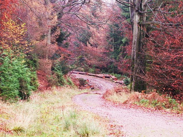
Forest stoned road, Ruspidge, Forest of Dean
This 'stoned' road, as opposed to green roads which are avenues of grass in the Forest, curves downhill and is lined with freshly felled trunks. They are lining the edge of the road like kerbstones and this is the result of 'thinning' operations. Clear Felling almost always results in tidy stacks of timber every so often. The timber from thinning is just dragged to the nearest point of the road and laid at its edge.
 Map © Crown Copyright")
TIP: Click the map for more Large scale mapping
- Grid Square
- SO6511, 47 images (more nearby 🔍)
- Photographer
- Eric Soons (more nearby)
- Date Taken
- Tuesday, 18 November, 2008 (more nearby)
- Submitted
- Tuesday, 18 November, 2008
- Subject Location
-
OSGB36:
 SO 658 111 [100m precision]
WGS84: 51:47.8875N 2:29.8228W - Camera Location
-
OSGB36: SO 656 111
- View Direction
- East-northeast (about 67 degrees)