2008
NZ2462 : Hadrian's Way above Redheugh Bridge
taken 15 years ago, near to Dunston, Gateshead, England
Hadrian's Way above Redheugh Bridge
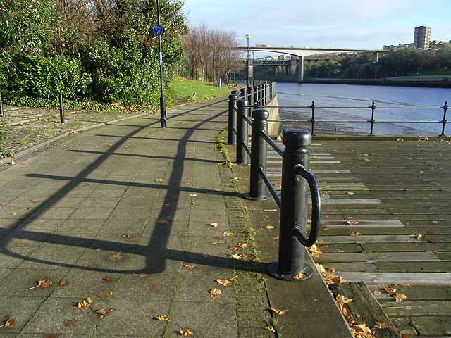
The footway on the north bank of the River Tyne carries Hadrian's Way, the local name for the traffic-free route along the Tyne through Newcastle. The Way is followed by both Hadrian's Wall National Trail
Link and by route 72 of the National Cycle Network (Hadrian's Cycleway
Link the Tynemouth branch of the C2C Cycle Route Link.
Redheugh Bridge and the railway bridge carrying the East Coast Main Line can be seen in the distance NZ2463.
Link
Link
Redheugh Bridge and the railway bridge carrying the East Coast Main Line can be seen in the distance NZ2463.
 Map © Crown Copyright")
TIP: Click the map for more Large scale mapping
- Grid Square
- NZ2462, 130 images (more nearby 🔍)
- Photographer
- Oliver Dixon (more nearby)
- Date Taken
- Tuesday, 18 November, 2008 (more nearby)
- Submitted
- Wednesday, 19 November, 2008
- Subject Location
-
OSGB36:
 NZ 241 629 [100m precision]
WGS84: 54:57.6579N 1:37.4721W - Camera Location
-
OSGB36: NZ 241 629
- View Direction
- Northeast (about 45 degrees)