2008
SO6411 : Lightmoor Tump, Ruspidge, Forest of Dean
taken 15 years ago, near to Ruspidge, Gloucestershire, England
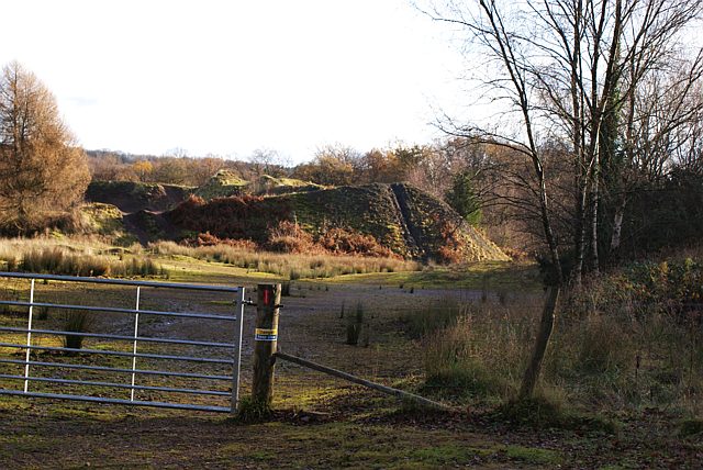
Lightmoor Tump, Ruspidge, Forest of Dean
The spoil from the Lightmoor Colliery was deposited here in vast, towering heaps. These are the somewhat eroded remnants of some of those spoil tips, known locally as Lightmoor Tump (Tump is a local word meaning man-made hillock). The spoil heap is situated beside the Family Cycle path and this view is facing more or less Easterly.
 Map © Crown Copyright")
TIP: Click the map for more Large scale mapping
- Grid Square
- SO6411, 31 images (more nearby 🔍)
- Photographer
- Eric Soons (more nearby)
- Date Taken
- Thursday, 20 November, 2008 (more nearby)
- Submitted
- Friday, 21 November, 2008
- Subject Location
-
OSGB36:
 SO 643 119 [100m precision]
WGS84: 51:48.2971N 2:31.1500W - Camera Location
-
OSGB36: SO 641 119
- View Direction
- EAST (about 90 degrees)