2008
SX8357 : Dart meander
taken 15 years ago, near to Stoke Gabriel, Devon, England
This is 1 of 2 images, with title Dart meander in this square
Dart meander
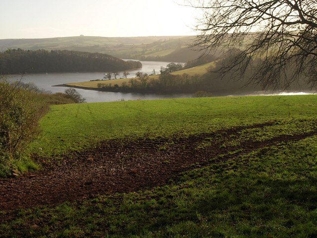
Taken from the gate at SX8357 : End of the green lane; the overhanging branch on the right belongs to the tree at the field boundary junction on the far hill of SX8357 : Across Ham Reach on the River Dart. Ashprington Point has the appearance of a classic slip-off slope on the inside of a meander. On this side of it is Ham Reach; on the far side, Duncannon Reach, with Duncannon Copse (in SX8457) on the steep river-cliff.
The last time I was here, on a misty morning several years ago, a herd of bullocks clustered around the gate.
The last time I was here, on a misty morning several years ago, a herd of bullocks clustered around the gate.
 Map © Crown Copyright")
TIP: Click the map for more Large scale mapping
- Grid Square
- SX8357, 48 images (more nearby 🔍)
- Photographer
- Derek Harper (more nearby)
- Date Taken
- Sunday, 23 November, 2008 (more nearby)
- Submitted
- Friday, 28 November, 2008
- Subject Location
-
OSGB36:
 SX 837 573 [100m precision]
WGS84: 50:24.2419N 3:38.2731W - Camera Location
-
OSGB36: SX 8364 5793
- View Direction
- SOUTH (about 180 degrees)