2007
NS3577 : Remains of the South Lodge
taken 17 years ago, near to Cardross, Argyll And Bute, Scotland
This is 1 of 2 images, with title Remains of the South Lodge in this square
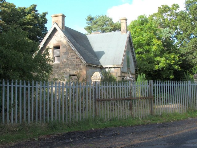
Remains of the South Lodge
This building was the South Lodge, one of two lodges that were associated with Kilmahew Estate. The estate was centred on Kilmahew House (for more on the history of the estate, see the latter part of NS3578 : St Peter's Seminary, Cardross).
The lodge is not depicted on the first-edition map (c.1860), but the equivalent map from 1895 includes it (there, it is simply labelled "lodge"); it therefore dates from the same general period as Kilmahew House itself. (I have not encountered the specific name South Lodge for this building, but have simply adopted it here as an appropriate description.)
For details of the building, see NS3577 : Remains of the South Lodge and NS3577 : South Lodge (detail).
Signs on the barrier, and on the front of the building itself, read "Dangerous Building - Keep Out". By the end of 2008, the former lodge had been demolished: NS3577 : Site of the former South Lodge.
Kilmahew Estate also had a West Lodge, which, at the time of writing, is visible as a ruin: see the link in the end-note.
South Lodge of Kilmahew Estate
This was one of the two lodges of the estate; by the end of 2008, it had been demolished. The other is the West Lodge: Link
 Map © Crown Copyright")
TIP: Click the map for more Large scale mapping
- Grid Square
- NS3577, 36 images (more nearby 🔍)
- Photographer
- Lairich Rig (more nearby)
- Date Taken
- Wednesday, 26 September, 2007 (more nearby)
- Submitted
- Thursday, 11 December, 2008
- Subject Location
-
OSGB36:
 NS 3534 7772 [10m precision]
WGS84: 55:57.8504N 4:38.3731W - Camera Location
-
OSGB36: NS 3534 7772
- View Direction
- North-northwest (about 337 degrees)