2006
NY6366 : Milecastle 48, Gilsland
taken 18 years ago, near to Gilsland, Northumberland, England
This is 1 of 4 images, with title Milecastle 48, Gilsland in this square
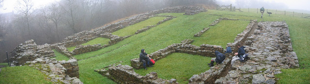
Milecastle 48, Gilsland
Roman Milecastle: Handbook to the Roman Wall by J Collingwood 1957: Immediately west of the railway station the wooded gorge of Poltross Burn divides Northumberland and Cumberland… The milecastle measures seventy feet north to south and sixty feet nine inches from east to west.
![Creative Commons Licence [Some Rights Reserved]](https://s1.geograph.org.uk/img/somerights20.gif)


TIP: Click the map for more Large scale mapping
- Grid Square
- NY6366, 151 images (more nearby 🔍)
- Photographer
- Les Hull (more nearby)
- Date Taken
- Wednesday, 18 January, 2006 (more nearby)
- Submitted
- Wednesday, 18 January, 2006
- Subject Location
-
OSGB36:
 NY 633 661 [100m precision]
WGS84: 54:59.2878N 2:34.5041W


