2008
NS6713 : Marchburn Cottage
taken 16 years ago, 4 km WSW of Lagrae, Dumfries And Galloway, Scotland
This is 1 of 2 images, with title Marchburn Cottage in this square
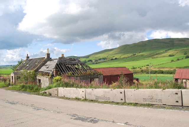
Marchburn Cottage
The ruin of Marchburn Cottage with Corsencon Hill in the background. The March Burn defines the march between Dumfriesshire and Ayrshire as well as the Dumfries & Galloway and Strathclyde
 Map © Crown Copyright")
TIP: Click the map for more Large scale mapping
- Grid Square
- NS6713, 29 images (more nearby 🔍)
- Photographer
- Robert Guthrie (more nearby)
- Date Taken
- Thursday, 4 September, 2008 (more nearby)
- Submitted
- Thursday, 25 December, 2008
- Subject Location
-
OSGB36:
 NS 672 130 [100m precision]
WGS84: 55:23.6085N 4:5.8472W - Camera Location
-
OSGB36: NS 673 129
- View Direction
- North-northwest (about 337 degrees)