2009
SD8118 : Rochdale Road Turn
taken 15 years ago, near to Edenfield, Lancashire, England
This is 1 of 4 images, with title starting with Rochdale Road in this square
Rochdale Road Turn
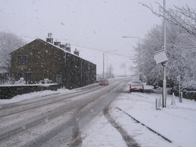
This is the A680 Rochdale Road, known locally as the "Owd Betts" road Link (Archive Link )
At this point, just South East of Edenfield, the A680 passes through the small village of Turn.
An hour after this picture was taken the road was closed for several hours due to snow blocking the road further along near the Owd Betts public house.
SD8216 : Owd Betts
For more information about Turn village click on Link (Archive Link )
At this point, just South East of Edenfield, the A680 passes through the small village of Turn.
An hour after this picture was taken the road was closed for several hours due to snow blocking the road further along near the Owd Betts public house.
SD8216 : Owd Betts
For more information about Turn village click on Link
 Map © Crown Copyright")
TIP: Click the map for more Large scale mapping
- Grid Square
- SD8118, 45 images (more nearby 🔍)
- Photographer
- Paul Anderson (more nearby)
- Date Taken
- Monday, 19 January, 2009 (more nearby)
- Submitted
- Tuesday, 20 January, 2009
- Subject Location
-
OSGB36:
 SD 811 181 [100m precision]
WGS84: 53:39.5912N 2:17.2393W - Camera Location
-
OSGB36: SD 810 182
- View Direction
- East-southeast (about 112 degrees)