2009
TQ5474 : The Salvation Army Church
taken 15 years ago, near to Dartford, Kent, England
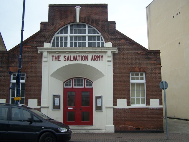
The Salvation Army Church
On Hythe Street. Has several dedication foundation blocks. The one closest to the door on left reads "This stone was laid by Councillor F.S.Putland Chairman U.D.C. 20th July 1912". The dedication block on the right of the door reads "This stone was laid by the Bandmaster on behalf of the Band 20th July 1912".
 Map © Crown Copyright")
TIP: Click the map for more Large scale mapping
- Grid Square
- TQ5474, 226 images (more nearby 🔍)
- Photographer
- David Anstiss (more nearby)
- Date Taken
- Sunday, 15 February, 2009 (more nearby)
- Submitted
- Monday, 23 February, 2009
- Subject Location
-
OSGB36:
 TQ 541 742 [100m precision]
WGS84: 51:26.7817N 0:12.9844E - Camera Location
-
OSGB36: TQ 541 742
- View Direction
- West-northwest (about 292 degrees)