2009
SO4494 : Carding Mill Valley
taken 15 years ago, near to Church Stretton, Shropshire, England
This is 1 of 22 images, with title Carding Mill Valley in this square
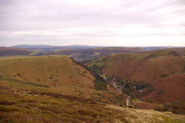
Carding Mill Valley
Viewed from the upper slopes of Haddon Hill, with Church Stretton beyond and Brown Clee and Titterstone Clee Hill in the distance.
 Map © Crown Copyright")
TIP: Click the map for more Large scale mapping
- Grid Square
- SO4494, 303 images (more nearby 🔍)
- Photographer
- Ian Capper (more nearby)
- Date Taken
- Friday, 20 February, 2009 (more nearby)
- Submitted
- Wednesday, 4 March, 2009
- Subject Location
-
OSGB36:
 SO 443 947 [100m precision]
WGS84: 52:32.8409N 2:49.3625W - Camera Location
-
OSGB36: SO 439 952
- View Direction
- Southeast (about 135 degrees)