2009
NU1241 : St. Cuthbert's Isle, Holy Island, Northumberland
taken 15 years ago, near to Holy Island, Northumberland, England
This is 1 of 5 images, with title starting with St. Cuthbert's in this square
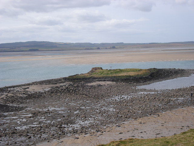
St. Cuthbert's Isle, Holy Island, Northumberland
St. Cuthbert's Isle and remains of chapel at SW extremity of Holy Island (Lindisfarne) seen at low tide.
 Map © Crown Copyright")
TIP: Click the map for more Large scale mapping
- Grid Square
- NU1241, 1017 images (more nearby 🔍)
- Photographer
- Rodney Clark (more nearby)
- Date Taken
- Sunday, 15 March, 2009 (more nearby)
- Submitted
- Saturday, 28 March, 2009
- Subject Location
-
OSGB36:
 NU 122 416 [100m precision]
WGS84: 55:40.0707N 1:48.3711W - Camera Location
-
OSGB36: NU 126 417
- View Direction
- West-southwest (about 247 degrees)