2004
NN2544 : Coire Toaig
taken 20 years ago, 3 km from Black Mount, Argyll And Bute, Scotland
This is 1 of 4 images, with title Coire Toaig in this square
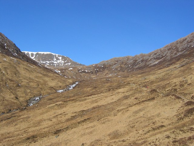
Coire Toaig
The Allt Toaig runs down a series of waterslides out the corrie. The pony track starts at the Clashgour hut and runs to the upper corrie, with a branch going up Stob Coire Odhair.
 Map © Crown Copyright")
TIP: Click the map for more Large scale mapping
- Grid Square
- NN2544, 9 images (more nearby 🔍)
- Photographer
- Richard Webb (more nearby)
- Date Taken
- Sunday, 29 February, 2004 (more nearby)
- Submitted
- Tuesday, 24 May, 2005
- Subject Location
-
OSGB36:
 NN 25 44 [1000m precision]
WGS84: 56:33.5966N 4:50.4649W