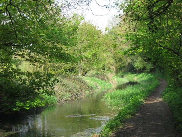
SP8810 : Wendover Arm: The Canal East of Hare Bridge (No 8), Halton
taken 15 years ago, near to Halton, Buckinghamshire, England
See SP8608 : The Wendover Arm of the Grand Union Canal
The Wendover Arm was planned as a feeder to supply water to the Tring Summit of the Grand Junction Canal (now the Grand Union Canal). It was completed as a navigable canal in 1797 and operated as such throughout the 19th century. However the canal leaked water and was closed early in the 20th century, and the water was piped into the reservoirs at Tring. As a result the route of the canal currently splits into three sections:
From Wendover to Drayton Beauchamp (via Halton and Buckland Wharf) the old canal channel carries what is, in environmental terms, a very healthy chalk stream. Because of the minimal human disturbance it supports a wide range of animal and plant species.
Between Drayton Beauchamp and Little Tring the canal channel is currently being relined so that it can be re-watered allowing canal boats to travel to Buckland Wharf, where low road bridges currently prevent further progress. This work is being carried out by the Wendover Arm Trust Link
Between Little Tring and the Tring Summit of the Grand Union Canal the canal is fully navigable, and a short section has recently been reopened to provide a winding hole. This section gives great pleasure to those who travel in barges but is environmentally far less interesting than the Wendover end because passing barges stir up the mud.
 Map © Crown Copyright")
- Grid Square
- SP8810, 35 images (more nearby 🔍)
- Photographer
- Chris Reynolds (more nearby)
- Date Taken
- Saturday, 18 April, 2009 (more nearby)
- Submitted
- Saturday, 18 April, 2009
- Subject Location
-
OSGB36:
 SP 880 107 [100m precision]
WGS84: 51:47.3038N 0:43.4819W - Camera Location
-
OSGB36: SP 880 107
- View Direction
- Northeast (about 45 degrees)