2009
SO8881 : Elan Aqueduct siphon
taken 15 years ago, near to West Hagley, Worcestershire, England
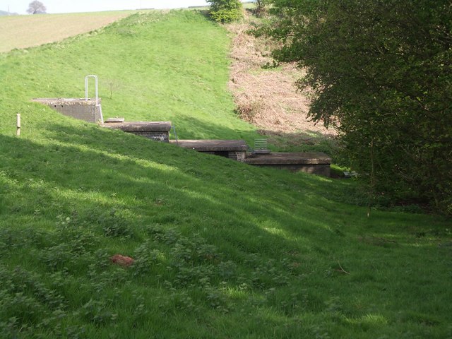
Elan Aqueduct siphon
Another part of the Elan Valley Aqueduct, this structure marks where it changes direction (heading almost due east from here, but south down this hill before bearing west again towards Cookley).
 Map © Crown Copyright")
TIP: Click the map for more Large scale mapping
- Grid Square
- SO8881, 24 images (more nearby 🔍)
- Photographer
- Simon Jobson (more nearby)
- Date Taken
- Saturday, 18 April, 2009 (more nearby)
- Submitted
- Sunday, 19 April, 2009
- Subject Location
-
OSGB36:
 SO 889 813 [100m precision]
WGS84: 52:25.8010N 2:9.8190W - Camera Location
-
OSGB36: SO 889 813
- View Direction
- East-southeast (about 112 degrees)