2006
SK5802 : Freemen's Common, Leicester
taken 18 years ago, near to Leicester, England
This is 1 of 2 images, with title starting with Freemen's Common in this square
Freemen's Common, Leicester
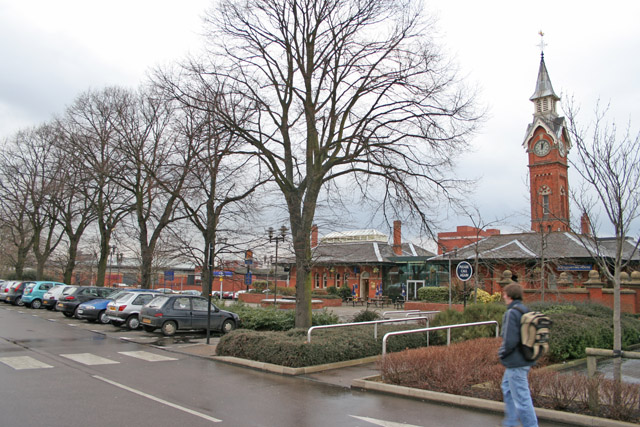
An Inclosure Award in 1811 allotted to resident Freemen and Freemen's Widows of Leicester 36 acres of land between Aylestone Road and the River Soar, 2 acres at Saffron Lane and 85 acres between Welford Road and Aylestone Road. The last mentioned was to become known as Freemen's Common, now a large retail and industrial estate. This picture shows the Counting House, a remnant of the old cattle market that used to be on the site, now a large and popular public house. View point is the carpark of Morrison's supermarket. See Link for more historical information about Freemen's Common and the surrounding area.
 Map © Crown Copyright")
TIP: Click the map for more Large scale mapping
- Grid Square
- SK5802, 241 images (more nearby 🔍)
- Photographer
- Kate Jewell (more nearby)
- Date Taken
- Tuesday, 21 February, 2006 (more nearby)
- Submitted
- Tuesday, 21 February, 2006
- Subject Location
-
OSGB36:
 SK 587 029 [100m precision]
WGS84: 52:37.2421N 1:8.0611W