2009
NY9569 : Pastures west of Errington Hill Head and the north defensive ditch of Hadrian's Wall
taken 15 years ago, 3 km from Sandhoe, Northumberland, England
This is 1 of 2 images, with title starting with Pastures west of Errington Hill in this square
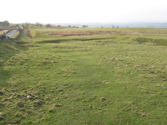
Pastures west of Errington Hill Head and the north defensive ditch of Hadrian's Wall
There is clearly some kind of ancient earthwork in the foreground - also visible in NY9569 : Pastures west of Errington Hill Head) - but I do not know what it is (or rather was).
 Map © Crown Copyright")
TIP: Click the map for more Large scale mapping
- Grid Square
- NY9569, 72 images (more nearby 🔍)
- Photographer
- Mike Quinn (more nearby)
- Date Taken
- Tuesday, 17 March, 2009 (more nearby)
- Submitted
- Thursday, 30 April, 2009
- Subject Location
-
OSGB36:
 NY 957 693 [100m precision]
WGS84: 55:1.1367N 2:4.0801W - Camera Location
-
OSGB36: NY 959 693
- View Direction
- West-northwest (about 292 degrees)