2009
SE0776 : Old incline
taken 15 years ago, 3 km from Middlesmoor, North Yorkshire, England
This is 1 of 2 images, with title starting with Old in this square
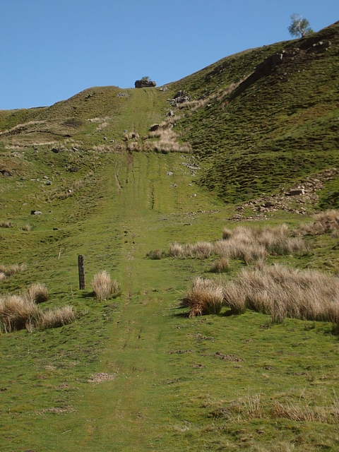
Old incline
The slope of a rope-worked incline which brought stone from a quarry at grid reference SE074764 for building Scar House Reservoir dam between 1921 and 1936. The remains of the winding house can be seen at the top.
 Map © Crown Copyright")
TIP: Click the map for more Large scale mapping
- Grid Square
- SE0776, 30 images (more nearby 🔍)
- Photographer
- David Pickersgill (more nearby)
- Date Taken
- Monday, 11 May, 2009 (more nearby)
- Submitted
- Thursday, 14 May, 2009
- Subject Location
-
OSGB36:
 SE 074 766 [100m precision]
WGS84: 54:11.1289N 1:53.2771W - Camera Location
-
OSGB36: SE 073 766
- View Direction
- East-southeast (about 112 degrees)