2009
TQ5267 : The A20 Dual Carriageway becomes the M20 Motorway
taken 15 years ago, near to Swanley, Kent, England
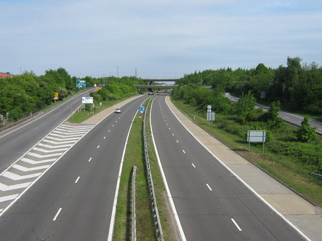
The A20 Dual Carriageway becomes the M20 Motorway
The A20 dual carriageway from London heads under B2173 London Road bridge then heads straight on to become the M20 Motorway heading towards Maidstone. Hence blue sign in the centre. The road on the left is a off-ramp heading to Junction 3 on the M25 Motorway (bridges in background over the motorway). The road on the right is a on-ramp to the A20.
M20 Motorway
The M20 is a 51 mile motorway running between the M25 motorway near Swanley and Folkestone in Kent. It was constructed from 1960. It is a key route for lorries connecting to mainland Europe via the Channel Tunnel and Ferries.
 Map © Crown Copyright")
TIP: Click the map for more Large scale mapping
- Grid Square
- TQ5267, 58 images (more nearby 🔍)
- Photographer
- David Anstiss (more nearby)
- Date Taken
- Tuesday, 12 May, 2009 (more nearby)
- Submitted
- Friday, 15 May, 2009
- Subject Location
-
OSGB36:
 TQ 525 678 [100m precision]
WGS84: 51:23.3515N 0:11.4646E - Camera Location
-
OSGB36: TQ 523 678
- View Direction
- EAST (about 90 degrees)