2009
SH5910 : Rocky foreshore at Llwyngwril
taken 15 years ago, near to Llwyngwril, Gwynedd, Wales
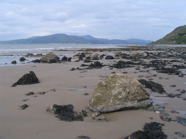
Rocky foreshore at Llwyngwril
The shore at Llwyngwril is fronted by low cliffs and is mainly boulders and large shingle, interspersed with a few sandy patches visible between high and low water. Taken at 1555, approximately 1 hour before low water (1647 in Barmouth). The hills behind Barmouth (SH6115) are visible in the distance.
 Map © Crown Copyright")
TIP: Click the map for more Large scale mapping
- Grid Square
- SH5910, 45 images (more nearby 🔍)
- Photographer
- E Gammie (more nearby)
- Date Taken
- Sunday, 10 May, 2009 (more nearby)
- Submitted
- Wednesday, 20 May, 2009
- Subject Location
-
OSGB36:
 SH 591 103 [100m precision]
WGS84: 52:40.3663N 4:5.0649W - Camera Location
-
OSGB36: SH 591 103
- View Direction
- North-northeast (about 22 degrees)