2009
NG4960 : Dismantled railway
taken 15 years ago, near to Lealt, Isle of Skye, Scotland
Dismantled railway
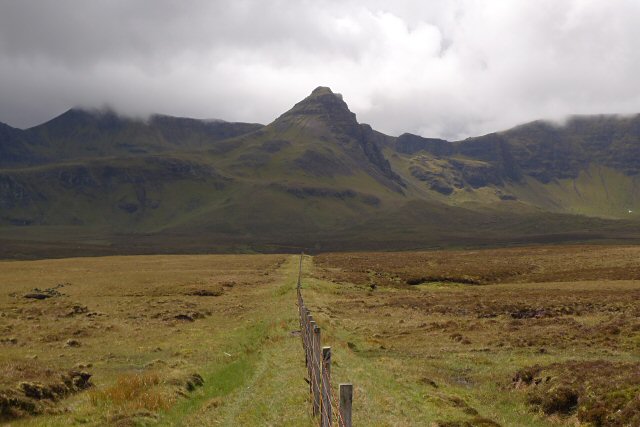
The railway used to run to a diatomite mine. This section has been used as dry ground for a fence, and it makes a good alternative path to the nearby track.
Ahead is Sgurr a'Mhadaidh Ruaidh (Hill of the Red Fox). It's hard to look at the ground with a view like this ahead.
Ahead is Sgurr a'Mhadaidh Ruaidh (Hill of the Red Fox). It's hard to look at the ground with a view like this ahead.
 Map © Crown Copyright")
TIP: Click the map for more Large scale mapping
- Grid Square
- NG4960, 11 images (more nearby 🔍)
- Photographer
- Rob Burke (more nearby)
- Date Taken
- Thursday, 21 May, 2009 (more nearby)
- Submitted
- Tuesday, 9 June, 2009
- Subject Location
-
OSGB36:
 NG 4941 6023 [10m precision]
WGS84: 57:33.7469N 6:11.4957W - Camera Location
-
OSGB36: NG 4941 6023
- View Direction
- Southwest (about 225 degrees)