2009
TQ4653 : Chart Lane - Steep Hill 10%
taken 15 years ago, near to Brasted Chart, Kent, England
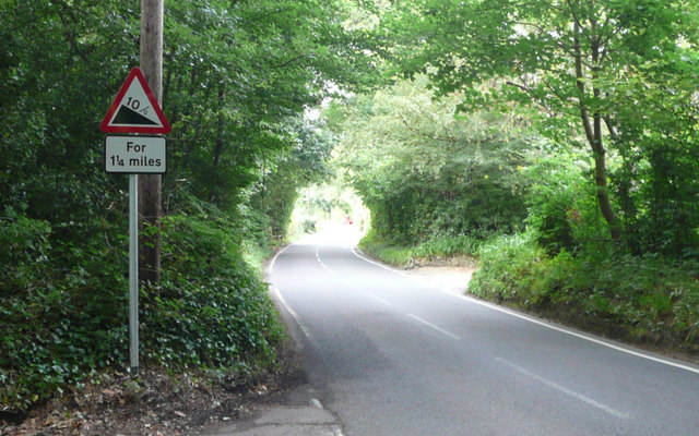
Chart Lane - Steep Hill 10%
Chart Lane, Brasted Chart. 10% steep hill down sign.
 Map © Crown Copyright")
TIP: Click the map for more Large scale mapping
- Grid Square
- TQ4653, 40 images (more nearby 🔍)
- Photographer
- Adam Morse (more nearby)
- Date Taken
- Thursday, 9 July, 2009 (more nearby)
- Submitted
- Wednesday, 5 August, 2009
- Subject Location
-
OSGB36:
 TQ 467 531 [100m precision]
WGS84: 51:15.5019N 0:6.0946E - Camera Location
-
OSGB36: TQ 467 531
- View Direction
- North-northeast (about 22 degrees)