2009
TG4001 : Norton Marsh Drainage Mill and Hardley Cross
taken 15 years ago, near to Reedham, Norfolk, England
Norton Marsh Drainage Mill and Hardley Cross
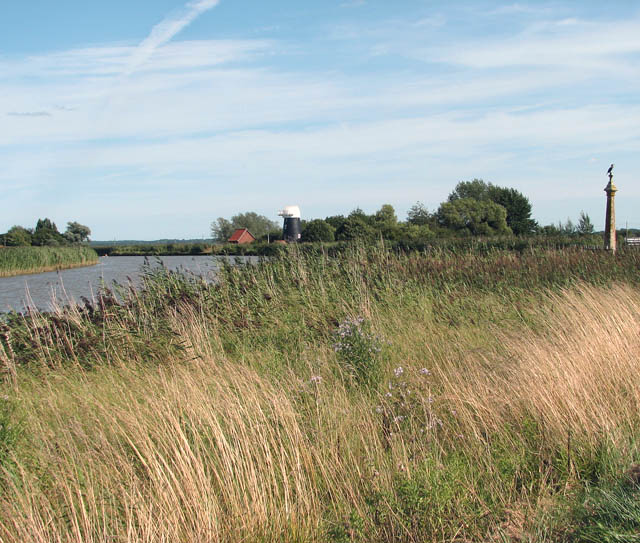
The restored Hardley Cross can be seen at right - with a cormorant perched on top of it > Link. Norton drainage mill and the adjoining pumphouse are located on the other side of the River Chet which here flows into the Yare.
Norton Marsh drainage mill, built in 1863 on the south bank of the River Yare just to the east of the mouth of the River Chet and to the south of Reedham Ferry stands beside a modern red brick pumphouse. The 4 storey tarred red brick tower stands 10 metres tall and has an overall base diameter of about 7 metres. When the mill ceased working the cap, sails and machinery were removed and replaced by a conical iron roof that remained in place until 1988 when it was replaced by a new Norfolk boat shaped cap with a modern safety barrier. The scoop wheel was also reconstructed. The mill has since been converted into a holiday let accommodation.
Norton Marsh drainage mill, built in 1863 on the south bank of the River Yare just to the east of the mouth of the River Chet and to the south of Reedham Ferry stands beside a modern red brick pumphouse. The 4 storey tarred red brick tower stands 10 metres tall and has an overall base diameter of about 7 metres. When the mill ceased working the cap, sails and machinery were removed and replaced by a conical iron roof that remained in place until 1988 when it was replaced by a new Norfolk boat shaped cap with a modern safety barrier. The scoop wheel was also reconstructed. The mill has since been converted into a holiday let accommodation.
 Map © Crown Copyright")
TIP: Click the map for more Large scale mapping
- Grid Square
- TG4001, 191 images (more nearby 🔍)
- Photographer
- Evelyn Simak (more nearby)
- Date Taken
- Sunday, 16 August, 2009 (more nearby)
- Submitted
- Monday, 17 August, 2009
- Subject Location
-
OSGB36:
 TG 402 011 [100m precision]
WGS84: 52:33.3009N 1:32.5856E - Camera Location
-
OSGB36: TG 400 012
- View Direction
- East-southeast (about 112 degrees)