2006
ST1020 : Wellington: The Holywell, Holywell Lake
taken 18 years ago, near to Holywell Lake, Somerset, England
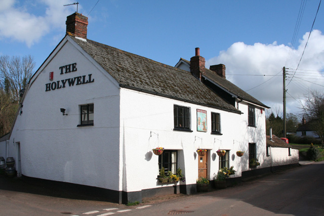
Wellington: The Holywell, Holywell Lake
An inn serving a small village on a secondary road from Langford Budville to White Ball. An old well, presumably the 'Holy Well', is shown nearby on the 1940s Ordnance Survey map. Looking south east
 Map © Crown Copyright")
TIP: Click the map for more Large scale mapping
- Grid Square
- ST1020, 22 images (more nearby 🔍)
- Photographer
- Martin Bodman (more nearby)
- Date Taken
- Sunday, 2 April, 2006 (more nearby)
- Submitted
- Sunday, 2 April, 2006
- Subject Location
-
OSGB36:
 ST 1063 2055 [10m precision]
WGS84: 50:58.6440N 3:16.4621W