2006
NZ2341 : Alum Waters
taken 18 years ago, near to New Brancepeth, County Durham, England
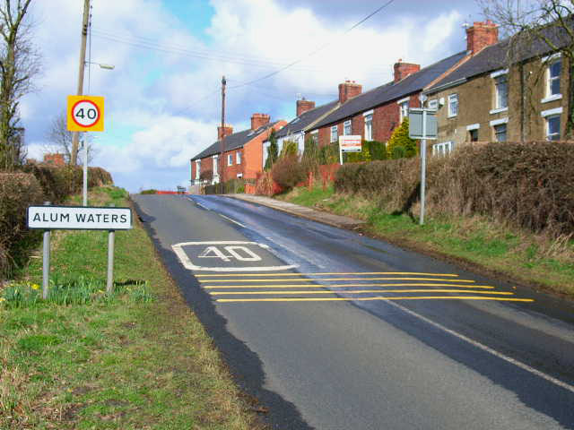
Alum Waters
On the road between Langley Moor and New Brancepeth. The name Alum Waters was derived from the stream which at one time ran down the hill between the left hand side of the road and the hedge as shown in the picture. This water
contained a high volume of the chemical alum which stained the water to a rich copper colour. The stream was diverted into a pipe system by the old Brandon and Byshottles Urban District Council, circa 1955. (information supplied by Geoffrey Turner)
contained a high volume of the chemical alum which stained the water to a rich copper colour. The stream was diverted into a pipe system by the old Brandon and Byshottles Urban District Council, circa 1955. (information supplied by Geoffrey Turner)
 Map © Crown Copyright")
TIP: Click the map for more Large scale mapping
- Grid Square
- NZ2341, 10 images (more nearby 🔍)
- Photographer
- Oliver Dixon (more nearby)
- Date Taken
- Monday, 3 April, 2006 (more nearby)
- Submitted
- Tuesday, 4 April, 2006
- Subject Location
-
OSGB36:
 NZ 234 414 [100m precision]
WGS84: 54:46.0193N 1:38.2699W - Camera Location
-
OSGB36: NZ 235 413