2009
TQ1049 : Drove Road and bridleway
taken 15 years ago, near to Abinger Hammer, Surrey, England
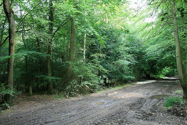
Drove Road and bridleway
The Drove Road, an unsurfaced byway open to all traffic (Abinger 137) at the crossroads with bridleway Abinger 4. At the time of submission, the Drove Road was closed to vehicular traffic, while maintenance work continued.
 Map © Crown Copyright")
TIP: Click the map for more Large scale mapping
- Grid Square
- TQ1049, 23 images (more nearby 🔍)
- Photographer
- Hugh Craddock (more nearby)
- Date Taken
- Monday, 7 September, 2009 (more nearby)
- Submitted
- Thursday, 24 September, 2009
- Subject Location
-
OSGB36:
 TQ 1027 4924 [10m precision]
WGS84: 51:13.9022N 0:25.3217W - Camera Location
-
OSGB36: TQ 1026 4924
- View Direction
- Northeast (about 45 degrees)