2009
NX5362 : Unclassified road between Gatehouse Station and Creetown
taken 15 years ago, 3 km from Culcronchie, Dumfries And Galloway, Scotland
This is 1 of 2 images, with title Unclassified road between Gatehouse Station and Creetown in this square
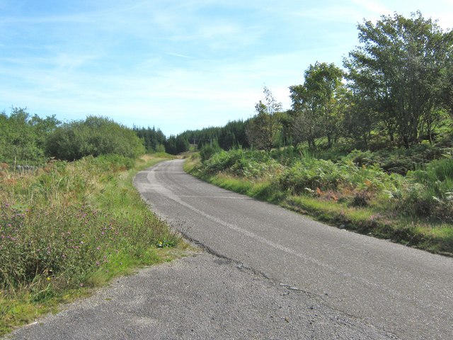
Unclassified road between Gatehouse Station and Creetown
This view of the unclassified road is taken from the entrance to the car park at Moneypool Burn. The view looks east to the area known as Gatehouse Station. The station is now gone [closed by Dr Beeching in June 1965] but the name remains.
 Map © Crown Copyright")
TIP: Click the map for more Large scale mapping
- Grid Square
- NX5362, 42 images (more nearby 🔍)
- Photographer
- Ann Cook (more nearby)
- Date Taken
- Saturday, 12 September, 2009 (more nearby)
- Submitted
- Wednesday, 14 October, 2009
- Subject Location
-
OSGB36:
 NX 539 622 [100m precision]
WGS84: 54:55.9878N 4:16.8525W - Camera Location
-
OSGB36: NX 538 622
- View Direction
- EAST (about 90 degrees)